Start of the Journey – 2018
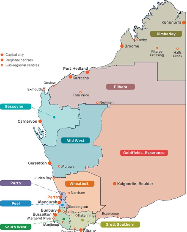
In this blog, as WA is huge, we have broken the state into its regions. This makes it much easier to navigate. We start our journey in the South West and end up in the Kimberley’s. Later we return to the South West and Midwest and also explore more in the wheatbelt and great southern.
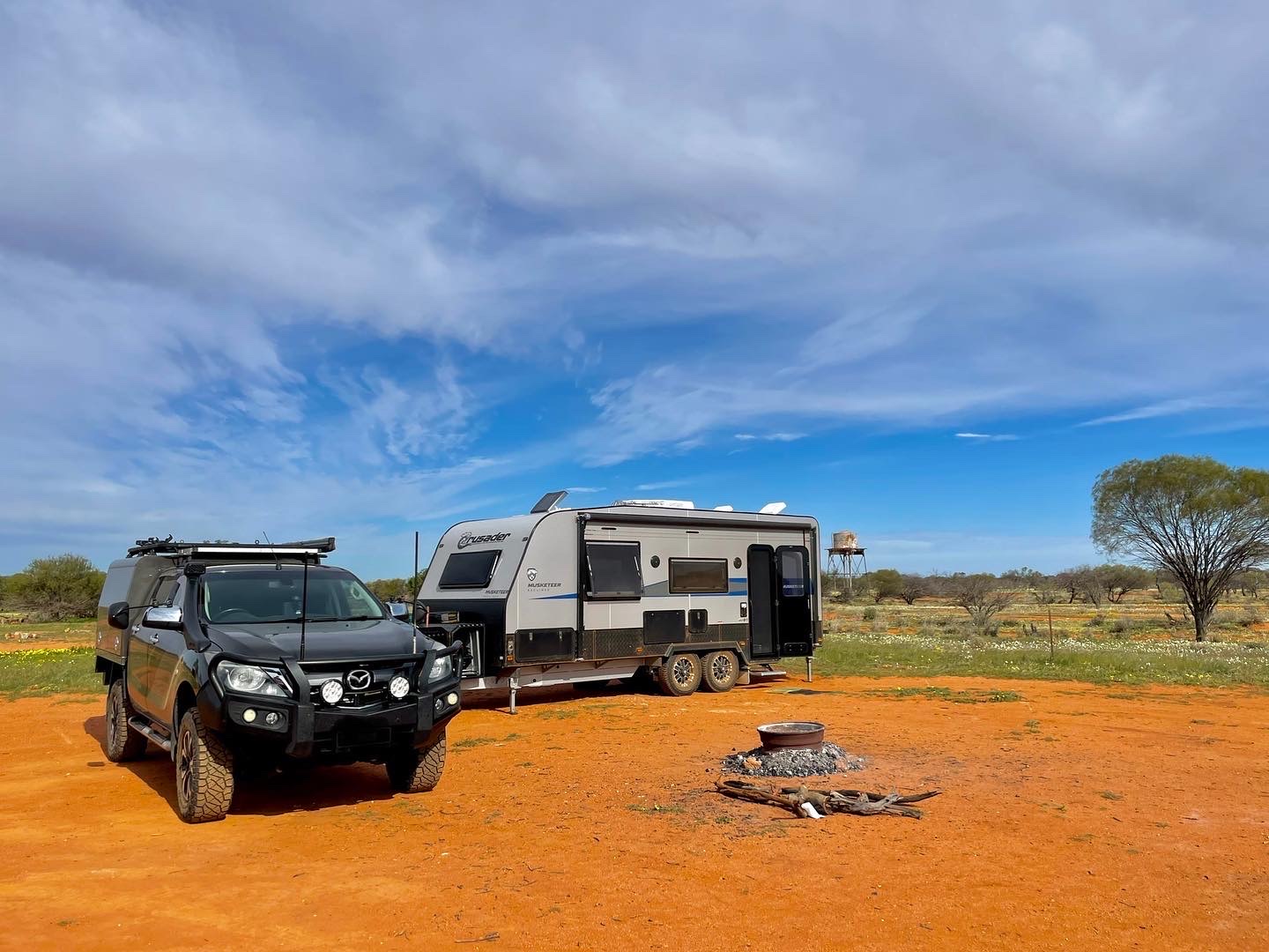
We start our journey with a new BT-50 Mazda with a new chassis mounted canopy custom built, and a second hand 2012 Jayco Sterling 20’ 6”. We chose to go second hand with our caravan as we didn’t know if this was what we wanted to do and whether this set up was what we needed. After all trucker hubby would much rather prefer to be driving an automatic Scania Prime Mover towing a custom built home!! But the budget didn’t reach that far.
Karratha bound……..
Our journey to the north west was planned to be a slow casual drive of one week to have a break from the frantic months of preparation, however due to the delays in Bunbury, we opted to head straight to the NW and get ourselves settled in and for Ian to get work.
Our travel up took three days with our first stop at Galena Bridge (north of Northampton) where the canola crops and farming country come to an end. This is a lovely little ‘free’ 24 hr camp spot by the water, with plenty to explore from that point, but for us it was a quick stop, having pulled in after dark with an early rise at dawn to head north to our next camp.
The opportunity to camp up early at the next spot was foremost on our minds to give us a chance to walk about and reduce the hours of travel the next day. Our planned journey was to be just under 1700km from Dardanup to Karratha, therefore by putting in two big days to start with, it reduced the travelling time for the last day.
Barradale, on the Yannarie River 39km north of the Exmouth turn off is another 24hr stop and was our second overnight stop. Last year, a few months earlier than this time round, when we travelled through here, this campsite was packed, however we found it to be very quiet, providing the choice of several good locations with no neighbours and close to the dry river-bed. Pulling up at 4.30pm gave us time to stretch our legs and take a stroll along the river before sitting down to a quiet drink and nibbles before dinner.
At both stops, we left the van connected, whilst we tried to set up as level as possible it still caused the use of water problematic with the 12V pump; but this was not a problem, as we hadn’t planned to have showers due to not wanting to carry too much water (weight), so it was good old fashioned camping with ‘top-n-tail’ job!! Now that might sound silly having a full self-contained van, but when you are on a mission, you just forge on!!
Meals were pre-prepared and frozen in zip lock bags, defrosted in the morning then cooking the pasta or rice to add to it. We certainly ate very well along our short journey, not to mention the wine was chilled and ready to go daily!!


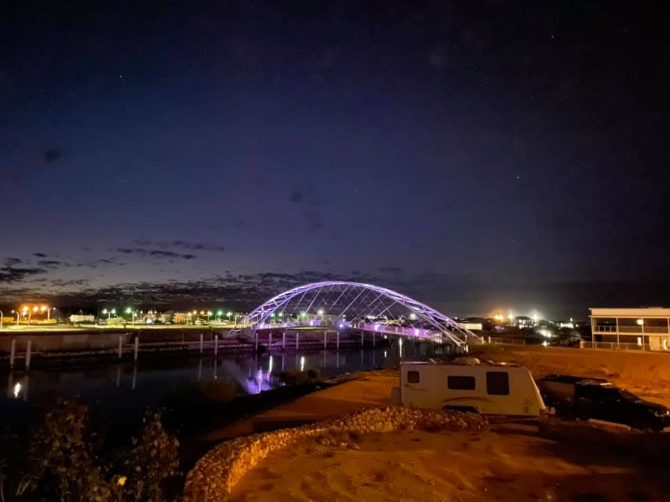
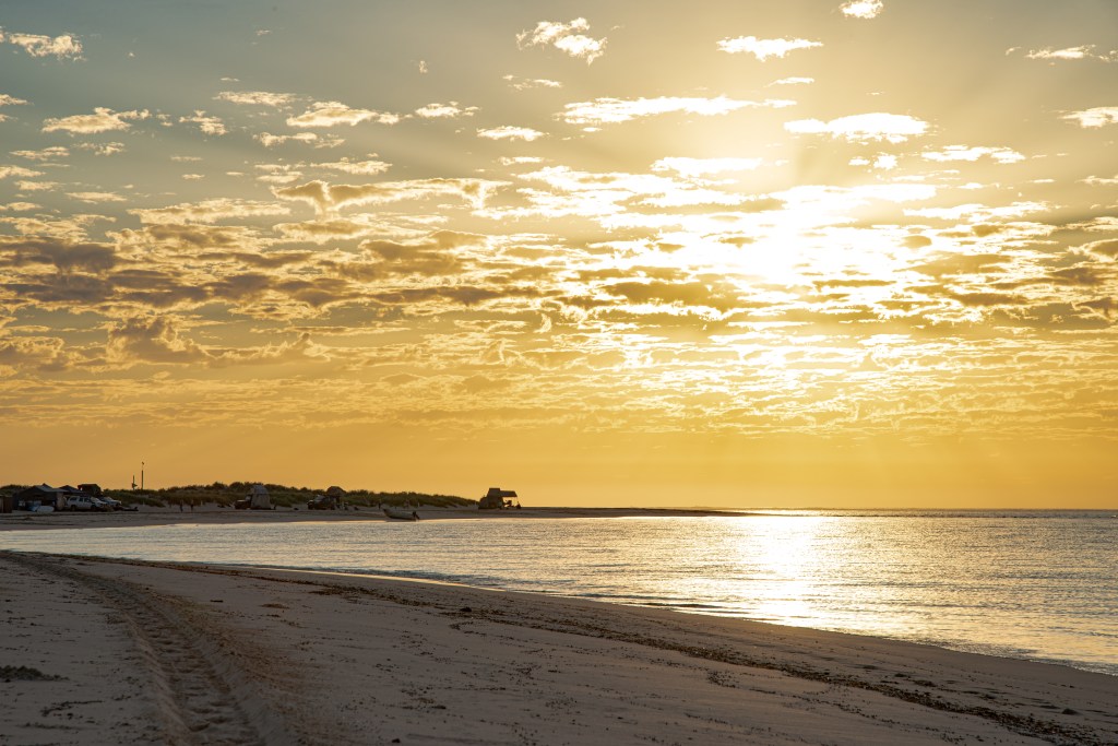
The next day, destination Karratha was in our sights. The red dirt, spinifex and those incredible rock covered hills surrounding the region were to be home for the next few months. We were here 12 months ago and already we identify several changes and improvements, the new hospital/health campus, the Red Earth Culture Centre, other new buildings, some demolished to make way for new ones.
One thing that hasn’t changed is the ‘feel’ of this place, the ambience, welcoming, relaxing, a place where one can easily fit in with the demographic wide spread and everyone very welcoming and friendly.
To be honest we haven’t camped in the caravan parks here as we have friends and family to borrow a front verge from. This time, once we have unpacked, the caravan goes into storage and we live in a house. Just as well as we will be here for the wet season. That means hot and humid.
Road Trip Ideas
Western Australia is a vast state with long distances between communities and towns. Such a different journey traveling the west coast of Australia in comparison to traveling the east coast.
There are many journeys that can be taken throughout WA so this section is to provide you with ideas, places to visit and camp and the best things to view. We haven’t yet completed all of WA, but pretty close. We have both lived in WA nearly all our lives, and most of our travel throughout the state has been since we were teenagers then continued once we married and had children.
The trips are designed to give you ideas for your journey. Your journey is personal as have been ours. Not all have been done in a caravan, some have been completed with a camper or just in a vehicle. Travel times will vary also. You may only opt to go so far north before heading back, each trip covers all the locations along that path, you choose what you wish to do. When you plan your trip here are some considerations:
- Ascertain how much time you have to do the journey. This will determine how far you go.
- Identify how many kilometers you plan to do in a day’s travel. this must include meal, fuel and toilet stops, things to explore, what bookings are in place.
- Once you have planned your itinerary ensure busy locations are booked well in advance to save disappointment.
- Contingency plan – breakdowns, illness, medical episodes, road blocks, etc.
Before you embark on any trip, get your WA National Parks access pass online. If you are an RAC member, it is heavily discounted and a 12 month pass is the best option. You can even add a second vehicle to the pass under the same membership. Remember, if you do choose to camp in a NP, you still need to pay your camp fees separately.
As you plan your trip from the information below, seek out the detailed information on most places mentioned to discovered what there is to see and explore. [The contents list at the top of the page will take you to the places mentioned in the trips]
Bunbury to Kalbarri
The road north of Perth along Indian Ocean Drive has some great coastlines to explore, and to watch spectacular sunsets from. It does face west, and if there is a front coming in, it will be windy.
Guilderton, 90kms north of Perth the mouth of the Moore River, has some fantastic river and coastal options with a caravan park at the mouth of the river or plenty of accommodation in town including BnBs and other rental accommodation. Things to do include kayaking and small boating up the river, fishing, surfing, swimming and walks. There is no supermarket in town so ensure you take all your supplies with you.
The towns continuing up along the coast are just as amazing Its just 27kms to Ledge Point, then 16km to Lancelin where you will find amazing sand dunes. Another 85km to Cervantes and the famous Pinnacles and Nambung NP and just a mere 27kms to Jurien Bay.
Cervantes to Jurien is a total of 140km.
Jurien Bay is one of our favourites. The CP is right on the beach at the jetty and children’s playground and walking distance to the shops and pubs. It’s very popular in school holidays and summer periods. In wildflower season, this is a great location to use as a base and explore the spectacular Lesueur NP, Drovers Cave NP, Beekeepers Nature Reserve. North of Jurien Bay is Sandy Cape, a great off grid campground in a protected bay. If you are not into that and simply wish to do a day trip to the beach, it is a lovely spot, but parking can be tricky. Great fishing location either from the beach, jetty or boat from the marine harbour. This place is also known for its crayfish, so keep an eye out for fresh off the boat supplies. There are many activities available in this small town including sky-diving.
Along the 132km to Dongara are some great off-grid camping spots and some smaller fishing villages worth exploring, some a only just off the highway where you can camp on the beach. Ensure you walk these tracks to check for sandy pockets as not all are 2WD accessible. 44km north of Jurien Bay is Leeman, a lovely quiet town on the beach. Just east of there is the amazing Stockyard Gully where stockman drove sheep into the caves for overnight shelter and protection from wild dogs. Not suitable for camping or caravans. Check at Leeman for accessibility.
Dongara and Port Denison are also very popular spots during the holiday season where the farming communities from further inland head to the coast for their annual breaks. The history here is amazing and well worth exploring with many old historic buildings from the early settler days. The two towns are split by the Irwin River with Port Denison on the southern side and where the tourism is. The boat harbour is well protected from the westerly winds with large groins. Lots of walks, swimming, cafe’s, playgrounds along the foreshore.
Only 45km to Greenough is the wonderful historic pioneer region that was settled before Geraldton. Between Dongara and Greenough are some small beach coves, but not good for camping. Read more on this region below.
Geraldton is only 20km north of Greenough and is a great base to spend some time and tour the region from here. There is a good choice of parks, all have their benefits. We have always stayed north of Geraldton town. Day trips can be down as far east as Mullewa, Yuna, Walkaway and Ellendale Pool. There are just so many places to explore, interesting history and tours to do from here. Lots of blogs sharing our trips to the places in this page. Plus, a great trip east to Cue from Geraldton with an optional loop on unsealed roads.
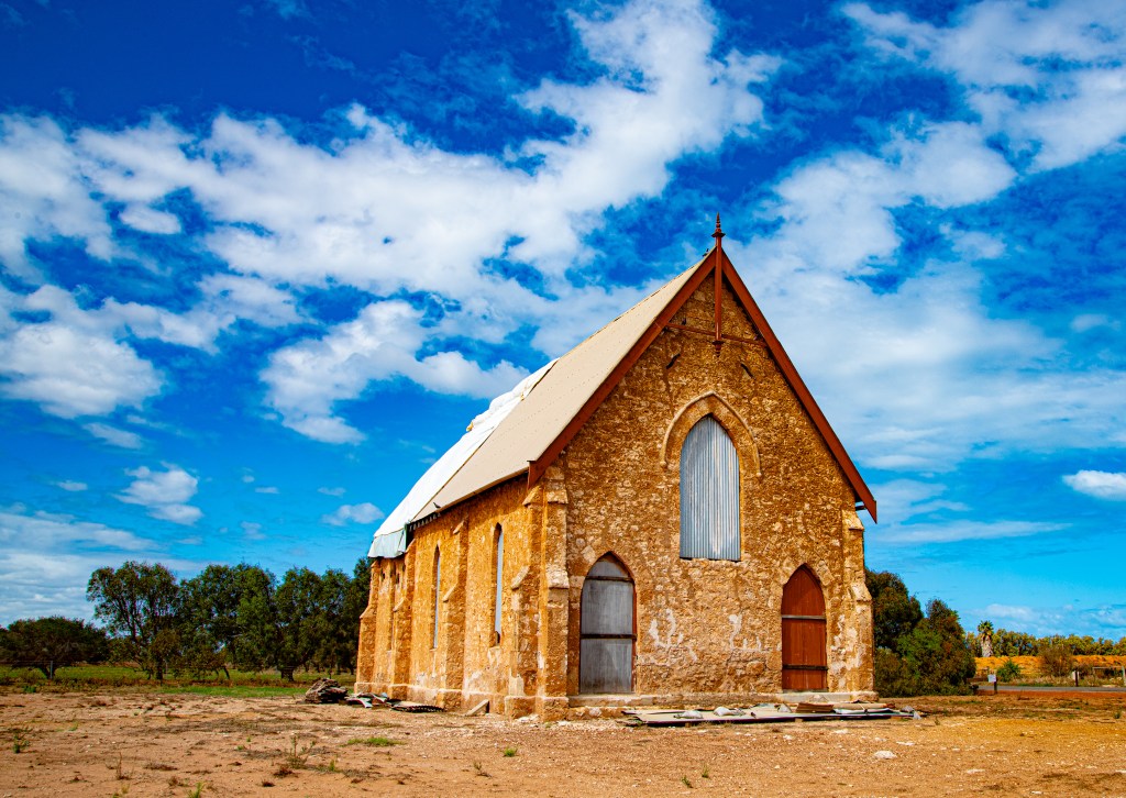
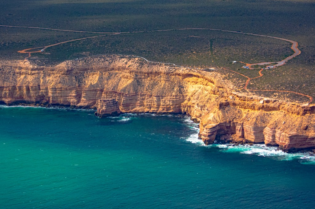
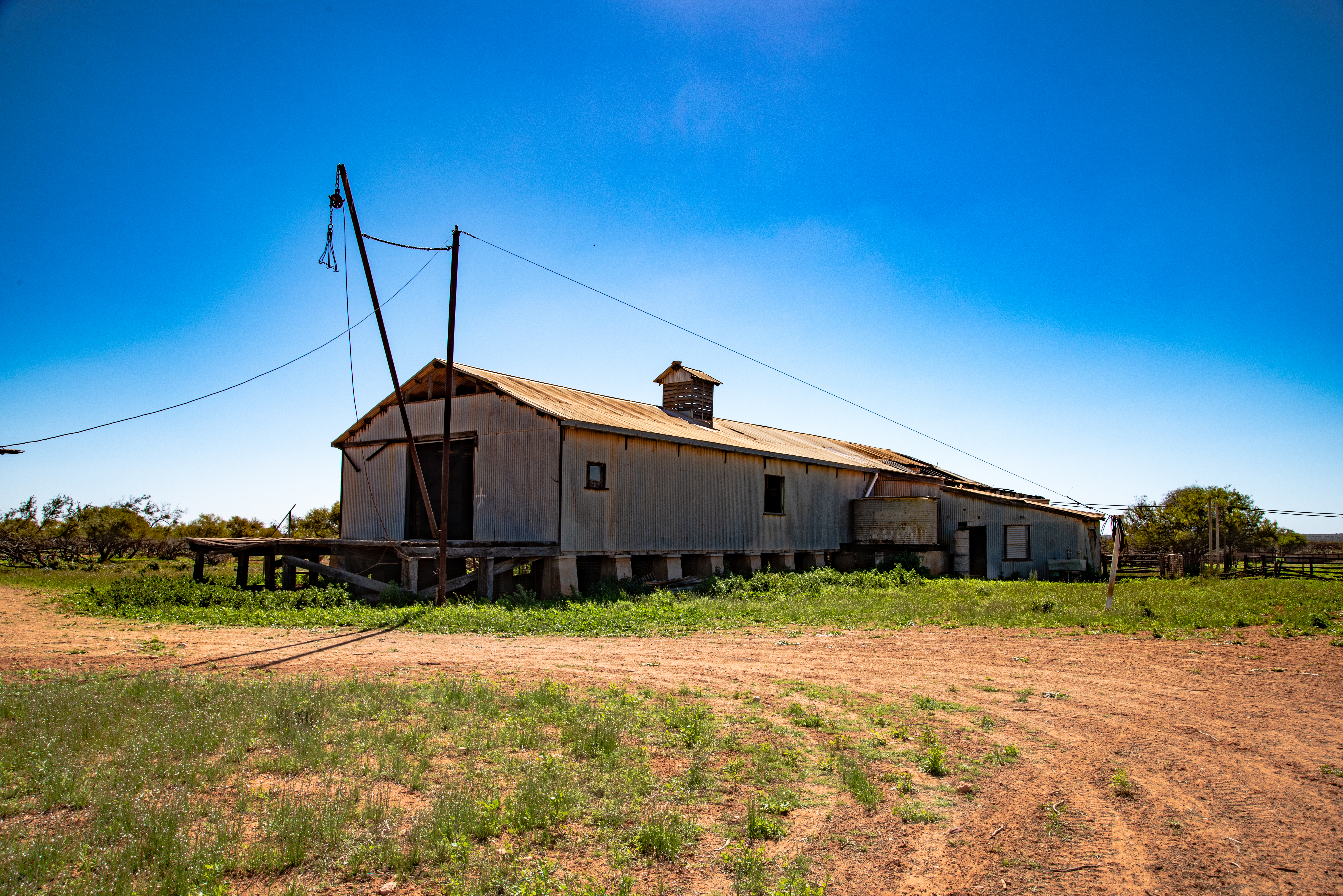
North from Geraldton a short 50km drive is another historic place – Northampton. This is well worth a visit, whether you do a day trip from Geraldton or do a night or two stopover. We stay at the quaint caravan park across the road from the newly refurbished Tavern that was destroyed in the cyclone in 2021. Walk the main street to explore so much including the shearing shed cafe, there is so much to explore in this historic region including mining.
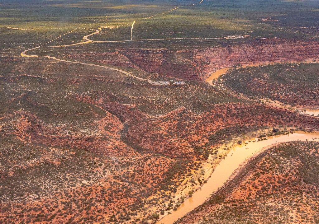
Road to Kalbarri – from Northampton take the 139 highway towards the coast where you have the choice to stay at Lynton Station, Horrocks Beach or Port Gregory. We recommend Lynton Station (40km from Northampton) then day trip to the others including pink lake.
Kalbarri is your next stop. There is just so much to see here and so many places to camp. We have camped and done an Air BnB and both were wonderful plus we have flown over the top and up the river. The Kalbarri Information Centre do most of the accommodation bookings and it is a great way to obtain local information.
Be sure to check out the blogs below covering all the places mentioned above in more detail.
Midwest
Geraldton via Jurien Bay
Geraldton is a unique city being 5hours north of Perth. With work arranged for us both in the area we head there in February 2022. On the way we call into friends at Guilderton where Ian gets back into the truck to help them out and to do some steel fixing in the shed. We park the van on the farm with peace and quiet, driving into Guilderton town site for the evening meals.


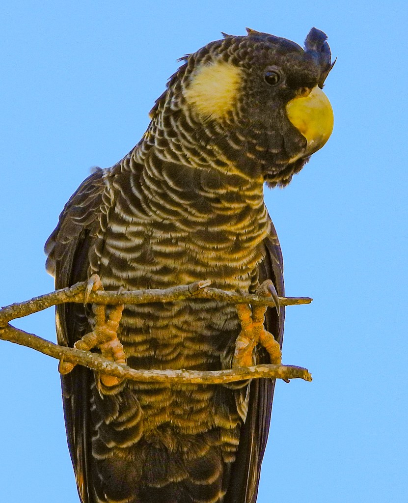
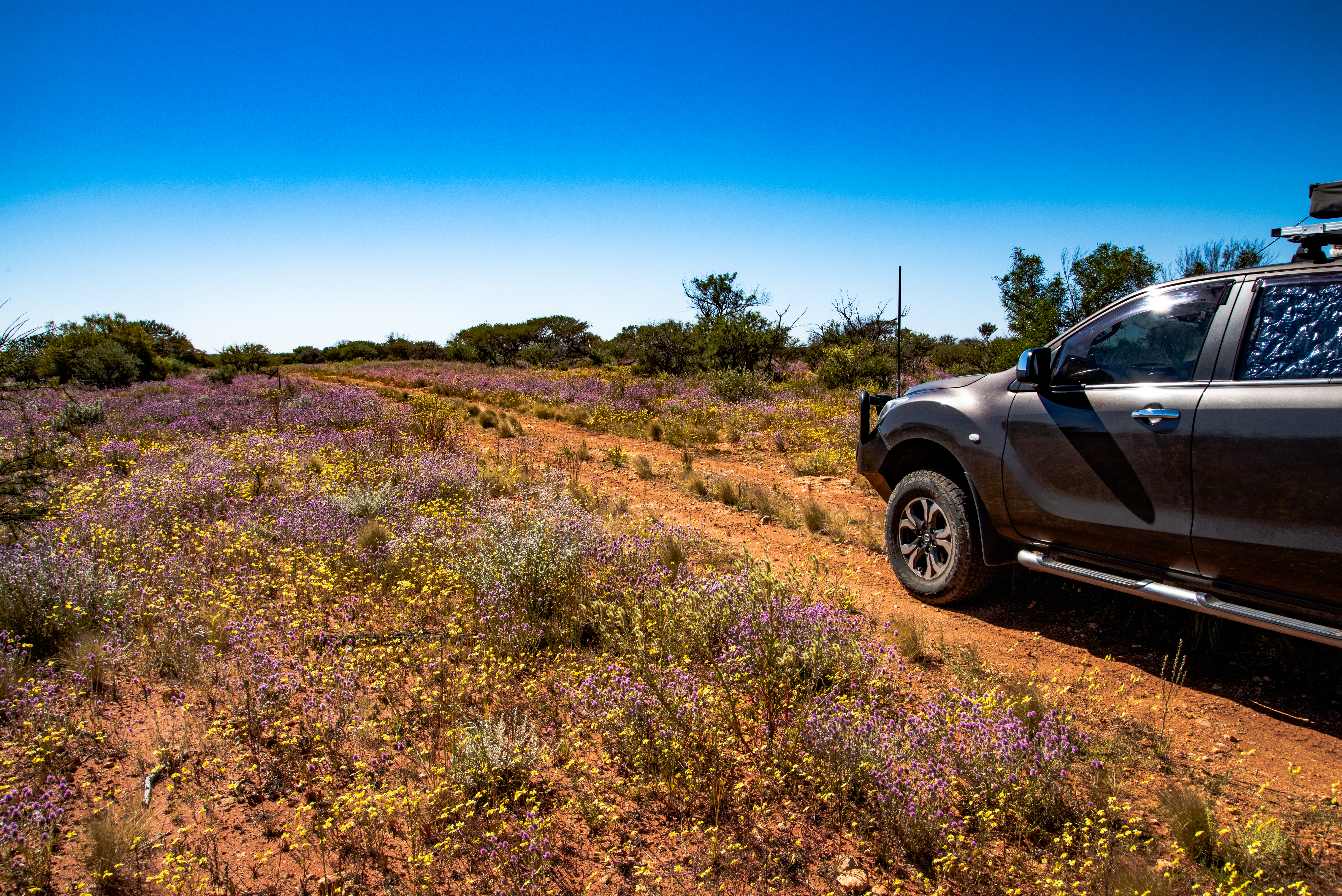
Our next stop is Jurien Bay parking up on the youngest son’s cattle property for a few nights to help out and have some Nan and Poppy time too. We love the Jurien Bay region, it has so much to offer, and the climate and location is perfect. In the autumn you will find the banksias in full bloom lining the sides of the roads with their flowers in bloom bringing in the bird life. The Carnaby black cockatoo are also prevalent at this time also. Each evening they fly into the tall eucalypt trees around the house chattering away. Check our other blog about the Carnaby Cockatoo.
We make it to Geraldton where we are based until the end of June. I have work at the Mount Magnet Mines and Ian has picked up a casual job putting tillage equipment together at Agwest, Geraldton.
Bron gets her mining groove back on starting her contract at the Mount Magnet Gold Mine, doing DIDO (drive-in-drive-out) a little different to the FIFO mining days of the past. This time she is a contractor not an employee, the respect is great probably due to this being a smaller mine setup and working in the Maintenance area. With a solid background in safety and training, the job is to develop their Work Procedures (from JHAs). Massive task, but doable.
Being here in Geraldton near the ocean at this time of the year has its rewards so our breaks are most enjoyable. The dragonflies are everywhere both in Geraldton and out at the mine site. Dragonflies are a sign of changing seasons. With the strong Midwest winds having dropped off, one can enjoy beach walks and pleasant touring times.
Geraldton’s lifestyle is very enjoyable especially with the temperate Mediterranean climate. Very rare to have cold days before June and the sun shines more often than not. Geraldton has become one of our favourite WA places.
Greenough, WA


Being only a day trip out of Geraldton, we decide to check out other parts of Greenough we had learnt about in the local paper. The interesting aspect of the Greenough area is how big it was surveyed to be.
The area was first explored by George Edward Grey in 1839, who was responsible for naming the area after Sir George Bellas Greenough, the president of the Royal Geographical Society in London. Grey claimed that the area could become “the granary of Western Australia”. As a result, several flour mills were built in the region.
In 1851 Augustus Gregory surveyed 30,000 acres, that’s 120 square kilometres of land in the region which became known as the Greenough Flats, known as the front and Back Flats of the Greenough River. These were once vast lagoons that were gradually cut off from the sea and then filled with alluvial soil brought down by the meandering and frequently flooded river.
The flats are between the sand dunes and the Greenough River to the west and the small ranges just east of the highway. Soon there was a population of over 1,000, divided into several smaller communities – North Greenough, Central Greenough, South Greenough and Bookara. These first homes were temporary shelters, in the 1870’s homes were built of stone quarried from the ridge still with calico ceilings, doors and windows and thatched rooves. Most were built close in against the eastern side of the hills to protect from the prevailing winds. Twenty years after the first survey took place there were 162 houses in the region in 1870.
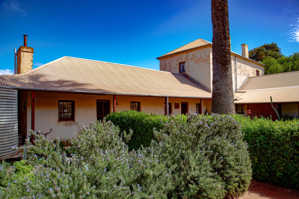
The buildings we see today are those built by the more successful residents like those found at the familiar Greenough Hamlet previously known as North Greenough.
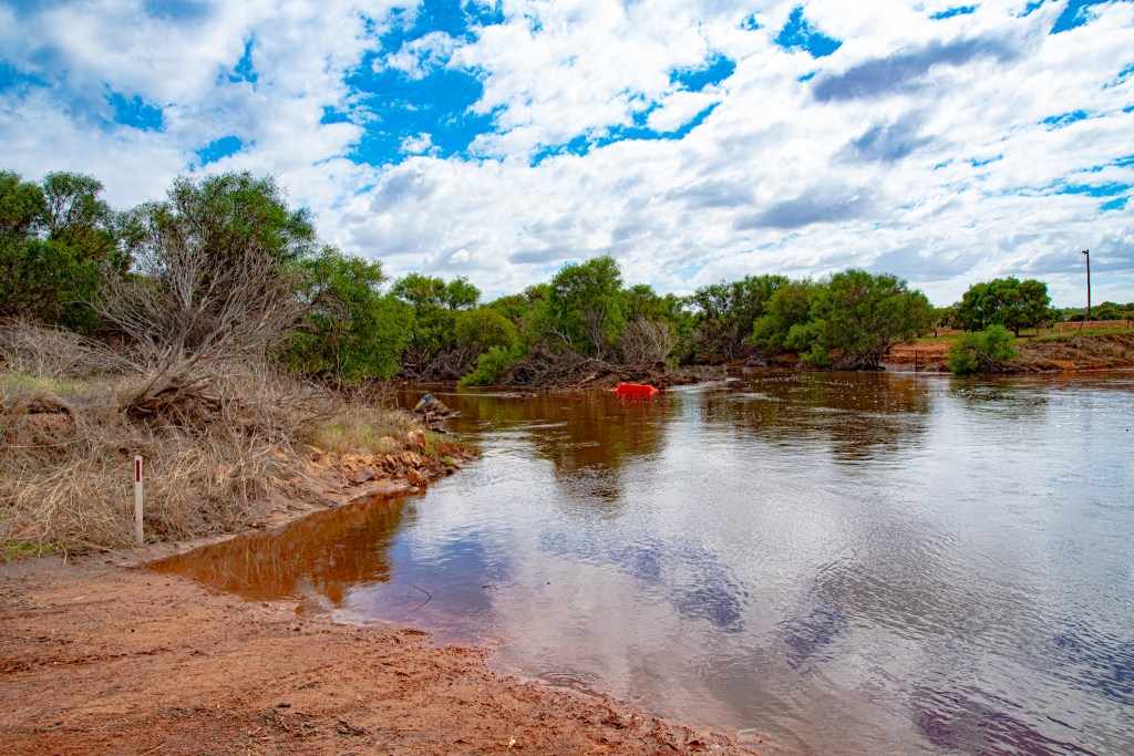
Our journey starts at the Southern and Central end near the Convict Bridge, mainly to see the Greenough River flowing as apparently this is a rare event with the river usually dry until it gets closer to the river mouth. The Greenough River starts near the Woojalong Hills on the Yilgarn Plateau and winds its way through the Waterloo Ranges then out onto the Greenough flats gently meandering its way through the farmlands before meeting the ocean just 10km north of the Greenough community.
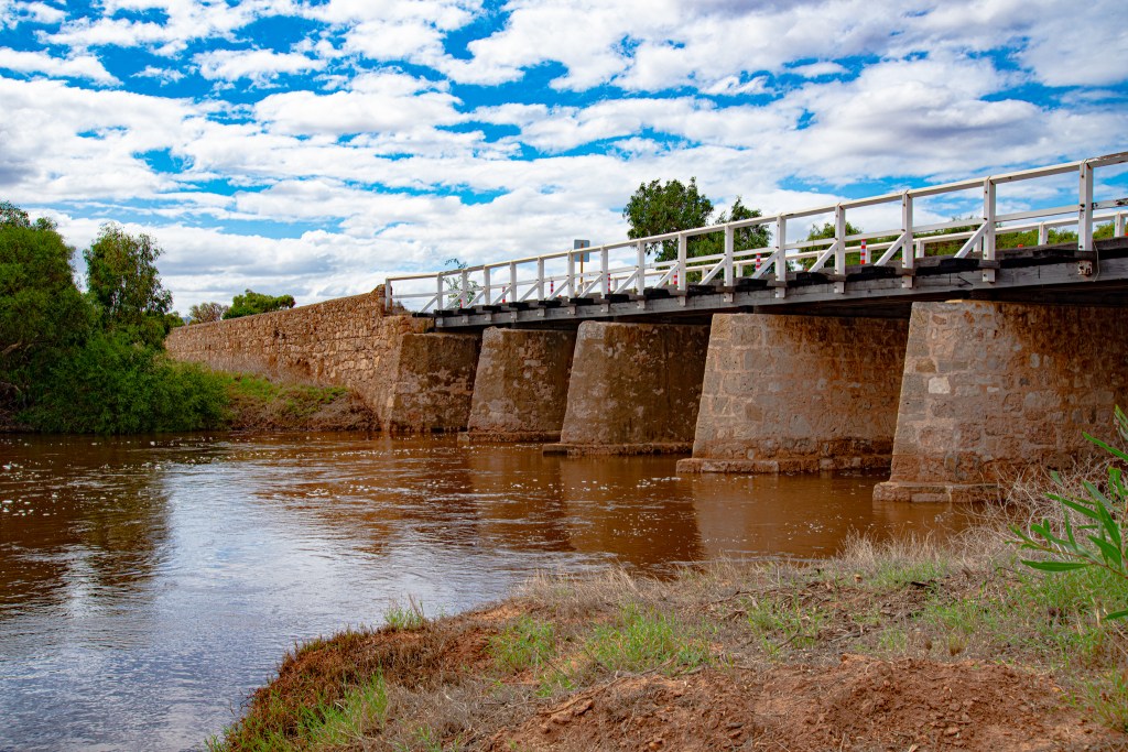
We drive carefully over the Convict Bridge and its wooden planks parking on the west side where we find a deteriorated stone barn c.1860, built by ticket of leave convicts and was owned by the Maley’s at one stage. We travel only a few kilometers further west to the cross roads where Gray’s store, the Wesley Church and further south is the Hampton Arms Hotel. The church and Gray’s store are both under repairs from the National Trust.
Maley’s Bridge c.1864, better known by the locals as Convict Bridge is still in very good condition, although only suitable for light traffic. It was built by Ticket of Leave Convicts. In 2006, floodwaters undermined and caused the collapse of one of the stone pylons. The bridge was subsequently restored.
Wesleyan Methodist Chapel c.1867 – due to the strong Wesleyan community a church was built for the community led by the Waldecks family. Also built by convicts. It is now just a ruin without roof cladding at one end, currently devoid of interior fittings, home to hundreds of pigeons.
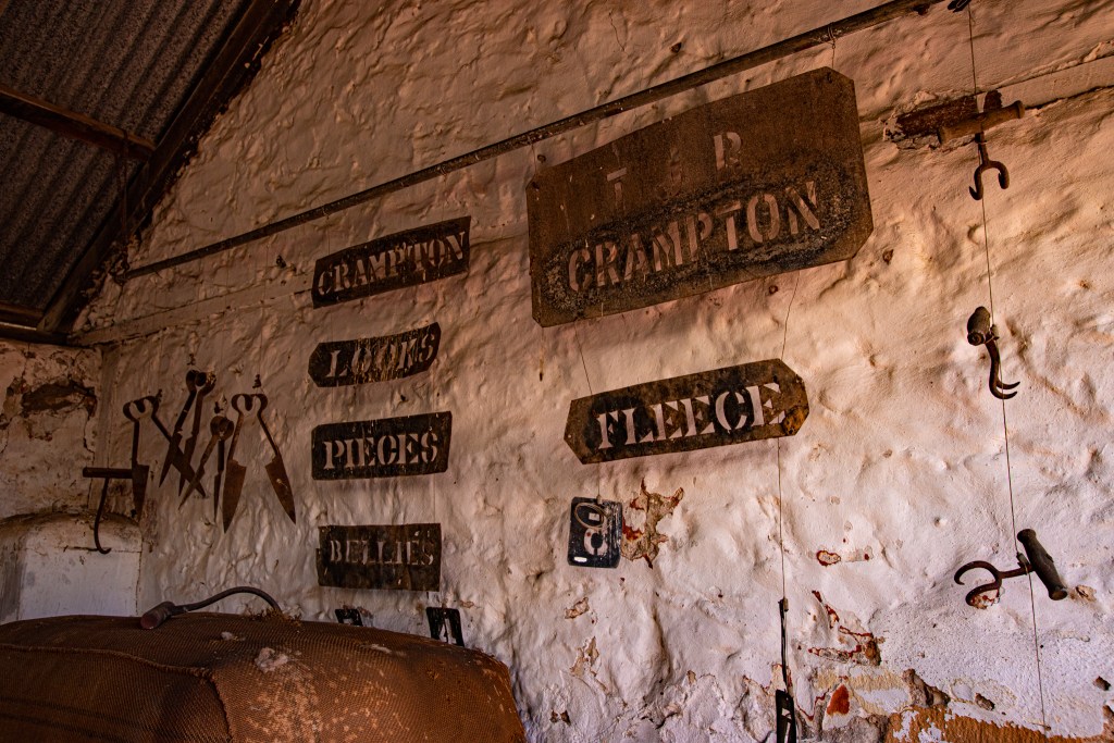
Gray’s Store c.1861 – across the road from the church we find a sturdy two story residence also built by convicts. The top level was the residence and the lower storey, the store. The large signboard on the northern wall, on which the ghosted form of the sign’s original graphics can still be discerned in certain light conditions. Behind the store is an unusual water cistern built of stone with a vaulted roof. Although sold in 1890, it was used as a residence until the 1950’s.
These buildings are all owned by the National Trust.

Further south is the Hampton Arms Inn c.1864 – one of the oldest licensed inns in WA. This was not built by convict labor. Company Road that the Inn is on was once a thriving bustling and busy road until the railway reached the district.
We leave here to drive north on the main highway to visit the Maley’s Cottage.
More information can be found: https://historicalaustraliantowns.blogspot.com/2020/05/greenough-western-australia-step-back.html
Greenough Museum


The old stone buildings in the area are numerous, if only the walls could talk, there would be so many stories to tell it could be quite deafening!!
I’m not sure where my love for old stone buildings comes from, but I am guessing it’s a mix of my South Australian heritage, a keen interest in my ancestors and my artistic flair. WA’s stone and historic buildings are limited to these areas settled early and also where the locals have taken pride to restore them. On the Yorke Peninsula we discovered these incredible buildings and fell in love with them, in fact we got hold of the emergency services map and found every ruin is registered on it.
My Mum also loved the old stone cottages and buildings in fact she was born in one in the Adelaide Hills, which is still standing today, although no longer in the family. I have many fond memories of that beautiful home where Mum and her brother grew up and my cousin later lived in it.
As with most early settled locations the buildings around Greenough are built using local stone and limestone and date to the second half of the 19th century. Many would be familiar with the Greenough Hamlet as you drive north towards Geraldton, where there are some fine examples of these early buildings. Geraldton and Northampton and surrounding areas, especially into the gold regions to the east around Mt Magnet and Cue, there are many more of these lovely old stone buildings. I just wish Western Australian’s were as good as restoring these old buildings as South Australian’s are.
After exploring the buildings of the Central and South areas of the Greenough Flats we return to Maley’s Cottage and Museum.
In 1860 John Maley arrived in Greenough to oversee the construction and management of a steam-powered flourmill. He married Elizabeth Waldeck at Gray’s Store and later built a cottage for her 5km to the north on Phillips Road.
Over the years their business enterprises expanded to include another flour mill at Dongora, a general store and hotel in Greenough and a brewery in Geraldton. With all that he still had time to produce 14 children so the cottage needed some additions!! Instead of going out, they built a second storey completed in 1880. At the time it was the largest homestead at Greenough and Maley was known as ‘King of the flats’!!!
Some 20 years later, around the early 1900’s the area fell into a gradual decline due to numerous reasons.
1872 – major cyclone; 1888 – Flooding; 1887-1893 – Goldrush – Southern Cross in 1887, Cue in 1891, Coolgardie in 1892, Kalgoorlie in 1893, Mullewa 1893
In 2013, a disastrous fire gutted Maley’s mill and store, one of Greenough’s more significant heritage buildings.
By 2016 the Anglican and Catholic Churches in Central Greenough were the only community institutions established in the 19th century that continued to have an active membership. The Hampton Arms also continues to provide for the social needs of the community. The Greenough Hamlet is now maintained and open to visitors.
Maley’s Cottage

As you enter the cottage, only part of it is set up as a museum as the other part is a private residence, you are transported back to a time of early farming days where you grew all your own vegetables, milk and meat, ground your own flour. The cottage was eventually built with a cellar, upstairs bedrooms, a full kitchen with ovens including a bread oven. Outside buildings include what was a blacksmith shop and beyond that the stables and other outer buildings.
After a walk through the museum, cared for by the community, we step out into the gardens, many plants are still the original ones planted and the Greenough Community garden c.2012 is maintain by locals.

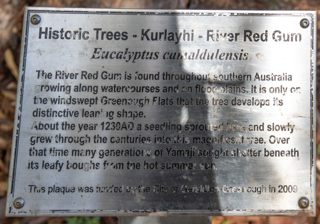
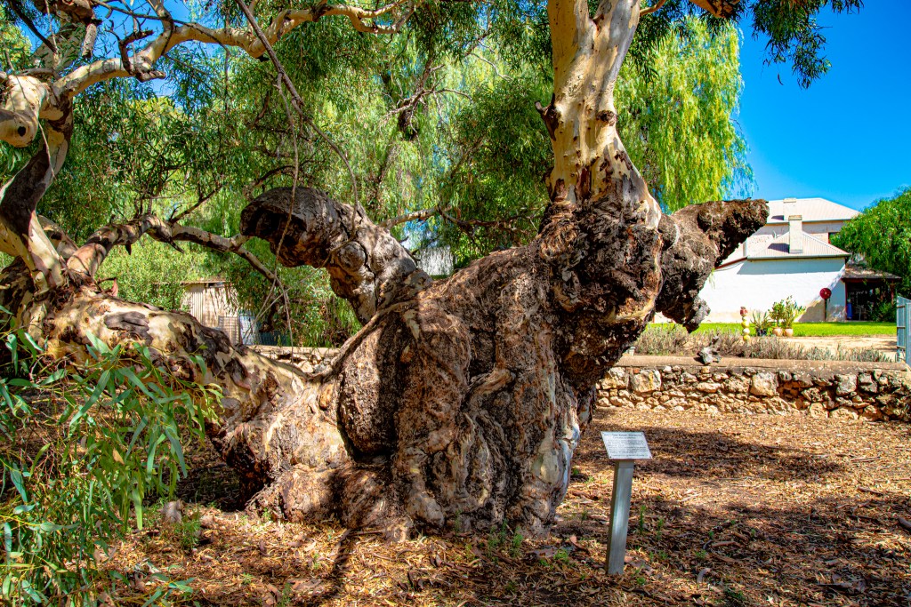
Stepping out beyond the community and garden wall we find larger trees including a Kurlayhi Rived Red Gum (Eucalyptus cumaldulensis) the famous leaning tree variety found on most of the Greenough Flats. A seed sprouted in about 1230AD, growing through the centuries into the tree we see today. The specimen still existing in the grounds in well over 100 years old. A raucous above us, slowly calms down as the red-tailed black cockatoos rest in the trees above.
I hope you enjoy the photos from our little day trip exploring this amazing part of the Plains.
Geraldton
During 2021 and 2022 we spent several months in the region and came to appreciate this part of WA. The climate for starters is very pleasant with very few cold nights below 6deg but day time temps in the summer can be like most other locations of 35+ deg. Despite this we have returned here several times.
In 2021 we passed through spending a month the first time where Bron was supposed to have done some time on the mine site at Mt Magnet. This work didn’t eventuate until 2022 when we returned this time with all our ducks aligned for Bron’s work and Ian easily secured work in town at an agriculture business.
Whilst there in 2021 we did find time to explore the region and the town. But more on those trips in the Mullewa to Yalgoo blog.
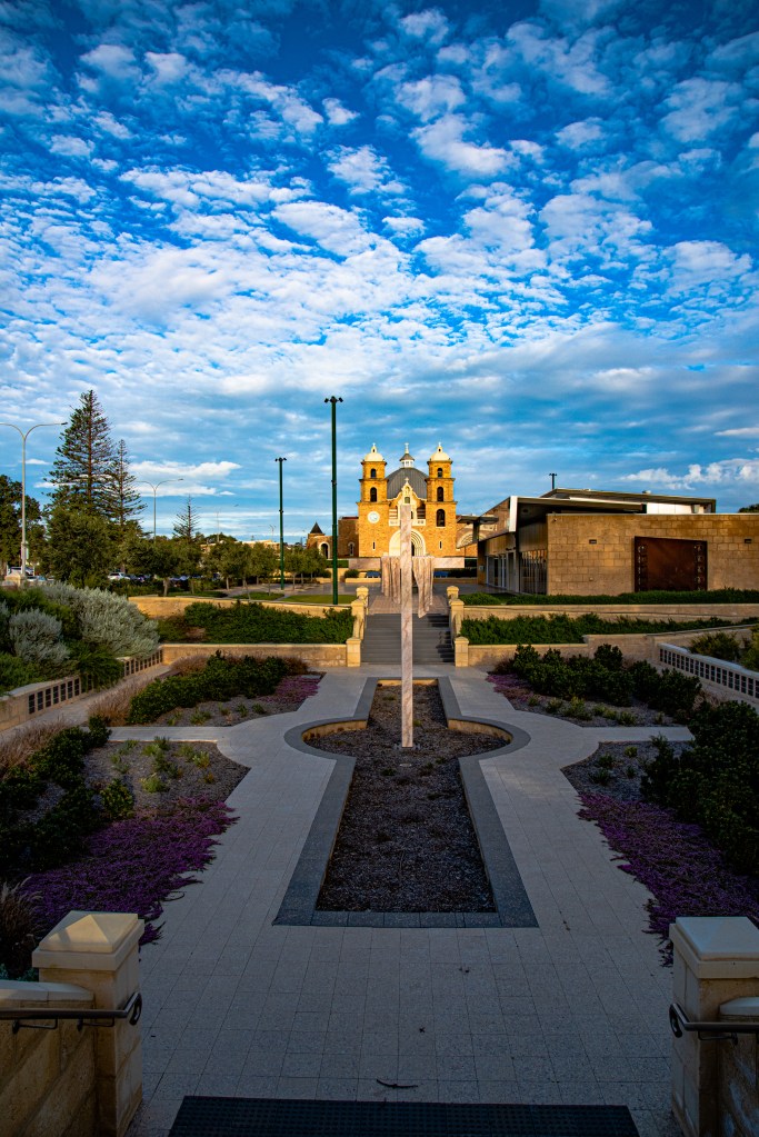
Geraldton has some amazing history and tourist attractions. These include Geraldton Cathedral, The port and foreshore, HMAS Sydney atop the hill, old gaol and hospital and much more.


Houtman Abrolhos Islands
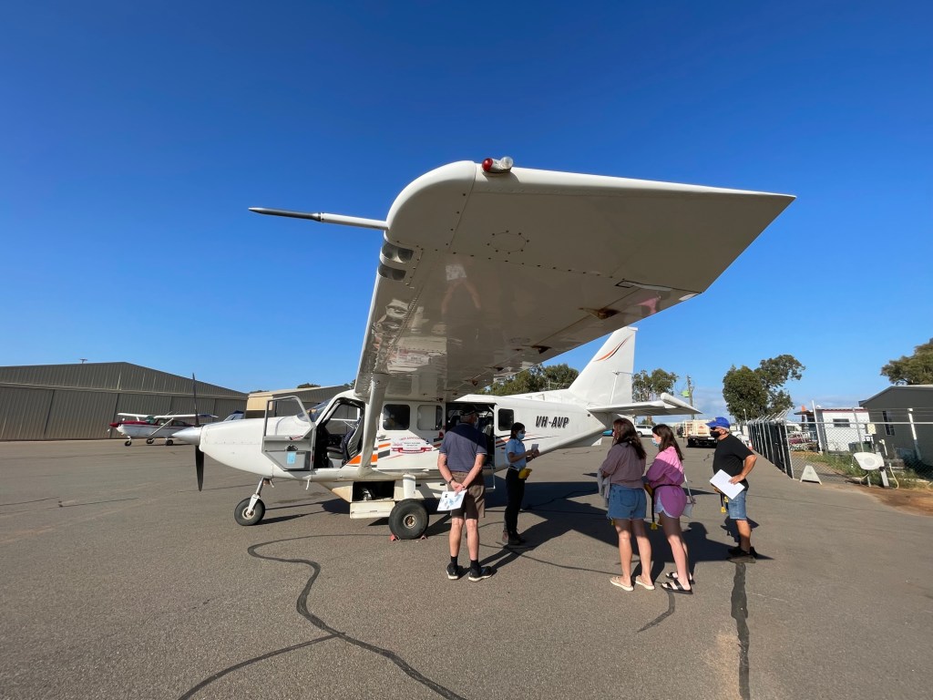
Whilst parked up in the beautiful Geraldton, and a wedding anniversary looming, we decided to treat ourselves to an experience. We boarded our 8 seater aircraft at the Geraldton Air Charters hanger after a summary of the Batavia and the islands.


The Houtman Abrolhos (often called the Abrolhos Islands) is a chain of 122 islands, and associated coral reefs a National Park since 2019, located about eighty kms due west of Geraldton. Tourism is limited with day trips by sea restricted with only a handful of anchorages primarily due to the conservation habitats, shipwrecks, and sanctuaries.
The islands are made up of three island groups, the Wallabi Group (north), Easter Group (middle) and Pelsaert Group (southern).
The Abrolhos boasts is the southernmost true coral reef in the Indian Ocean and globally the highest latitude reef systems with significant seabird breeding sites as well as Western Australia’s largest single-species western rock lobster fishery.
The history of the Island groups started in 1931 with a crayfish cannery, and during WWII Catalinas used the islands to practice air raids. There are numerous shipwrecks around the islands due to the passage taken by ships from the southern tip of Africa east then followed the winds and currents north to Indonesia, known as the trade routes. 1619 – First sighting of the islands; 1929 – Batavia was wrecked. Read more on the Batavia history Batavia’s History | Western Australian Museum or take a tour of the museum on the Geraldton foreshore.
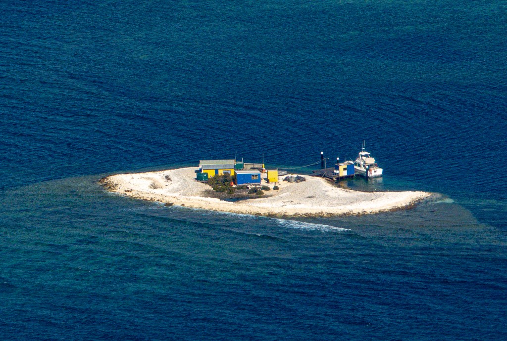
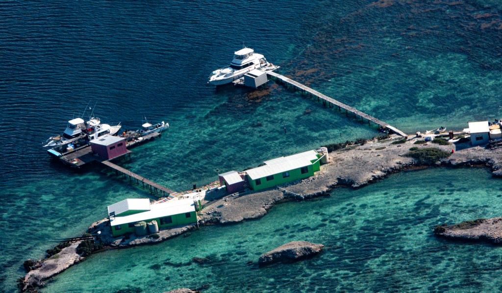
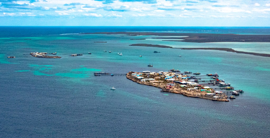
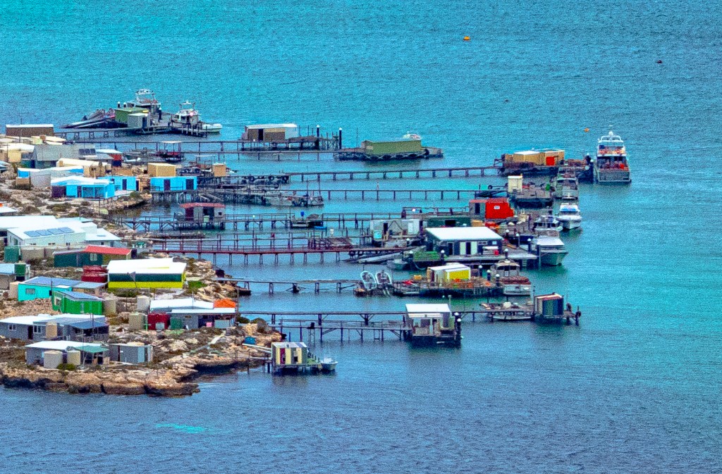
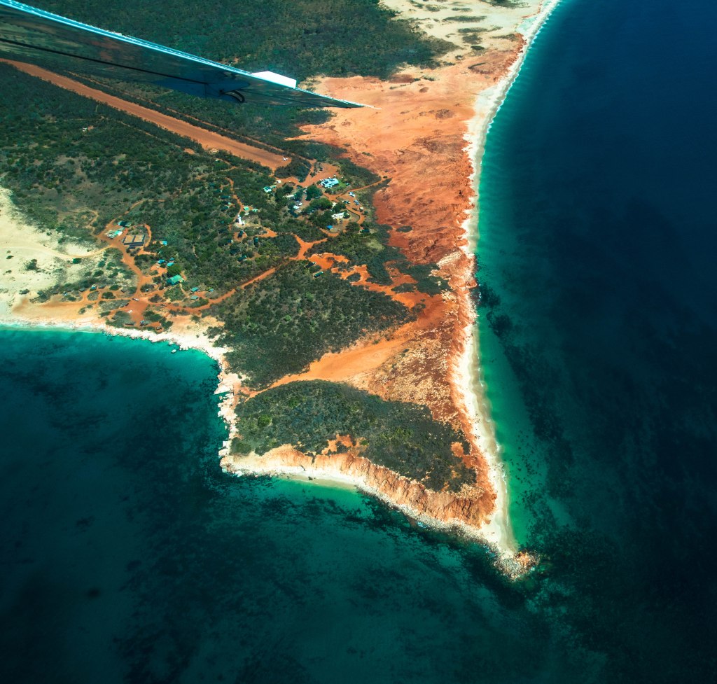
We start at the bottom group of islands called the Pelsaert Group flying around the Mangrove group before following Long Island from top to bottom. We flew low enough to take in the topography and the boats anchored in a couple of locations. From our view we see the fisherman shacks and personal jetty’s. One small island was just enough for a dwelling, a jetty and a fishing vessel parked out front.

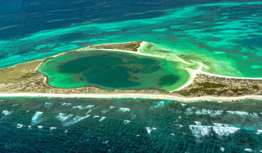
These islands are barely above sea level, with the land or reef only just above the reef itself. It’s amazing how they survive there protected by the reef, the jetties out beyond the reef for the boat mooring.
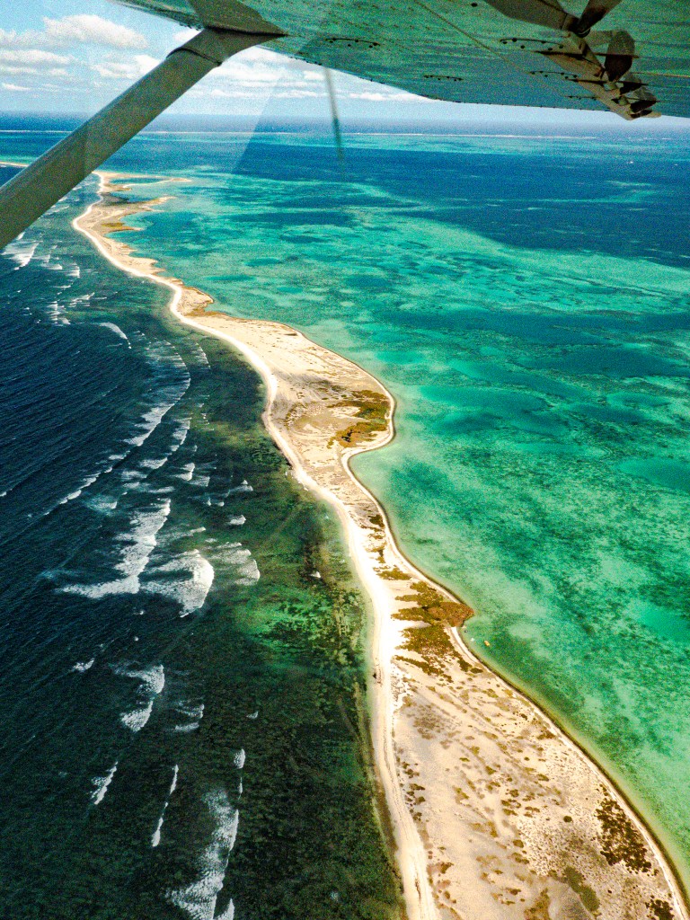
We have a bird’s eye view of the coral reef that artistically gives off variances of blues, aquas and greens with the hues giving the depth of the water, fringed by the green coral, seaweed and pale yellow hues of the shallow water over the reef itself. Numerous mangroves are scattered along the edge separated by crisp white beaches. our view enables us to see a couple of ship wrecks along the edge of the reef.
Our tour takes us over the Middle group of islands finally reaching the northern group of the Wallabi Islands, the location of two shipwrecks, the Hadda and the more famous and tragic Batavia. Between the two Wallabi island are lightly vegetated smaller islands full of fishermen homes and their jetties. Most of these people live out here permanently and they even have a school.

We land on East Wallabi Island in time for a late morning tea overlooking Turtle Bay. The bay is very sheltered from easterly and westerly winds but is bombarded by any northerly winds. The bay is one of the most popular anchorage points for yachts and boats coming to the island for short stays (which they do so on board their craft).
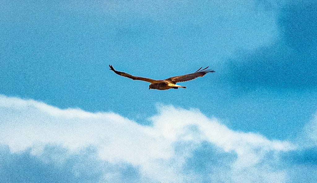
Morning tea done we take a nature walking tour as it was too cold for a snorkel of the reef a few meters from the beach for us. The island is the most botanically diverse of the two islands with 124 plant species recorded, carpet python, skinks and frilled lizards, many bird varieties including white bellied sea eagle and ospreys, and shy Tammar Wallabies (native to the islands) whom we find tucked away under the shrubbery. We visit a huge weather damaged nest of the local osprey that allows us to discover the incredible things they gather for their nest building. Further over is a more recent nest, however we stay clear of it in case there are chicks.
What is incredible is how the Ospreys break shellfish to obtain the morsels within. They gather the intact shellfish in their talons then rise up and let the shells drop to the rocks below, before diving down to collect their dinner. Amazing to hear, unfortunately we didn’t witness it. What we did see was the remains of their shell breaking on the rocks (as shown above).
We left the islands in complete awe of what we had just witnessed and experienced. A tour we can highly recommend. We took this tour mid-April when the weather can be quite fickle, we were lucky to have the almost perfect day. The second half of the tour is Hutt Lagoon and Kalbarri.

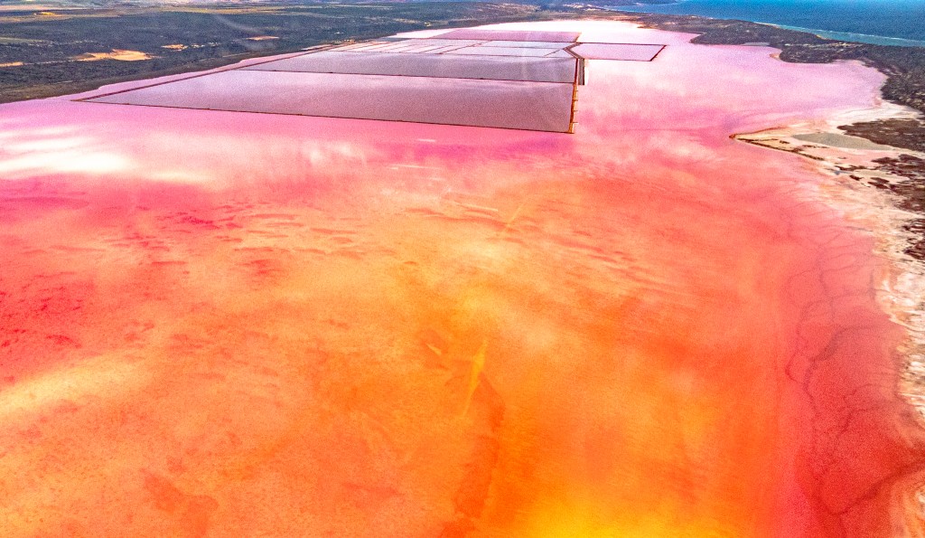
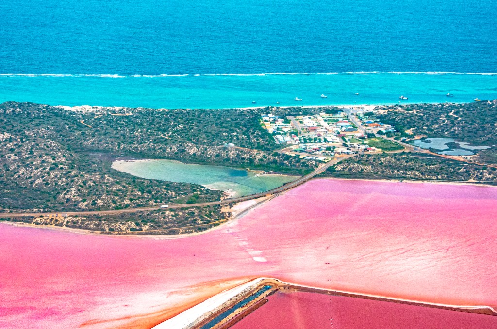
Hutt Lagoon, the Pink Lake and Kalbarri from the Air
The second part of our tour takes in the Pink Lake, Kalbarri and the National Park. Due to our tour being the second half of a full day tour, we farewell four people who were flying back to Geraldton. Whilst still on Wallabi Island and we approach the plane, I asked the pilot if I could take the front seat, I got the nod of approval. The position would now give me a bigger, cleaner window for photos. Woohoo!! Yep, you could say as a photographer, I was just a little ecstatic!!
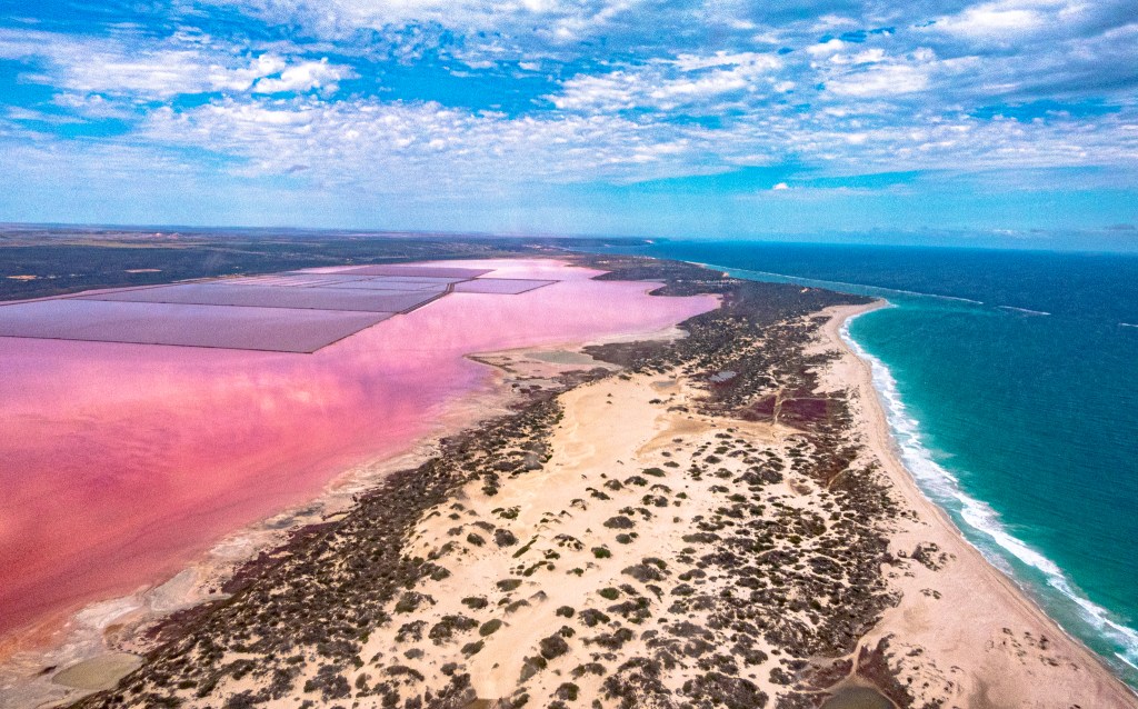
As we head out over the ocean back east towards the Western Australian coastline it gives us all some time to sit back and even have a wee kip. It’s not long before the Pink Lake or Hutt Lagoon as it is least known, comes into view from our plane true to its name, it is actually pink!! Wow! And my photos are original, not enhanced. The lake/lagoon runs parallel to the coast between Horrocks Beach to the south and Kalbarri to the north with only a sand dune and a small reef as a barrier to the ocean.
The lake’s pink colours go from bright bubble-gum pink, to lilac, and occasionally even red, only visible like this from the air. Yes, you can view the lake on the drive between Port Gregory and Kalbarri, but from the air the colours are spectacular. We are told that due to recent rains the algae activity had increased, therefore the colours were intensified. This is why we call this an experience and I’m literally in my photographic element.

“Hutt Lagoon is a long body of water running parallel to the coastline situated in a dune swale adjacent to the coast and is about 14 km long and around 2.3 km wide and is fed by marine waters through the barrier ridge and by meteoric waters through springs year round. The Lagoon comprises most of the Hutt Lagoon System, a DIWA-listed wetland system that also takes in a number of adjacent small lakes, such as Utcha Swamp that lies at the northern end. Discovered In 1854 by Augustus Charles Gregory who promoted the salt and gypsum deposits. The Port Gregory Saltworks consigned its first shipment of salt on SS Venus in 1908 but finished in 1924.”

So why is it pink? The pink colouration is caused by the naturally occurring algae ‘Dunaliella Salina’ which produces the orange-red colouring pigment called ‘Beta Carotene’. Yes, the same the one found in carrots.
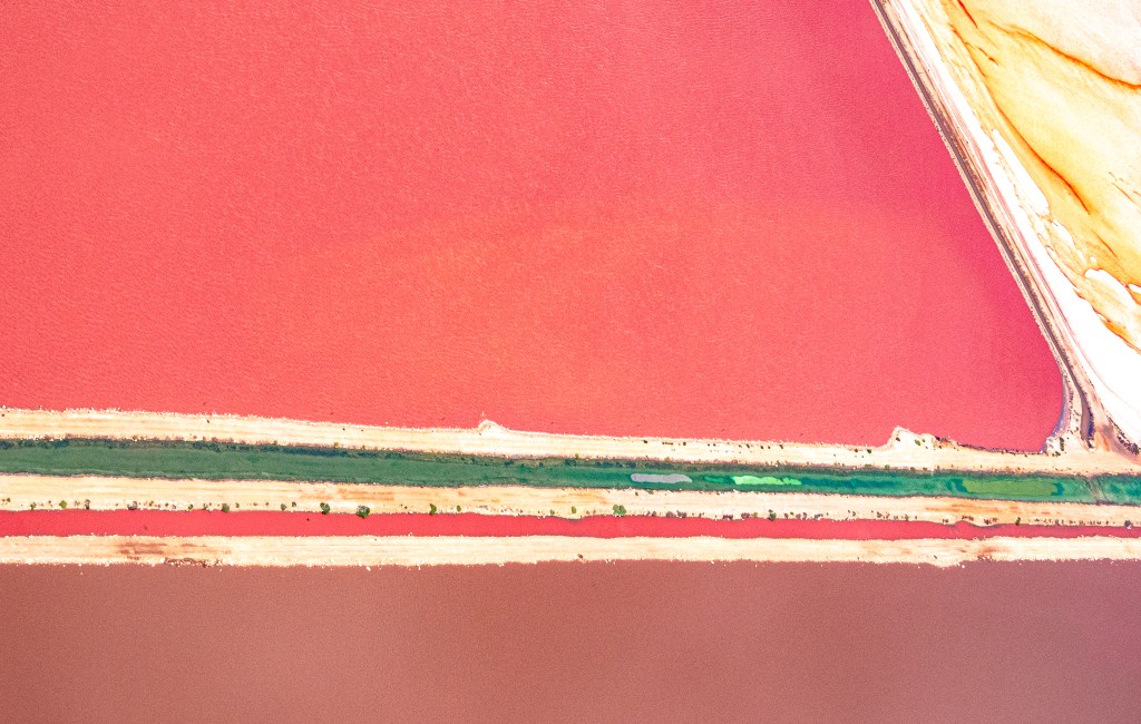
The salinity levels are extremely high which produces the unusual and variable hues and vibrancy that changes with the seasons, the weather and even time of day. Although the best colours are found on a clear day, around mid-morning or sunset, from the air the colours are incredible despite some scattered cloud cover.
Our approach is from the northern end and despite the lack of a pure clear day, the clouds actually provide a wonderfully reflective image of pink clouds on the still water of the lake. At this end the colours are orange and yellow with fine streaks of red like fine blood vessels around the edges and occasionally meandering through the to the inner sections of the lake.
As our pilot dips and turns the aircraft back and forth over and up and down the lake, we get some spectacular views of the lake from various angles. At some angles the lake gives up its creative formations where water runs into the lake providing amazing images.


The lake is edged by sand dunes on the western edge creating the barrier between the lake and the ocean and on the other side the main road to Kalbarri and farmland. Towards the northern end the lake is dry yet the algae show through where the white crusted salt is still present. About halfway along the lake natural walls have been built by the Lynton Mine creating concentrations of the water. The colours in these are richer and more intense creating another spectacle. Mining occurs along the eastern side of the lake.
We fly out over the hamlet of Port Gregory to follow the coast towards Kalbarri giving us a wonderful view of the coastal cliffs and onto our approach to Kalbarri. Then it’s onto the Kalbarri Gorges and the Murchison River. I’ve always believed you need to see these things from both the ground and the air, this return trip via the air to Geraldton is no exception. Viewing the river system from the air you get a true perspective of the enormity of the river system.


Fortunately, due to recent good summer storms and rainfall, the river was flowing with brown muddy water. It was wonderful to see the vegetation fresh and green from the rains, providing a wonderful contrast to the red earth. We arrive back in Geraldton mid afternoon feeling very fulfilled from a wonderful experience.
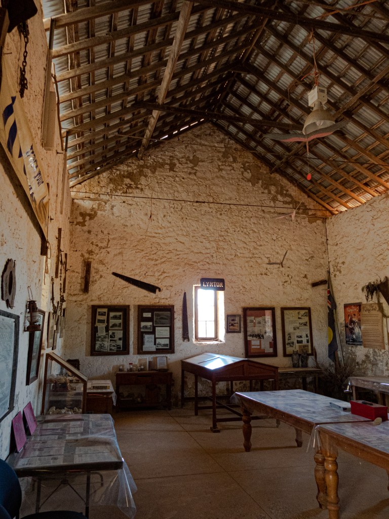
The Lynton Convict Hiring Depot


This little gem is hidden on the road from Northampton to was the first convict depot north of Fremantle, Western Australia and was established on 22 May 1853 as an established labour supply to the Geraldine Lead Mine, 64 kilometres (40 miles) north of the site on the Murchison River, and to local settlers.
The depot was closed by order of Governor Kennedy on 3 January 1857 due to the high cost to the government of its maintenance.
By 1856 a store, bakery, depot, lockup, hospital, lime kiln and administration block had all been built but a lack of fresh vegetables had seen the convict population ravaged by scurvy. It was decided to close the settlement and the convicts were transferred with the officer in charge to Champion Bay in 1857. The transfer seems to have been due to the growing importance of the town of Geraldton, and the need for public works in the district.
Lynton remains the most intact example of a regional convict depot in Western Australia and is located near Port Gregory.
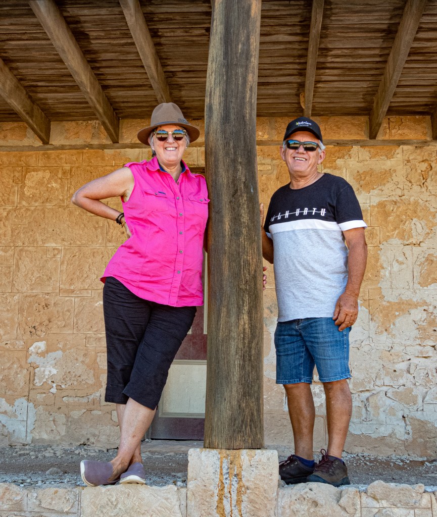
This amazing piece of history is located on Lynton Station where they have a wonderful caravan stay.


Gascoyne
Wooramel Station
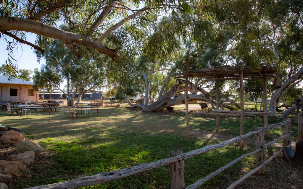
Our trip to Exmouth along the coastal highway will take us through some of the most amazing country of Western Australia. After we leave the farmland we enter the pastoral regions. Wooramel station is out first stop. We have opted to use this as one of our favourite camp places simply because of the proximity to the highway, but also due to the options for camping from the generator use area, the river sites and the grassed area close to the amenities and camp kitchen.
There are so many wonderful things to do at Wooramel, artesian swims, drives out on a station self-drive, their junk museum, walk the upside down river or simply enjoy a good book under the gums.


The self drive takes you to the other side of the highway and across to the coast. This drive can be done in a 2WD vehicle withy reasonable clearances with the exception of the second half of the drive where one can opt to cross the sandy river bed. We didn’t, so we returned along another road.


Exmouth
Exmouth is a must stay and is one of our favourite places in this region. This time we park the caravan and move into a two storey Air BnB on the canals for a week’s relaxation enjoying a wonderful weeks holiday with the family.

Our view was amazing, the location excellent, the company the absolute best. The weather can be fickle at this time of the year (August) but there is still a lot to see and the town was full and buzzing. Yes you do need to book, at least a year ahead. There is swimming and beach walks, self drives and hiking. You can even relax, read a book, play cards, and eat out. As our eldest granddaughter lives in the town we had the chance to catch up with her.
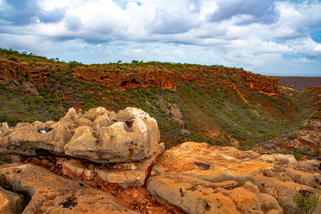
It might only be a small peninsula, but it certainly has plenty to keep you busy. We took a drive out to Cape Range NP from the eastern side to find some absolutely beautiful scenery, the range totally lush from recent good rains.


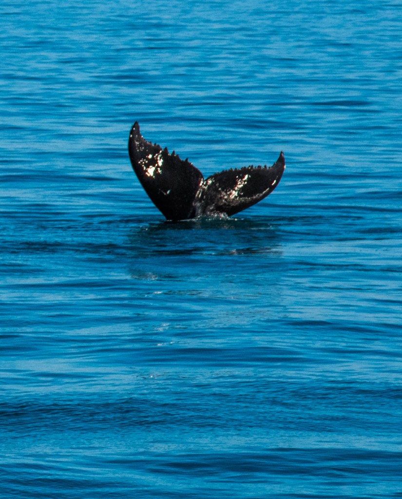
We explored beaches, combing for all types of interesting things including shells and other things washed up on the beach. We even found crabs scurrying across the sand, dolphins swimming past but to see the whales we took a whale watching tour.
Ningaloo Station – Winderabandi Point
Travelling in convoy with two others, a caravan and trailer, we leave Exmouth behind, including our caravan parked up on private property. Fuel and water refills completed and a friend’s boat hitched up to our Ute, we head off towards our turn off. There are two ways to get from Exmouth to Ningaloo Station, but as we were towing equipment we take the road in off the main highway. There is no difference in time or kilometers, but the western drive requires crossing the unpredictable Yardie Creek which is not suitable for caravans. Ningaloo Station is now under Department of Parks ownership therefore booking online at least we months in advance is recommended. This is 4WD access only.

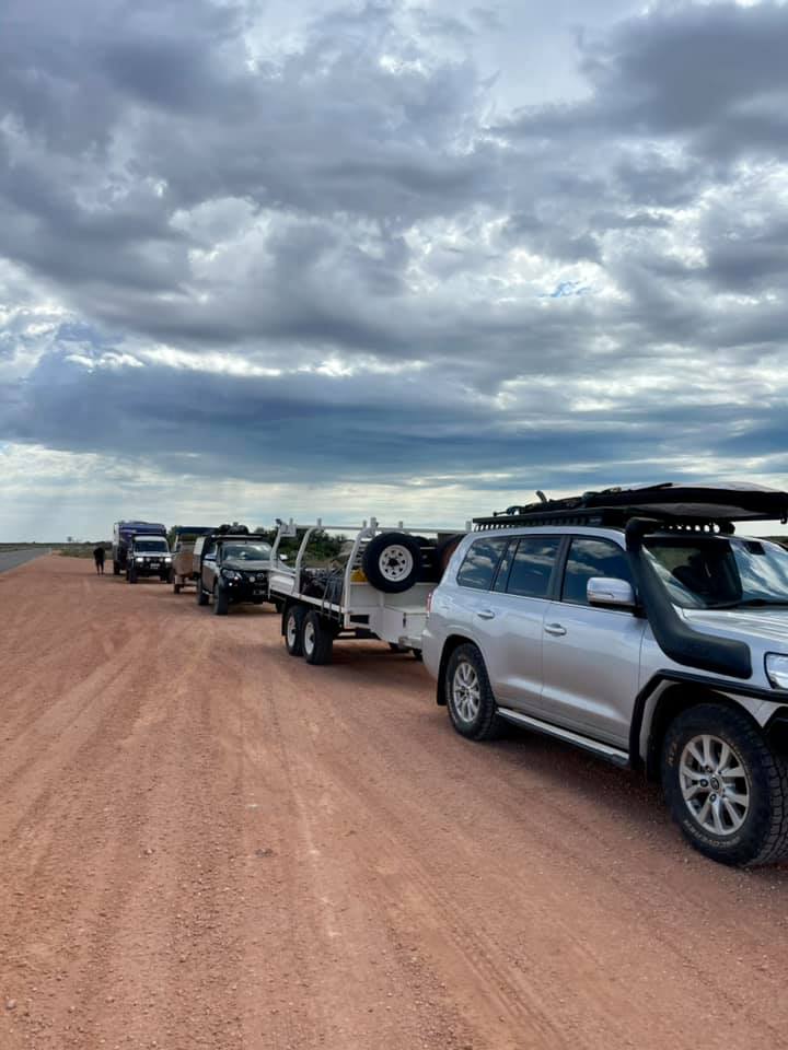

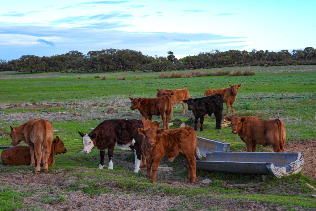
Turning off the highway onto the gravel road into Ningaloo Station, we pull over to conduct the required tyre pressure reduction ritual. This part of the road heading west into the next turnoff is a good wide gravel road following the lie of the land over the dunes through the Bullara Station property. But lowering tyre pressures and driving at 40kph is respectful to the conditions. At every dip on the road there was remnant water from the recent rains and cattle camped near the water completely unperturbed by the passing traffic.
This is no quick trip, with the first section of 26kms taking an hour at an average speed of 40kph as we were all towing. The road conditions were corrugated with rocky limestone ridges and muddy water holes to traverse. Having good 4WD tyres with quality side wall protection is paramount. We reach the next turn off to the various camping locations at a gateway onto a narrow two wheeled track (ungraded) presenting the challenge of meeting travelers coming out forcing one vehicle up onto the grassy spinifex edges. Courtesy is a priority here.
The track meanders along the coastal plain between the Cape Ranges to the east and the sand dunes to the west. Our camp spot is at Windirabandi the one farthest north next to the Federal Defence Zone. We turn onto a sandy track windy our way slowly around the bay to access our site, but first we stop at the caretaker’s camp to check in.
The caretakers conduct their checks including enough toilet cassettes for the people on our site, advised of the rules for campfires, fishing and cooking. Each site is very different requiring some detailed planning to get two tents, a swag and a caravan onto the site. Across from the site is plenty of parking for the trailer (loaded with our wood and water containers and the boat.)

We walk up the track to our site to find the most prestine flat, calm turquoise water, protected by the outer reef that lies over a kilometre to the west, lapping gently at the whiter than white sand. The Cape Range NP creates a protective barrier to the east. The sun shines gently down on this amazing paradise that will become our home for the next 5 days.
Eventually we are set up with the caravan in the back dunes and the two tents and the gazebo (our living area), set up right on the beach. Even the loo/shower has a beach view! Perfect!!
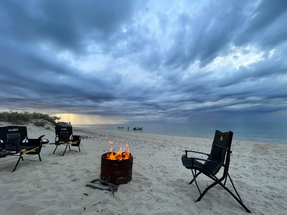
The lads get the campfire going whilst the rest of us finishing setting up the kitchen and camp area. Fires must be done in the supplied half 44gal drums, no open fires on the beach. When you leave your site, you leave the drum and the ash intact for the caretakers to remove and cool the fires down.

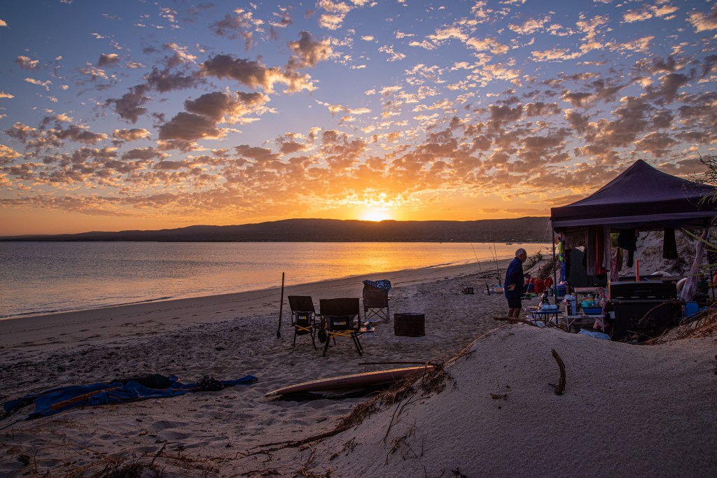
The skies to the west were building up with menacing and threatening storm clouds. We were in for an interesting night and hopefully a sky show. We sat around the fire watching the sunset and the clouds develop on the horizon whilst enjoying a well-earned drink. By night fall the lightning is flashing across the northern skies and thunder is crashing around us providing a spectacular sky show. Fingers crossed it stays to the north. Our hopes of the storm abating or passing is short lived and by midnight the wind picks up and the rain falls.
By morning the storm has all gone and we awake to a beautiful stunning sunrise across the ranges. Fishing is only allowed from the beach at Windirabandi due to the dolphins, stingrays and turtles and other protected species, all boat fishing must be done beyond the reef. We launch the boat with much ado, but after lots of laughter and digging we get the boat in and the Ute back off the beach. The beach sand was very, very soft.
The boys head out toward the reef and returned very quickly with huge smiles on their faces, they had caught a Cario for dinner that night. Dinner plans changed, the fire is ramped up for a sumptuous meal of fish and chips and salad!! The next morning, Ian decided he would try his luck at fishing and returned with a rather smaller sized fish, but at least the quality was there, a red emperor!!

Our days at Ningaloo start with a glorious sunrise over the ranges turning the water a vivid liquid orange then by 9am, its time for the first dip of the day. The water temp varies, but we jump in and enjoy the freshness. As the sun rises higher into the sky, the water turns to the wonderful turquoise colour the Ningaloo is renowned for and the water warms up and becomes almost still and crystal clear.
The days become a rhythmic process of breakfast, a walk along the beach, planning for the evening meal, spot of fishing, relaxing, chasing the grand daughter, and just enjoying the company whilst watching the changing view.
Towards the point the rich golden hues of the setting sun bounce off the scattered clouds reflecting on the water turning it from turquoise to golden yellows and oranges shimmering across the water as it laps against the shore. Magical.

In the shallows of the water we saw sting rays, dolphins feeding, turtles, then under the water we found sea anemones, sea slugs, minoes and bait fish. One evening we spot a dorsal fin and tail of a small 1.8m reef shark feeding on the bait fish.
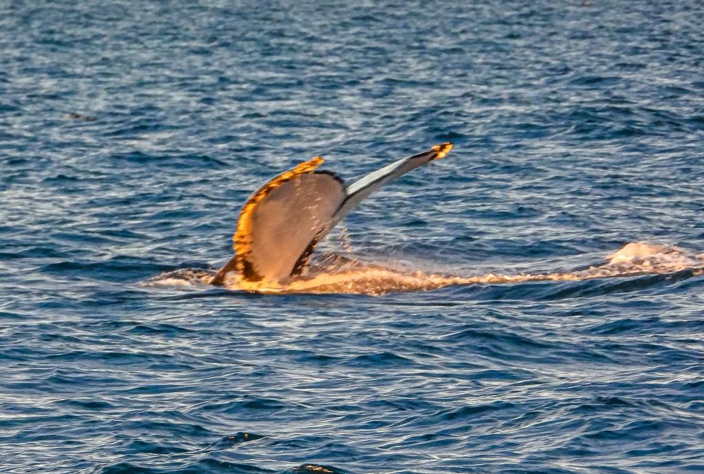
Later in the evening as one sits around the campfire, you can hear the whales slapping their fins and breaching beyond the reef. Ah the serenity, it really is worth the effort to get there.
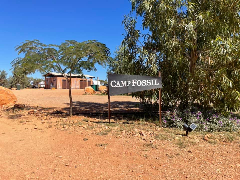
Bullara Station
Bullara Station Stay is a must stay for anyone wishing to experience station life in a wonderful location. Additionally, many people who are unable to get into Exmouth or Coral Bay have opted to stay here and do day trips to the locations. The Shallcross Family started this venture over a decade ago and the improvements have been increasing each year, we stay here on our trips north and every time the improvements far exceed the previous stay. We did book both Wooramel and Bullara well in advance regardless of what time of the season it is. Plus remember both these stations are closed during the warmer months.
We were fortunate to have a powered site in the aptly named ‘Camp Fossil’, with brand new ablutions located right behind our site. Winning!!! The showers were filtered by a metal bucket with holes drilled into the bottom, very authentic. This initiated the old song “there’s a hole in the bucket dear Liza, dear Liza……” whilst having the shower!!

Pilbara
When one thinks of the Pilbara they think, iron ore, Karajini, more iron ore but do you really understand exactly what IS the Pilbara?
Yes it is the red dirt, oh and red dog (of course), iron ore, but it is much more than that too. There are so many amazing places that people often don’t know about or consider to be rough and ready and don’t fit into the romantic image that has been created of the region.
Now before you grab the maps or Google anything, let us tell you of our experiences. We lived in Karratha for 7 months, actually experienced a wet season that was very dry, only 22mm of rain fell, but we had some amazing storms. It was an wonderful experience and one that will stay with us for ever. We made lots of wonderful friends there and despite the heat, found it a very easy town to live in.
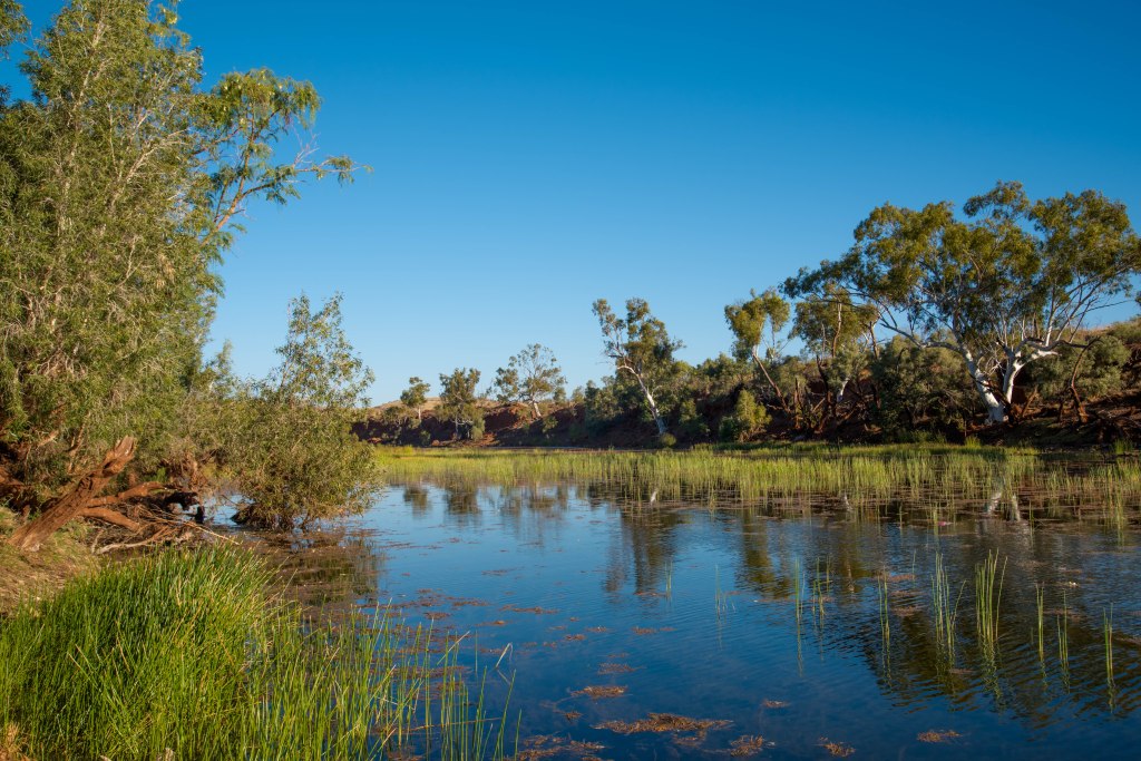
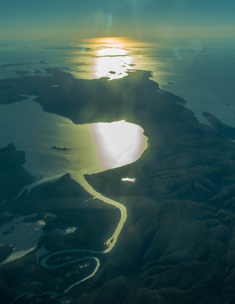
Fortesque River
Only 100km south of Karratha is the Fortesque River. Fantastic when its full but just as special when its nearly dry with its beautiful billabongs, birdlife and station cattle who wander in for an evening or early morning drink. There are no crocodiles so it is very safe to swim here.


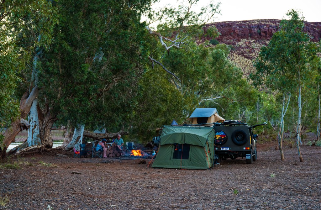

Our first serious off-roading 4WD camping trip, time to test out the new Darche Tent and our gear and what better way to do that with friends and family. Just north of the Fortesque roadhouse you cross the bridge over the Fortesque River. The turn off to the camping areas and the river is a kilometer north of the bridge. The track changes with each heavy downpour so there really isn’t a track, you find the best section of the river to drive along. The pebbles soon become boulders cracking and rolling under the tyres. The drive in is slow and methodical and definitely not recommended for caravans, but off-road campers are okay. We wouldn’t recommend taking a caravan into here, only suitable for 4WDs. No lowering of tyre pressures needed for these ground conditions.
We find the first spot near a billabong with flat ground minus the boulders and trees under which to sit. Whilst further along is much prettier, we decide this was far enough. Setting up camp required building a camp fire, cutting fire wood, putting tents up and getting the paddle board out. The water was most welcoming and we are soon in for a swim in the cool waters of the billabong. The billabong is reedy in places but the water is clear and not muddy underfoot. We spend the afternoon paddling, swimming, reading and generally relaxing. Mid afternoon we get the fire cranking as we had prepared camp oven cooking and damper for dessert.
The camp ground is on a station, permission is not required, but respect for the waterways, wildlife and livestock is vital. There is an abundance of wildlife and birdlife around most of which can be found on walks up and down the river on either side. During the dry the river forms pools or billabongs along its path, but this is the closest pool to the highway.
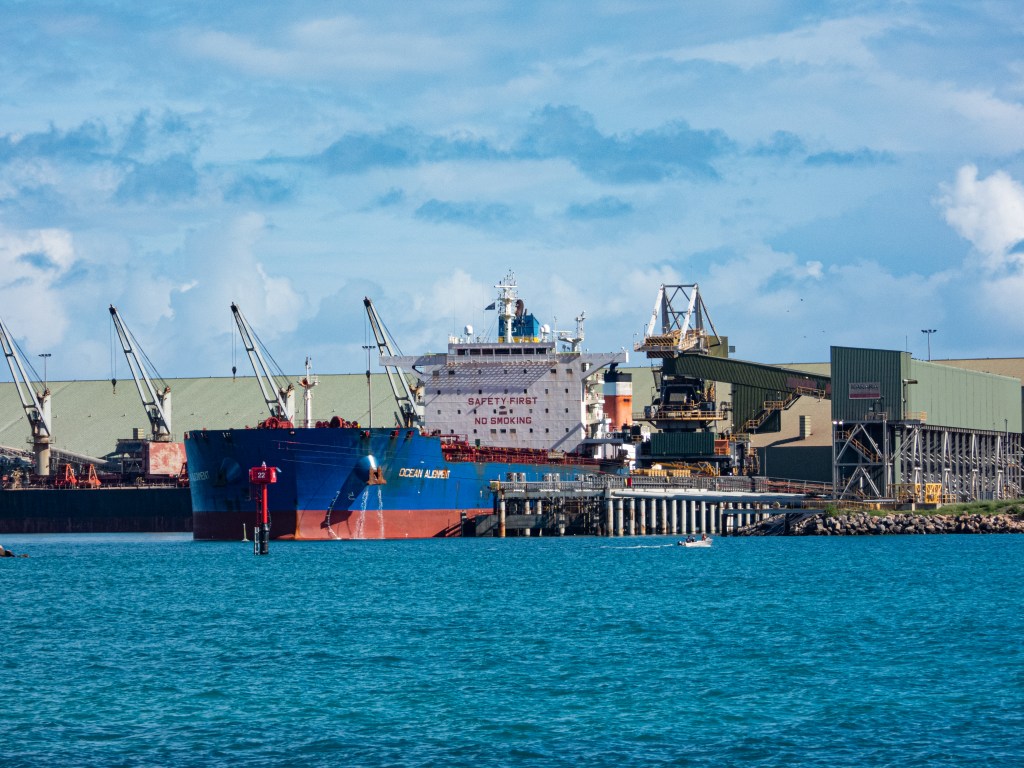
Dampier

When the town of Dampier comes to mind, there are often two things that stand out – Red Dog and mining. Both are related, both are linked to mining. But there is more to this beautiful location than that.
The town was named after the explorer William Dampier and there have been many changes to this location particularly once the mining sector became active when Hamersley Iron required a port to ship out the iron being mined further inland.
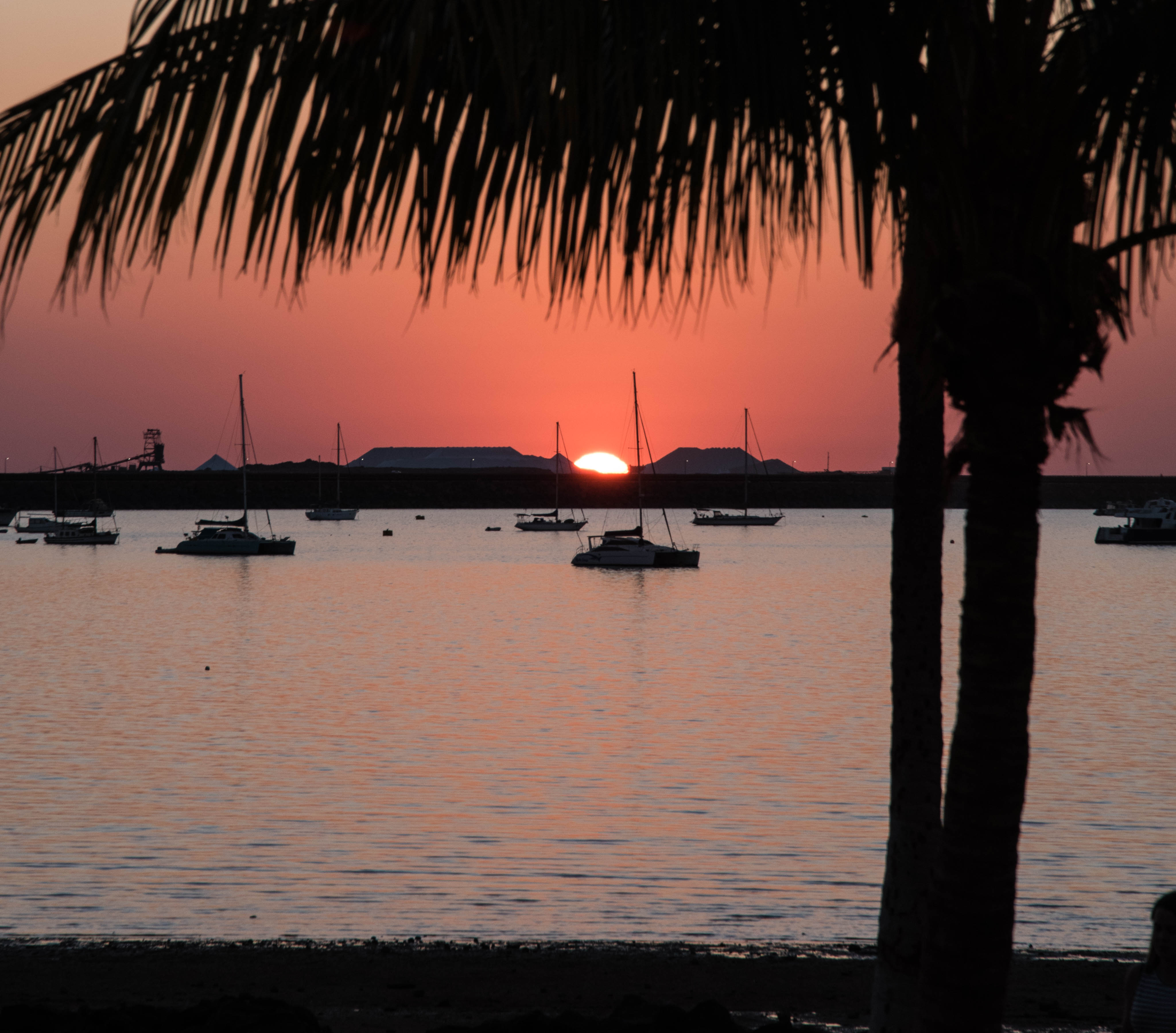
Added to this is the incredible Dampier Salt Limited that one crosses on the causeway out to Dampier and the famous Burrup Peninsula (more on that in another story). The Dampier operation (now part of mining giant Rio Tinto) was established in 1967 and currently produces 4.2 million tonnes per annum. The total area under evaporation at Dampier Salt Limited operations is 19,500 hectares. The three sites evaporate an average of 1.1 billion litres of water a day. Sun and wind energy comprise around 99 per cent of the total energy required to grow, process and ship the salt. More information is located at the link below.
But there is more to this picturesque location than the historical facts and industry, it starts with that famous red dog whose statue welcomes you on arrival into the community. There is a very welcoming feel about the town that is clearly different from the industrial and busy nearby city of Karratha. Maybe it’s the grassed areas fringed by palms along the newly renovated foreshore making the beach more welcoming, the mix of sand, rock and mud flats on low tide, or the relaxed mood of its inhabitants or the fact that there’s no rush of vehicles or people, whatever it is the town is certainly very welcoming.
When you first arrive, over the railway lines that bring the iron ore to the port, past the red dog statue and the homes of residents, you rise up and over the hill you are met with a glorious view of the Dampier beach.
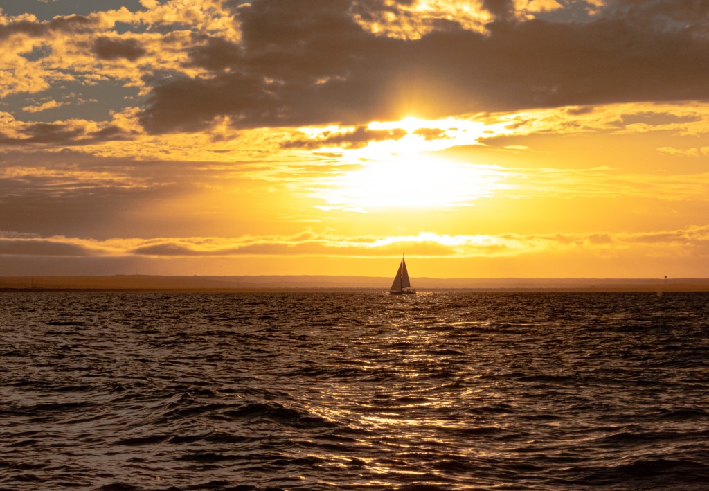
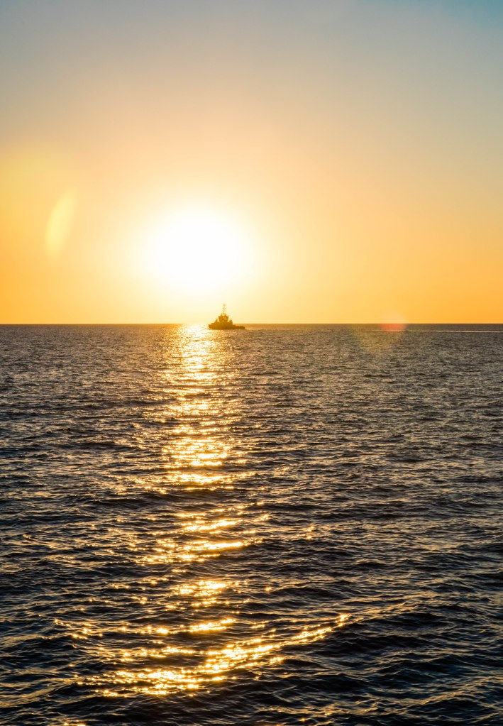
There is a stark contrast to the busy port loading iron ore ships, Rio Tinto’s mining activity humming away on the nearby islands and luggers, ships and barges sitting in wait for their call to work against the small leisure craft gently moving with the tidal movement, in and out, birds gathering food from the tidal mud flats and people walking in the late summer light or like us watching the beautiful sunset.
The sunset was mesmerising, with the tide out, boats, islands and people walking along the tidal flats are silhouetted by the red sun. Picture perfect opportunities for any photographer. Add to this the full moon rising to the east between the palm trees, a pleasant and surprising opportunity. One thing a photographer always knows, don’t just focus on the obvious (in this case the setting sun), but to look around at the impact on the rest of the landscape or other things that may be happening.
http://www.aussietowns.com.au/town/dampier-wa


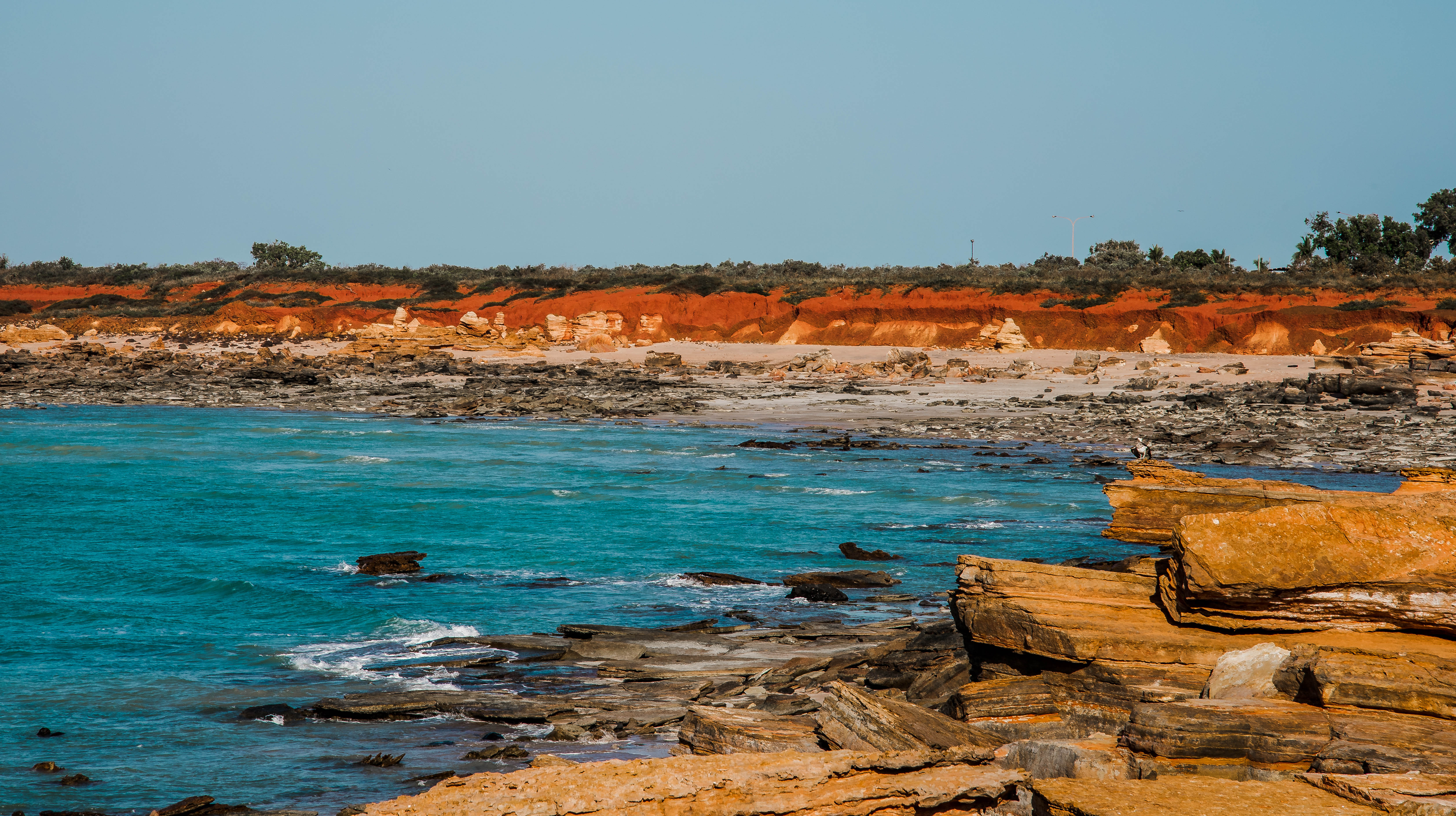
Hearson’s Cove

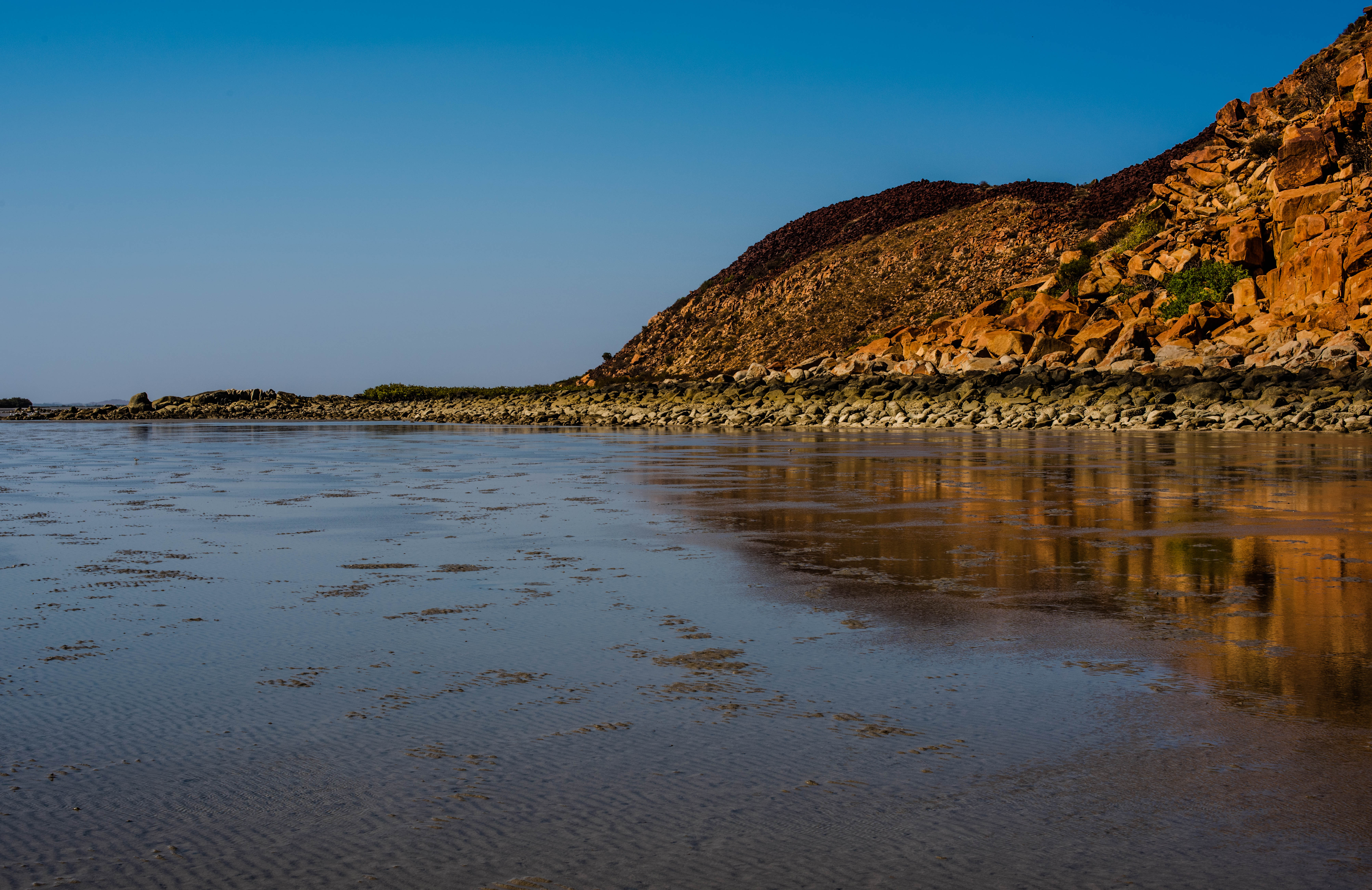

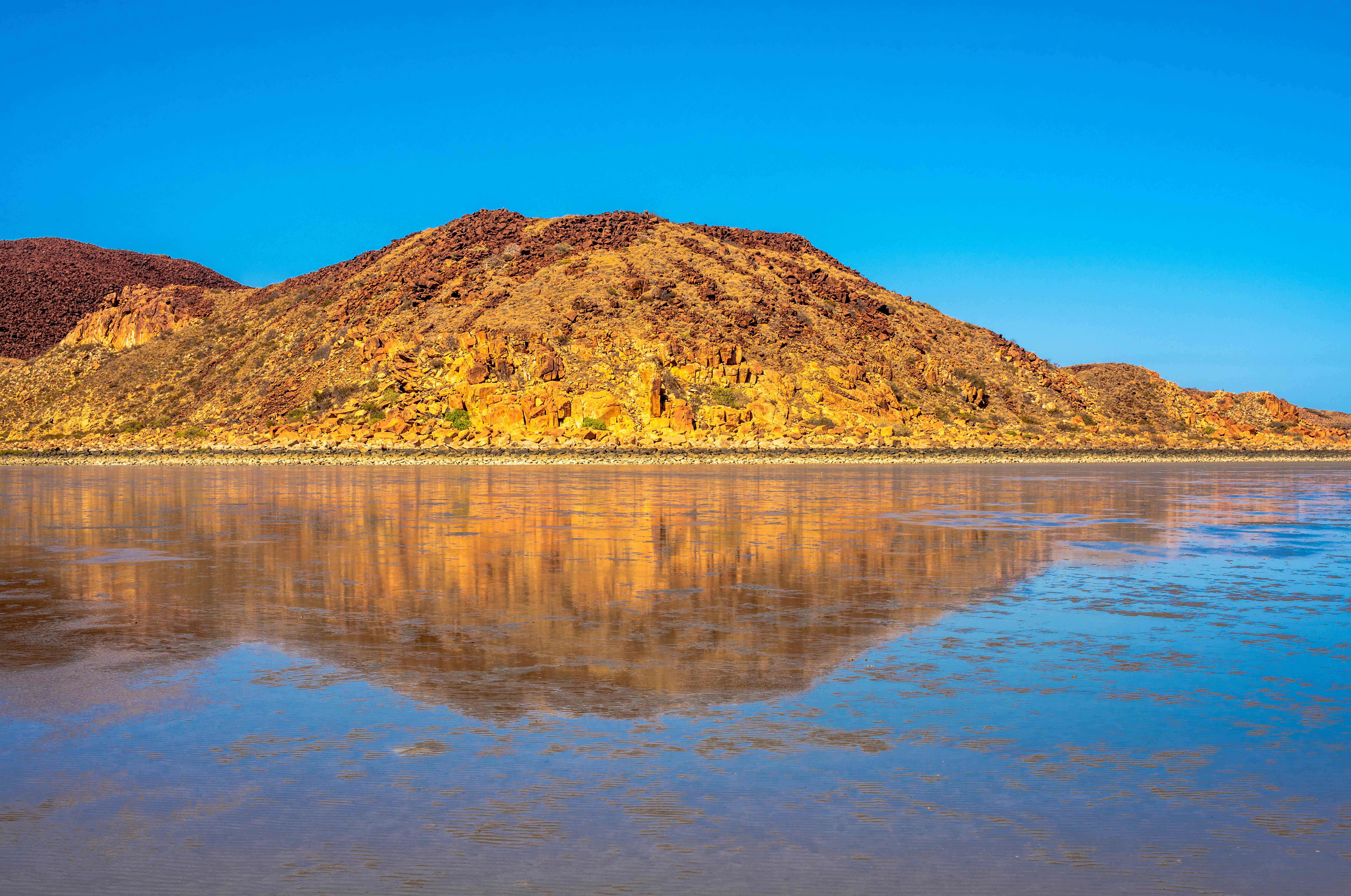
There are so many amazing and beautiful locations to visit within a stone’s throw from Karratha and whilst the weather is hot one might think it isn’t conducive to sightseeing, but you can choose the time of day and temperature to take a visit and experience these locations.
Our favourite location in the area is Hearson’s Cove on the Burrup Peninsula, where this beautiful cove has a sweeping beach of shells protected by hills on either side. The tidal movement that can be up to 6m, provides some great exploring opportunities. The tide pulls back several hundred meters at the Cove enabling one to walk barefoot over the smooth fine mud where it squishes between your toes. Due to the tidal movement the mud is left with a rippled effect where sea water settles in the low points of the ripples creating a shimmer across the flats, either from the sunlight or the full moon. Thus, the famous staircase to the moon is visible at the cove monthly when the moon rises over a low tide.
Walking out along the mud flats to the edge of tidal movement, one needs to be constantly looking down so as not to interrupt and tread on the small creatures foraging for their food as they take advantage of the low tide. There are little molluscs no longer than 2-3cm that propel themselves steadily along leaving their trail plus tiny crabs scurrying about darting suddenly into the mud hiding from any potential predator. Unusual holes in the mud are located across the flats, so one must be sure not to step into one, therefore walking slowly and looking down is all part of them enjoyment, stopping occasionally to take in the landscape around you.
Once out at the edge where the tide has begun to move slowly back in with each movement of the waves, a ‘scum’ appears on the forefront of the returning tide. This scum or sea-sawdust with its biological name Trichodesmium, is found in nutrient poor tropical and subtropical ocean waters, it may also look like emulsified diesel on the water and when the sea-sawdust lands on the beach, it can turn purple, green, and black as it rots/decomposes. It is common during summer around the Pilbara waters and is a natural phenomenon.
Hearson’s Cove itself is very picturesque with the surrounding hills that seem to embrace the cove in a protective way, edged on the west side by small mangroves at the base of the hill. On the NE side the hill, covered in rocks, seems to disappear into the water as they change colour marked by the tide, leaving the rock colours that are a light sand colour at the mud level then change to brown then black at the high tide level leaving a line where the rocks become the orange/red ochre colours of the Pilbara. This hill on the NE side looms up majestically protecting the cove, is completely covered by the red rocks, that looks like dump trucks have tipped the rocks out over the top of the vegetation. Viewing the rocks from the edge of the tidal flat there is a distinct wave as the colours of the rock are the yellow/orange the change suddenly along this line to the Pilbara red.
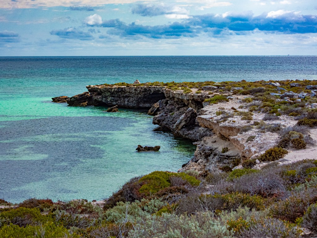
This is the incredible natural landscape of the Burrup Peninsula. the most famous of all are the spectacular indigenous rock art on the rocks of the hills. We have been fortunate to have experienced a very personalized tour of the rock art. A privilege only granted to a few locals. There are however, many organised tours you can take, and we highly recommend that you do to truly ‘feel’ the incredible experience you will have. When next in Karratha, ensure you book your tour, it is one you will never forget.
The Kimberleys
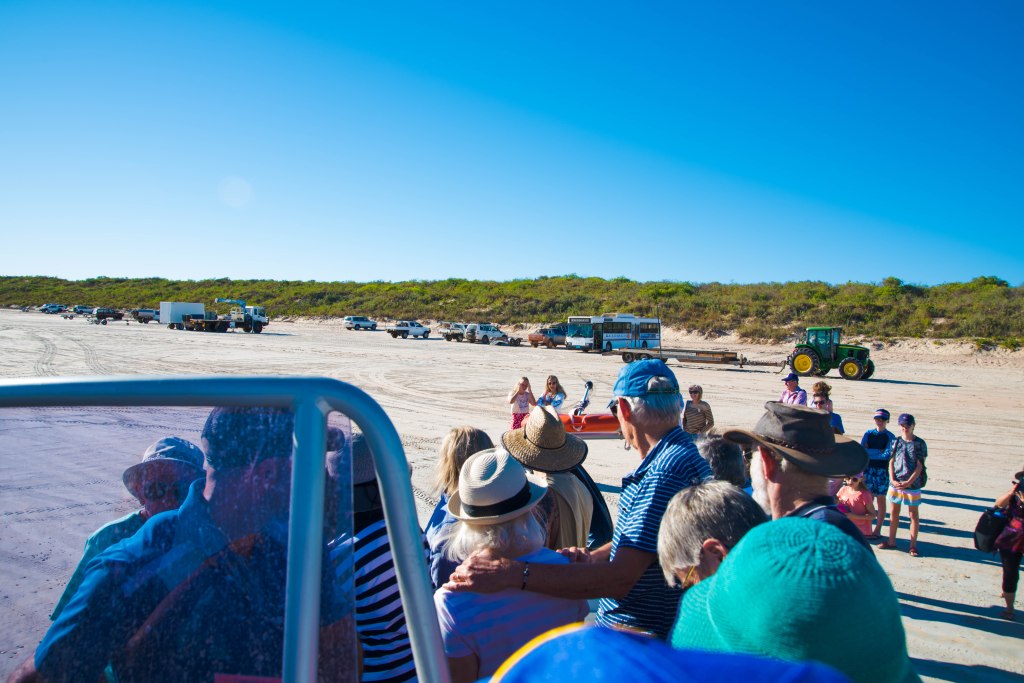
80 Mile Beach 2018

80 Mile Beach is a stretch of endless beach stretching for eighty miles, thus the name situated 250 km north of Port Hedland and 365 km south of Broome. Both Wallal Downs and Mandora Stations run parallel to the beach with the main caravan park located on Wallal Downs Station between two sand dunes and 9 kms off the Great Northern Highway. The caravan park has been operating for over 35 years and the owners are constantly improving the park facilities.
Upon arrival there were minimal campers in the park and it looked like we had the place to ourselves. We stayed for 5 nights and when we left the park was filling up with the long termers who stay for the dry season and short term travellers passing through. A very friendly park with most of the workers happy to stop for a chat.
We arrived at the end of the wet season and only a few days after the last cyclone for the season, a time with the potential for storms, the weather is around 35 deg and the humidity is still present. TC Wallace was passing the coast followed closely by another tropical low whilst we were there, this weather provided some amazing photo opportunities, but didn’t cause any major dramas for us weather wise.
Travelling with a caravan in the north, one needs to be vigilant with the awning particularly when there is the potential for strong gusts and squalls that could whip your awning up and off in seconds. We went to bed, no ariconditioner on, windows open to feel the ocean breezes. There wasn’t a hint of a strom anywhere and we are very vigilant to check the forecasts.
Around midnight we were woken by rain, then realised wind was also picking up. We watched the awning out the window until we decided to retract it, just to be safe. Barefoot, in our PJs we step out of the caravan straight into 50-70mm of water. We quickly retracted the awning, secured it into place before looking across at our neighbours whose camper was getting a battering in the wind and rain. We called out and they were fine, so we stepped carefully back inside our van drying off our feet before returning to bed. As per our luck, the rain and wind also relaxed and we woke up next morning to sunshine and all the water had soaked away. At least we still have our awning intact!! Our neighbours had a very sodden camper and were busy drying it off. Poor buggers were from the UK and had only been in Australia a month!!
80 mile beach doesn’t offer swimming opportunities but it is certainly to perfect fishing spot directly off the beach. No, we didn’t try our hand at fishing but spoke with the experienced, a weather worn Englishman who had been there since the park started up. He explained how the fishing is done at high tide, how particular fish grab the bait from different angles, the type of bait, why you fish using floats and sinkers, we could have spent hours with this lovely gentleman who was clearly the salt of the earth and was most interesting, but as he is the parks only hedge trimmer, we had to let him get back to work.


High tide is defined by the sudden movement of the 4wheel bikes towing carts with deck chairs on the back heading to the beach for their daily fishing. So, you don’t like fishing, not a problem, at low tide, take your bike, pram, or simply walk/run the beach. This beach reminded me of Waihi Beach in New Zealand with its wide gravelly beach where people rode bikes, push prams and wheel chairs along the beach to enjoy the evening.
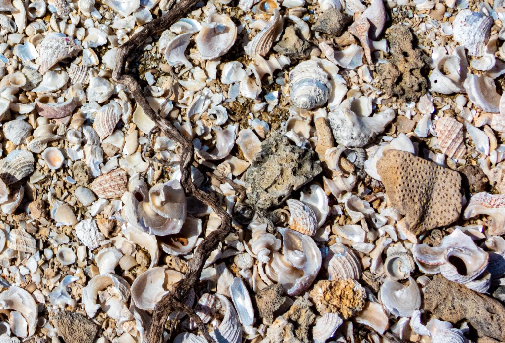
Eighty Mile Beach is also famous for its incredible shells, magnificent sunsets, sunrises and a great place to re-charge your batteries by enjoying peace and solitude.
The only downside of this beautiful peaceful location is the poor reception (Telstra), power interruptions (regular), limited food and no work options.
Broome
We have made several trips to Broome over the years, our first time was in 1998, since then we have returned with two trips in 5 months in 2018-19. The first visit was a weekender. When you live and work in the Pilbara, Broome becomes a weekender, just a mere 800km trip!!


At a day’s notice, we found ourselves in Broome. The perks of living and working on the road, and really we had only really just got started on our full time travel. This was a great positive start. The previous week, Ian’s work had taken him to Kununurra, working on road repairs with Karratha Asphalt on the Bow River Bridge, being multi skilled makes him an attractive employee apparently. The job finished up earlier than expected, so the choice was to return to K Town (1800km) or stay in Broome for 4 days before returning to the next job at the Bow River and not seeing us all for 3 weeks.
It was a no brainer actually, especially when Ian’s fatigue had to be considered, so I packed a bag for us both, said my goodbyes to my Son and his wife and drove the 835kms on my own to join Ian. I decided the butterflies were more about excitement rather than fear. I’d done thousands of trips solo so that wasn’t the issue, this was a very long drive that I was doing on my own in one day.
A long drive, most definitely, however as all experienced country drivers do, I broke the trip into stages, had my breaks (fatigue management), kept the music pumping (next time I’ll download some podcasts to listen to) and headed out on the open road. Port Headland was the first to navigate. Now this is where you realise, you are great at navigating as long as you are not the driver. My challenge was to navigate and drive!!
After Port Hedland I cross the De Grey River, onto Pardoo roadhouse and take a break at the Sandfire roadhouse. I head off and finally arrive at the T junction where I would turn left towards Broome. I kept a watchful eye on photographic opportunities as well as marvelling at the amazing landscape as it had been 20 years since we drove this road with our family, so the experience felt very new. Our other trips to Broome had been via a plane flight!
This landscape changes with each kilometer, hills, buttes and mesas make way for spinifex plains with colours ranging from deep reds, oranges through to yellow ochres and then as you get closer to Broome, the landscape suddenly turns green with the early summer wet season rains creating a flush of bush shrub so high one feels like you are driving in a mini forest. Then as suddenly as the green came the landscape opens up as burnt areas from recent fires create a blackened landscape with new growth pushing its way through the red and blackened earth.
From Pardoo station heading north, the highway runs along what some call the ‘verandas’ of the north west coast. Even from the 4WD white sand dunes and in places where the road rises over a crest, you can view glimpses of the turquoise blue ocean. Signs, posting campgrounds towards the beach were very inviting, taking note for the next trip north I sadly push away the temptation and kept forging onwards towards Broome to ensure I arrived late afternoon.
As the road took a slight bend to the left it sloped gently downwards and onto the vast open plains of Roebuck Plains Station, the vista before me took me immediately back to the landscape south of Geraldton, rolling plains of thick grasses, except these grasses were buffel grass, as far as the eye could see, paddocks fully fenced to retain the cattle who contentedly grazed on the pastures clearly flourishing after the rains and the rich alluvial soil that retained the moisture to keep the pasture palatable for the stock.
On the last 30km into Broome I hit the famous 12 mile peg east of Broome, nearly there. The GPS takes me towards Cable Beach, turning off a few streets before. Our accommodation, the Frangipani Resort on Cable Beach was perfect, and the weather gave us days of 30-33 degs, only a hint of humidity and no clouds. This short break of 4 nights in a self-contained apartment with a pool gave both us and our son and his wife a break from each other.


Immediately upon arrival I head straight to the pool, which just happened to be right next to our bungalow! Ian arrived later in the afternoon after a long an exhausting drive from Kununurra in a truck. The next day we drove around Broome revisiting lots of places to see how much it had changed. This would prove to be most useful for when we returned here in 2019. At the end of our short stay, Ian headed back to the Bow River Bridge near Kununurra and I returned to Karratha. He joined me about five days later back in Karratha to have a week off before hitting the road again carting Hot liquid bitumous product for the road works around the Pilbara.
Broome 2019

Broome is renown for its camel rides, Cable Beach, red sandstone cliffs against turquoise waters and of course pearls. Should you visit? Well at least once, but don’t expect a cosmopolitan swish place with high rises, cafes and restaurants on every corner. Broome prides itself on its eclectic and colourful history. So, immerse yourself into the history, research before you come so you can enjoy the sights that there is to offer.
I guess it can be a place where you either love it and cannot get enough of it or stay a day then leave. What I intend, is to give you the reason why Broome is amazing and a place where you should give it at least a week on your first stay.
Broome should be used as a base from where you can travel, explore and experience the amazing surrounding region. I have to laugh when I hear people say, where in Broome can we ‘free’ camp, I simply reply try about an hours drive out of town and they are astounded. Sadly, people only see Broome as being a dot on the map of the Kimberleys in Western Australia and are completely unaware of this incredible yet very remote and unique location.
Horizontal Falls
This is an experience you shouldn’t miss out on. It is incredible. The tour is extremely safe and the exhilaration of the experience will stay with you forever. As Ian is one of 4 bus drivers for the Horizontal Falls Seaplane Adventures collecting tourists three times a day, for the tours, driving them to the airport where at the hanger he escorts the paying guests to the caravan or seaplane for their adventure. One of the perks of such a job is you get the opportunity to experience what the tourist pay to see/experience. This is called a famil. We did a couple of these whilst working in Broome.


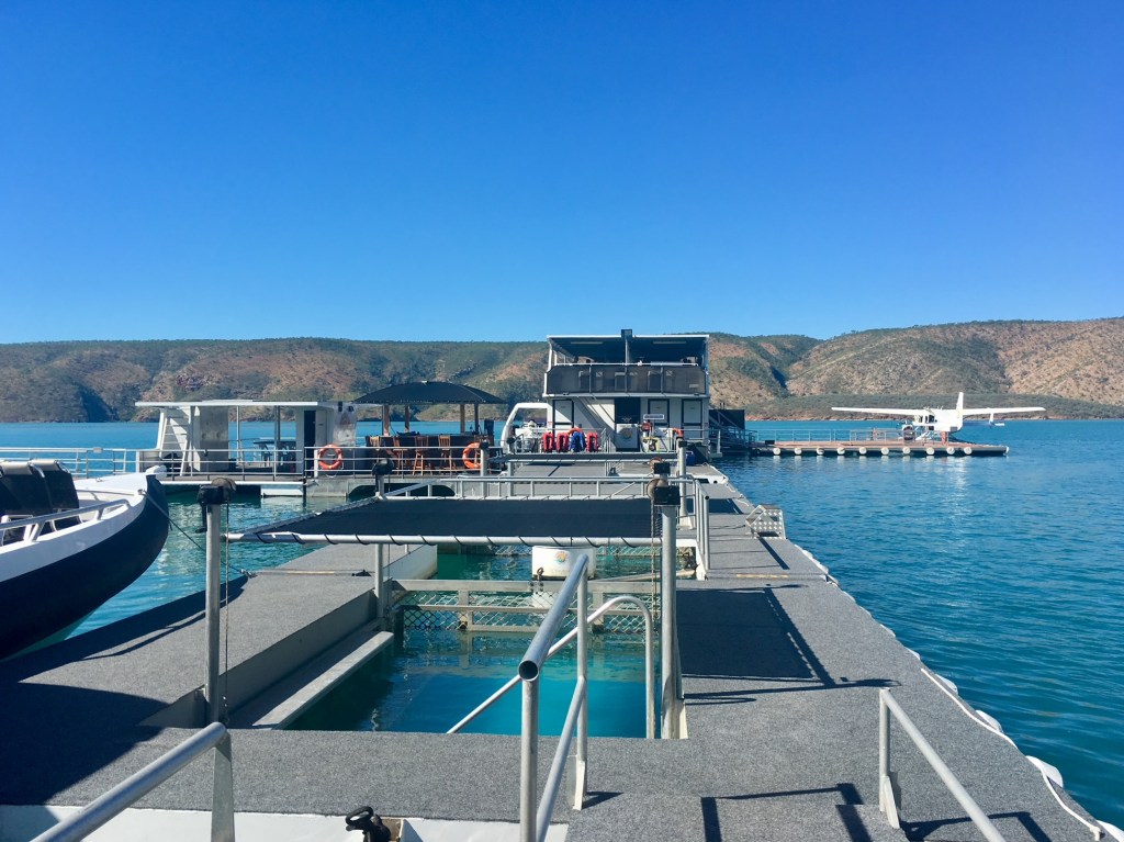
The Horizontal Falls are located north of Broome in Talbot Bay near Koolan Island where the land is owned by traditional owners. As you cannot drive to the location, the only access is via seaplane or boat, either with a tourist operator or via permits. Our famil and part of Ian’s training, is done on ther afternoon half day tour.
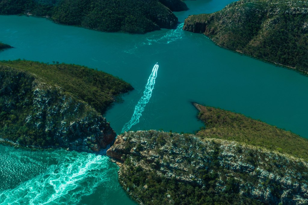

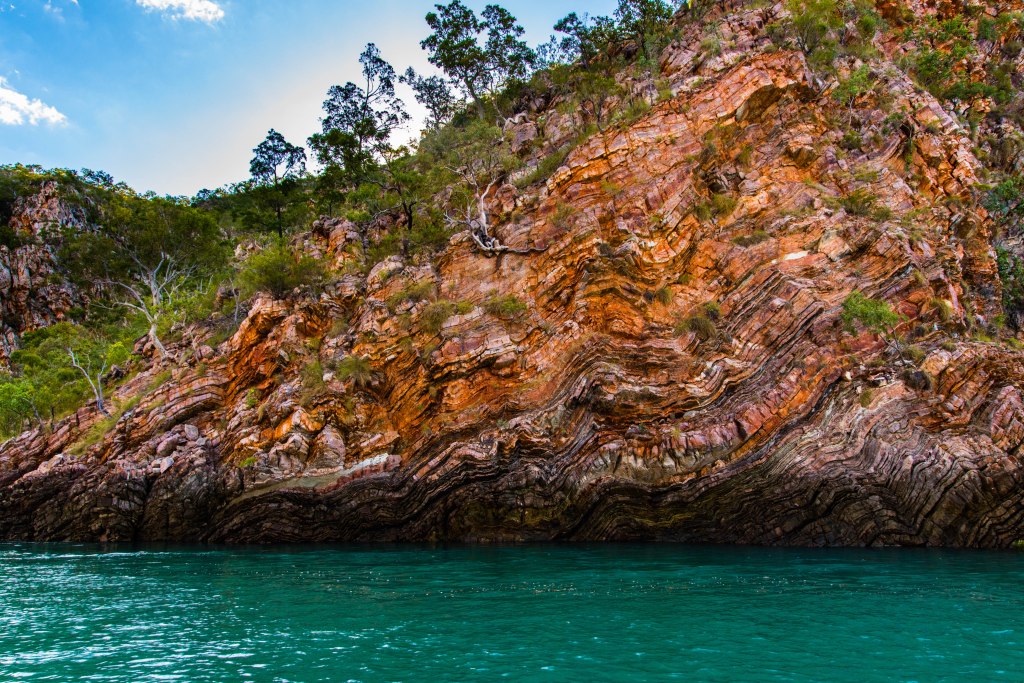
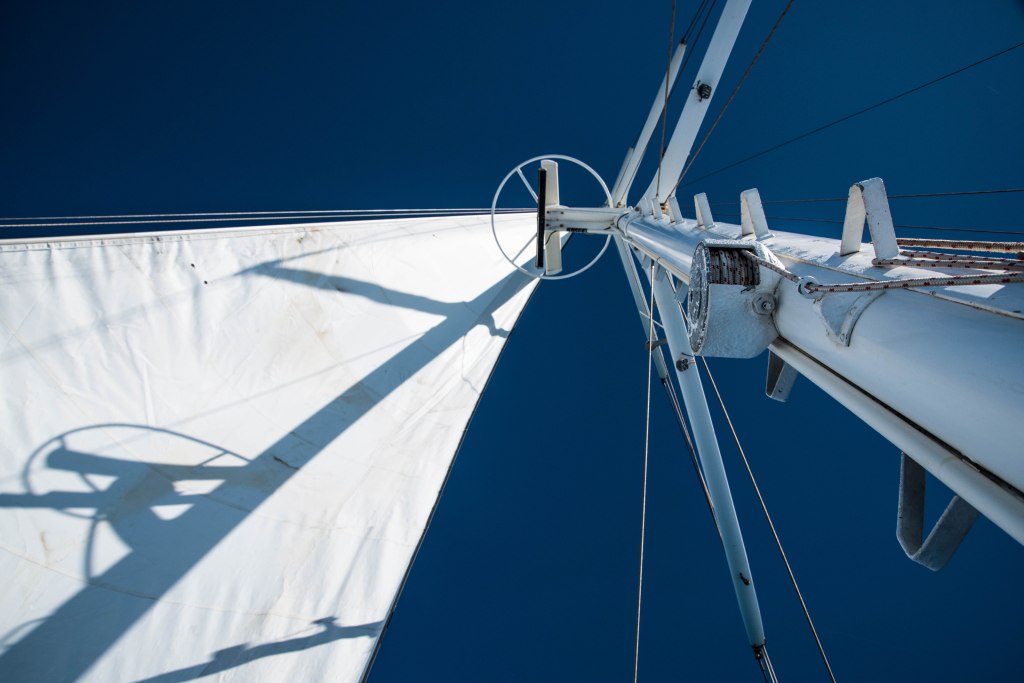
Our seaplane took us over the peninsula, flying low over Willie Creek Pearl Farm and Cape Leveque before flying very low over the falls and finally landing on the waters of Talbot Bay. Completely breath taking and we have only just landed! We then boarded the jet boat fitted with four 300hp outboard motors necessary to ensure the boats are able to push against the current of the tidal movement when traveling through the falls. They take you through two narrow points between the red cliffs that soar high above the water. This is where the tide moves between the rocks creating the horizontal falls caused by the extremely high tides the volume of water going in and out during the tides. We then return to the pontoon and its floating dining area to enjoy freshly wild caught Barramundi and salad for lunch.
After a swim with the Grey tawny nurse sharks, a second more sedate boat trip takes you up into Cyclone Creek to view the spectacular rock formations. This is the area where they locate the floating pontoons, houseboats and equipment during the wet season where they are protected from storms and cyclonic weather. We then board our seaplane to return to Broome. Coming into Broome on the eastern side we get to view the tidal flats that flow into Roebuck bay amidst a setting sun.
Broome Town & China Town


Broome is relatively quiet in the shoulder season and very quiet in the off peak season. The population grows from ~15,000 to 55,000 in the peak. Our work in the town would mean we would be experiencing this crazy season. In previous visits we have always visited on the shoulder of the seasons. We were to experience a very different Broome this time, not as tourists but as workers even perhaps as locals.
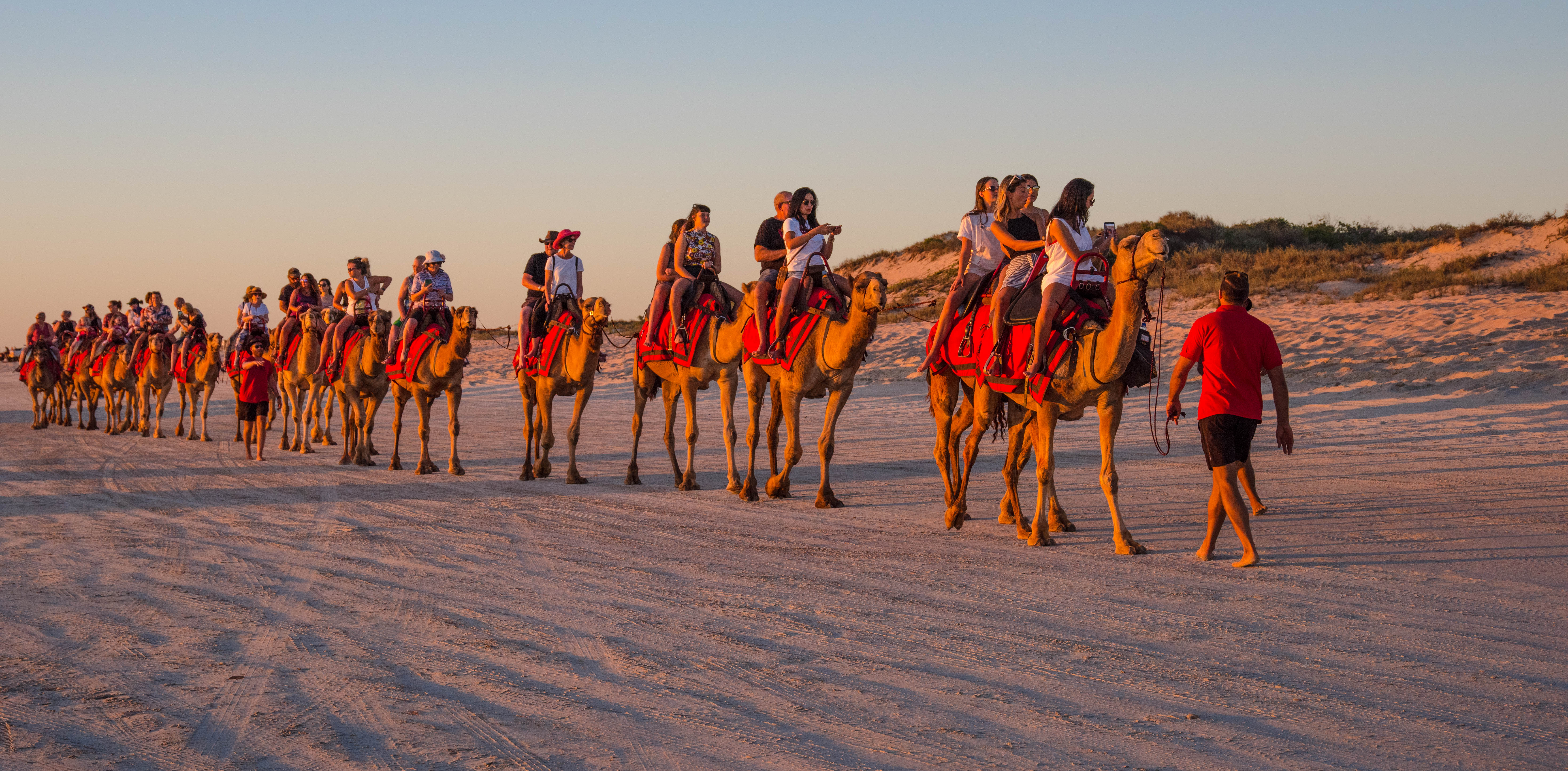
Broome itself is always progressing and is a bustling community, although development had slowed on this visit. The camels still make their daily pilgrimage to the beach for those tourists wishing to take the traditional sunset beach ride. The Cable Beach sunset bar is full with tourists and locals alike. When we arrive in April the caravan parks were near on empty, clearly too hot for those grey nomads.

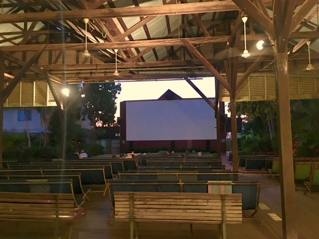
Broome’s Sun Pictures is the World’s oldest operating picture gardens open air experience and is a must when in Broome. We go a few times viewing ‘Mumma Mia Here We Go Again’ and at another time ‘Top End Wedding’ a perfect movie to watch in the Kimberleys although it is set in the NT. As you enter the building you are taken back to another era, albeit ticket payment and the kiosk are modern. The entire building is still in its original timber condition with memorabilia and old movie equipment on display in the foyer. Once you have your ticket and traditional chocolate topped icecream or popcorn, you walk toward your chairs, you can choose to be under cover or out under the stars. Reclining back, one relaxes into the old wooden but comfortable deck chairs, positioned perfectly for the screen. Unless you are aware of the tradition you can be taken by surprise, the picture theatre is positioned right under the flight path for the airport!! Our grandson Harry would have been very excited as the planes are so low you feel like you can reach up and touch them!!
Places to explore include the historic China town and Jimmy Chi Lane, the old jetty in town, art galleries, the wonderful old timber buildings. One such building, now an art gallery, has a colourful history of being one of the pearl diver’s homes. When the big tides or floods came in, they were able to sit on the verandah and fish. It is hard to imagine. There’s the famous Roebuck Pub where many stories can be told.
Out towards the point the new main jetty stands strong and vibrant able to carry a road train of cattle out to waiting live export ships. There’s Roebuck Bay where the famous staircase to the moon can be viewed, Cable Beach where one can drive their vehicles out on to beach, remember to return before the incoming tide maroons you. And the beautiful Gantheaume Point with its incredible rich red rocky shoreline is a stark contrast to the turquoise waters of the ocean. Sadly, since we last visited 8 years ago, this section of the coastline has taken a battering by several severe cyclones. Whilst the history of its origin remains, Anatastia’s Pool has collapsed and crumbled almost beyond recognition. In Jan 2014, the Broome Shire submitted a report from extensive studies opting not to repair the pool, so once again the sea has won out and taken back its coastline.
Gantheame Point viewed from the ocean
Whilst out at the point we met and chatted with a lovely young family of 5 from Adelaide, they had been on the road for three months, and now heading south. With three boisterous boys enjoying the point, rambling over the sandstone rocks, searching for creatures in the rock pools, this family reminded us of ourselves when we travelled with our family to various parts of Australia. We wished them well and gave them tips on the WA locations to tour. On my travels home, after overtaking a caravan towed by a 4WD, I recognised the tow vehicle, when a crackle came over the two-way radio – it was the Adelaide family, they were on their way to 80 mile beach for a short break (one of my recommendations). Now that’s exactly what travelling this great country is all about, it leaves the soul feeling positive that there are beautiful people in this world, albeit of course they were from South Australia, so you would expect that.
Eco Beach Resort Cruise 2019

Broome continues to provide some amazing experiences in our extended stay here in the region. Whilst we hadn’t planned on staying for this long, it has given us a real ‘feel’ of the pearling capital of Australia through experiences and this experience was no different….
We talked before about famils. This next experience is exactly that. This is a very affordable, relaxing day cruising the seas from Broome to the renown Eco Beach on the Karma IV.
A reasonable start to our day at 8.30am, we were collected by the Karma IV coach and transported to Cable Beach, no not the popular end opposite the Cable Beach Club, but the southern end near the race track where our coach turns into the road signed – ‘boat ramp’ and drives directly onto the beach, yep you are reading that correctly, straight onto the beach in a big coach!!
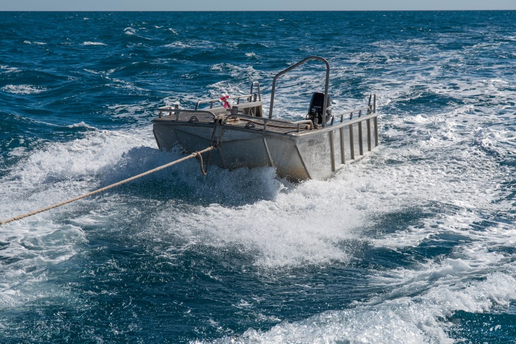
We are then transported in a ‘Sealegs Amphibious’ boat, yes that’s a zodiac style boat on wheels with an outboard motor!! The wheels are used to get the craft out of the water and onto the hard sand then back into the water, where the outboard motor kicks in and zooms us across to the catamaran, the Karma IV. We board our cruise vessel onto the first level with a helping hand from one of the owners, then head up to the top level where we find a seat and to take in the views of Broome from the ocean side.
The Karma IV is a family owned and run business, plus additional crew including a chef. The sons of this family operation often bring their children on board, these young children (under 4) had their sea legs and were at ease even on the rocky craft. The family are incredibly welcoming, making your experience relaxed and enjoyable, stopping to chat and explain various aspects of the tour with no question too silly or complex. You are completely placed at ease feeling part of their extended family that adds to the entire experience.
Once everyone was on board, the Karma IV set sail out past Gantheume Point, across Roebuck Bay and out into the wide blue yonder towing the tender behind. (The first vessel – the wheeled Zodiac – was left behind in the shallow waters of the bay, swapped out with the aluminium tender.) The tender is a little more rugged and therefore able to take the constant battering on the wake as it is towed behind the catamaran. Sadly, this particular morning the seas were a little rough making walking about on the Karma a little tricky for us who hadn’t yet got our sealegs. It wasn’t rough enough that it was uncomfortable, just more rolling with an occasional higher pitch of the waves. And the wind was a tad chilly.
Within a half an hour of the cruise a delicious breakfast was served including ham and cheese croissants, quiche tart, tea and coffee. We had no sooner finished breakfast when morning tea was served including the most amazing muffins I’ve tasted. By this time the waves had become gentler and one could move around the craft and enjoy the company of other guests and the 360deg views. The sails were put up on the Karma as the seas settled and we sailed calmly along with the gentle breeze assisted by the motors, allowing you to take in the sea air, the gentle lapping of the waves and lolling of the vessel, providing complete serenity.
It was close to midday when the distinctive outline of the rugged reds cliffs against the white sand near Eco beach Resort was evident on the horizon. The Karma IV anchored off shore and we were ushered onto the tender and transported to the beach. Eco Beach guests took a whale watching tour on the Karma whilst we enjoyed Eco Beach, lunch, drinks and a tour. This is an excellent example of tourism businesses working together to provide ultimate experiences for guests.

We attempted a swim in the ocean, but it was too cold, so took a long walk along the beach before boarding the Karma IV and off we went whale spotting, we saw turtles, whales (a mother and her calf), plenty of mackerel and other fish enjoying splashing and dancing about on the surface. You could see the fish racing along just under the surface then break surface flipping and splashing about like a dance.
It was time to return to Broome and to enjoy the sunset, the music was ramped up – perfect music for the crowd, with champagne, wine and beer available for purchase to have with the excellent array of yummy delicacies served to us. What an amazing day on a cruise that we can highly recommend to anyone paying a visit to this incredibly magical location that never ceases to amaze.
