The final leg of the Covid19 Trek
Qld: Hebel – Durranbandi – St George – Surat – Roma – Injune
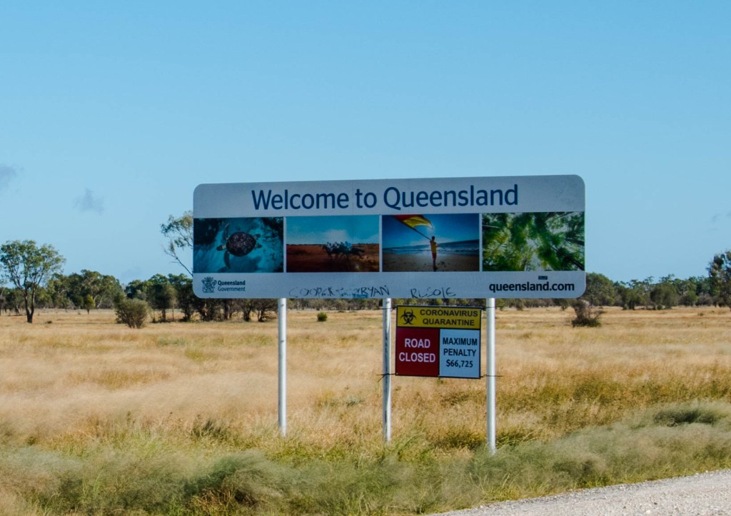
We still had a long way to go and it had only been three days of travel. But today we were very nervous. Hearing of the horrendous attempts by people needing to cross the WA border, we were very concerned about this attempt. 64kms to go for the NSW leg of the journey. We had all our documentation ready and feeling very much like a Mexican trying to cross the border, our anxiety levels were high. I am sure plenty of you have done these road trips before us and just cruised on through without a worry, if only that was our situation, but it wasn’t.
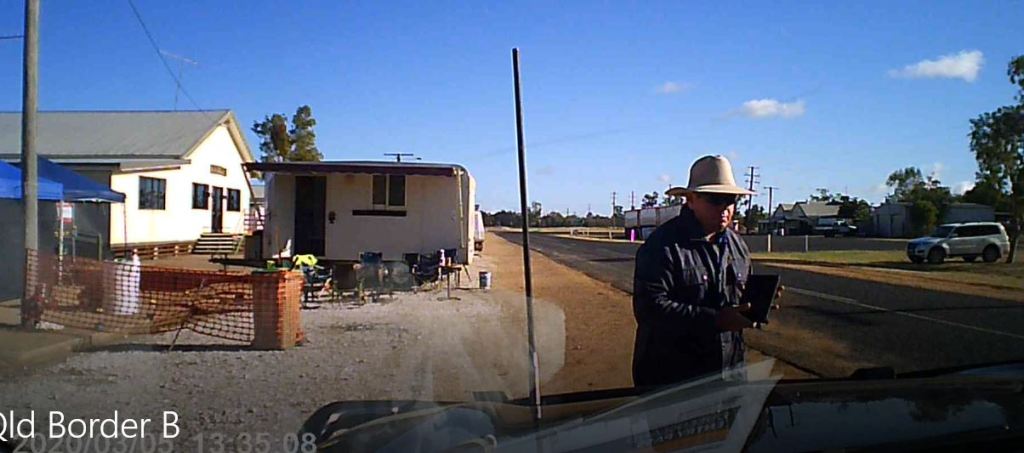
We carefully drive up to the check point and were ushered into the inspection zone. Here we are met by a local police officer and an army personnel to conduct their checks. The army dude said nothing, but the policeman chatted and was very friendly as he took our details and vehicle registration recording it all on his Tablet.
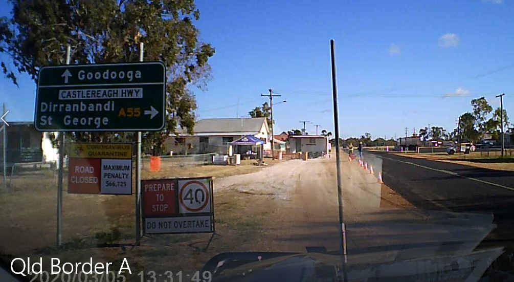
Quarantine??? We asked the question and were advised kindly that as we were essential workers, had not been to a hotspot (primarily Sydney) or overseas, no quarantine required. He advised to leave our permits on the dashboard, at all times, until the restrictions were lifted. Once he waved us on and wished us luck, our anxiety levels dropped considerably, and we drove on out of town on the A55 and towards our next destination of Dirranbandi. Phew what a relief!!
We follow the Balonne river to the next town of St George. This country is very different with irrigation enabling farming to be undertaken. The massive dams and paddocks stretch out across the flat landscape.
“Agricultural production in the Balonne river region is diverse and dynamic. The leading primary industries in the region are Beef / Cotton / Sheep / Wool / Grain / Wild Game Harvesting / Fruit and Vegetables. Production of cotton, beef, grain, sheep and wool.”

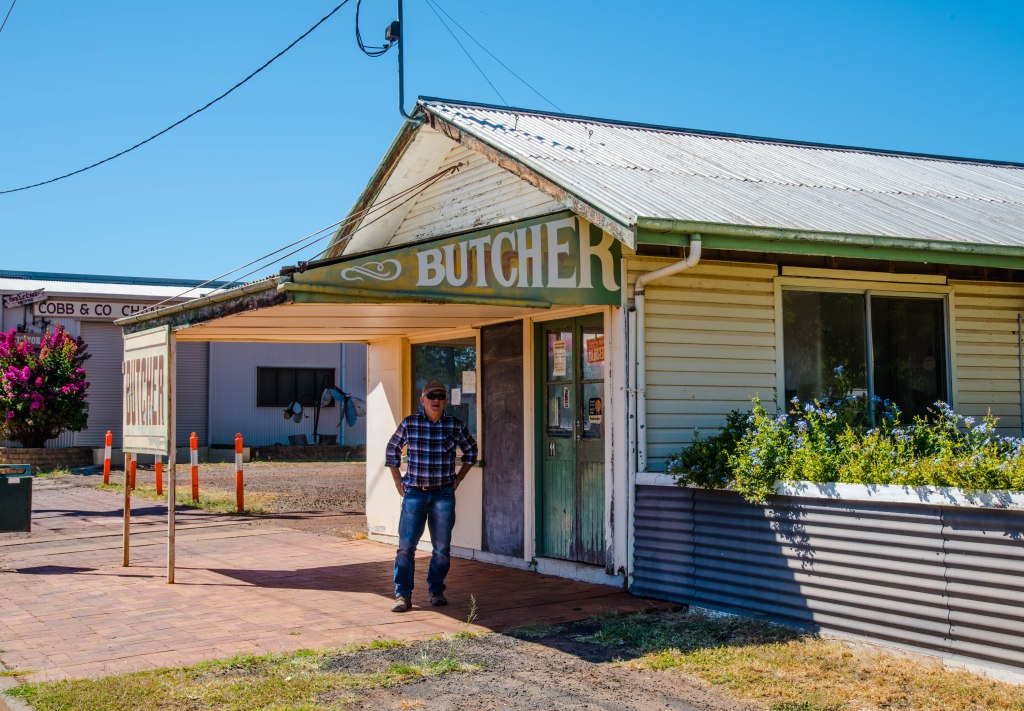
Just south of Roma we pass through the lovely little town of Surat. Very quaint, so we stop here for lunch on the edge of the Balonne River, then take a walk to check out the delightful old buildings. Our relaxed demeanor is short lived as the Council’s approach to the virus is laughable. There was a huge tree trunk log bordering the park available to sit at, yet playground equipment and seating areas are taped off to prevent anyone using them.
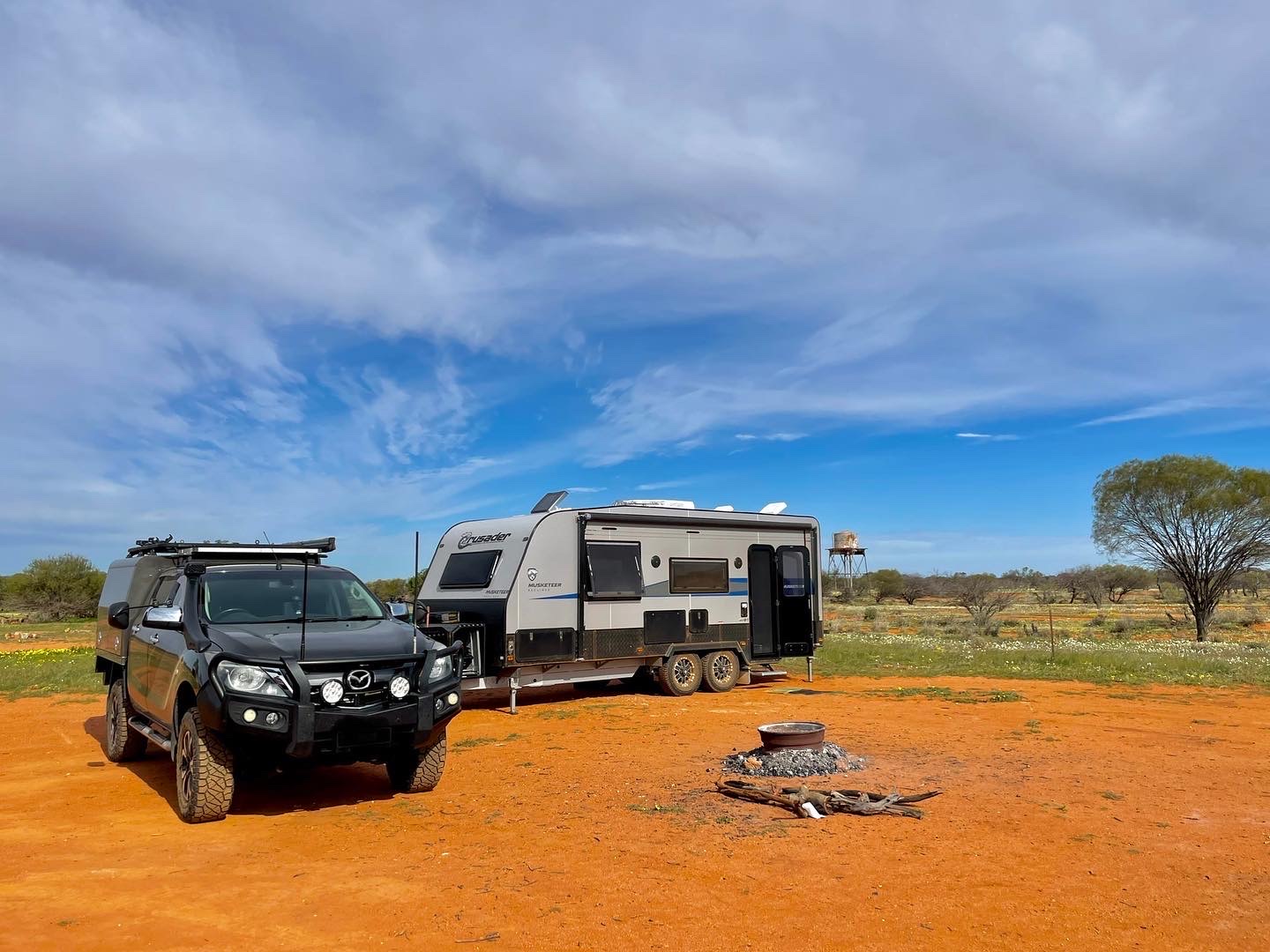
We need to fill our tanks with water and luckily Roma has provided this for us at the ‘dump’ point. We head north along the Carnarvon Hwy towards Injune towards the Carnarvon Gorge National Park which is of course closed. We find a road side stop at the southern end of the Carnarvon Ranges. 2041kms so far.
Qld: Rolleston – Springsure – Emerald – Clermont – Belyando Crossing


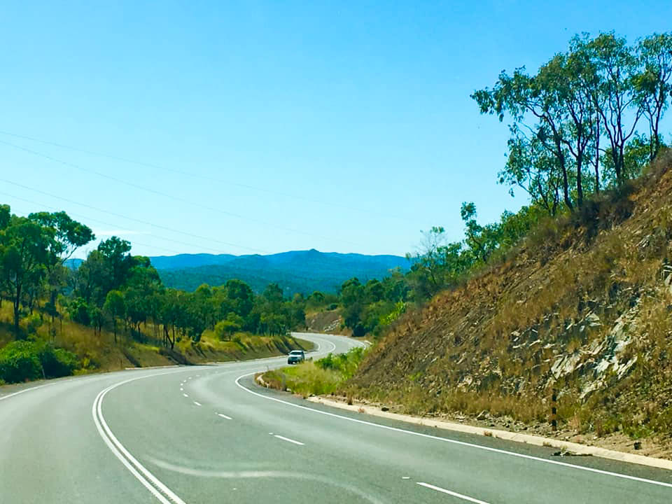
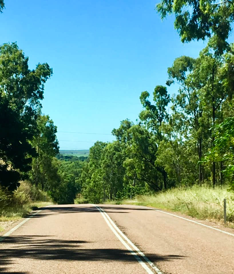
Our plan is to get as close to Charters Towers as we can so our last day is an easy one. Starting our journey from the southern end of the Carnarvon National park we drive onward on the Carnarvon Hwy (A7).
The stunning Carnarvon Range on both sides as we traverse the highway include stunning rocky outcrops, gorges, rivers and creeks. Views from the tops of the hills we climb give remarkable views and the bush is alive, vibrant and lush with new growth. Shame we are unable to stop and explore.
We bypass Rolleston and head to Springsure, a quaint little town at the foot of the Minerva Hills NP, very picturesque again with much to offer and see. We stop for morning tea at a small rest stop near a creek that is running with water and showing evidence of a recent strong flow from heavy rains.
As we travel along the Dawson Hwy (A7) towards Emerald the landscape changes from mining into broadacre farming where we are greeted with acres upon acres of sorghum, maize and millet growing due to the irrigation availability from the nearby Lake Maraboon. Emerald, established in 1879, was named after the lush green hill – emerald in colour – located just north of the town called ‘Emerald Downs Hill’. It is the hub of the Central Highlands and gateway to one of the largest sapphire fields in the southern hemisphere.
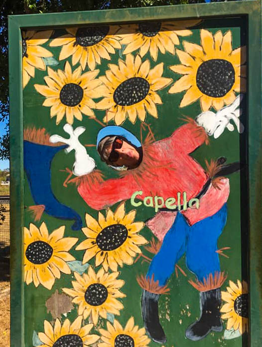

Clermont on the Gregory Hwy (A7) leads the way to Charter’s Towers. Along the way we discover the quaint little town of Capella, the perfect stop for lunch. Here we found people to be much more relaxed, smiling and welcoming, although the town was quiet due to the Monday labour day holiday. We take a leisurely stroll up the street to check out some lovely old buildings then its back on the road again.
No stops at Clermont, a cattle oriented community with their cowboy hats, boots and Landcruiser Utes, we continue towards Charters Towers. As we approach the roadhouse, we discover the small and only caravan park has a sign ‘Trucks ONLY, no Travellers due to COVID19. Next stop 4.5km north’. Displaced again, we do a quick search on Wiki Camps (whilst we had a signal) and found a small gravel pit in the location advised and continue to our nights stop.
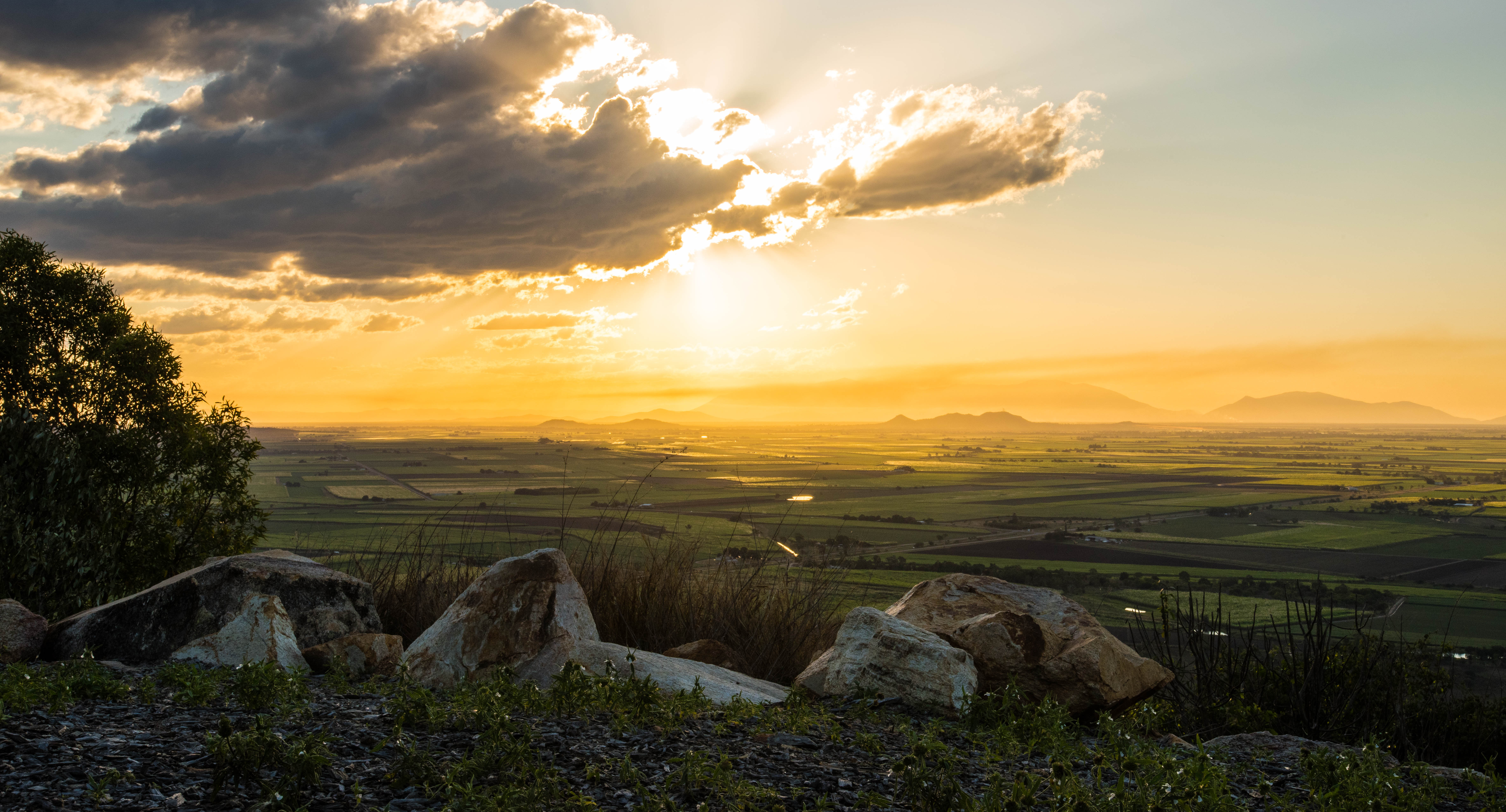
As it turns out the stop on the corner of Mount Hope Road was quite sheltered, albeit no toilets or water, but as we are self-sufficient free camping was a breeze. It is the earliest we have stopped for the evening so take a walk up the gravel road then back to watch the sunset over the ranges whilst enjoying a red wine and contemplate our last day tomorrow.
Last Leg to Ayr via Charters Towers
We wake having had a very good rest and aware that this is the last day before we arrive at Ayr our destination, a short day by the last weeks traveling standards. It is a great relief to know this is the last day of intense travel.
Charters Towers – we fuel up on the way in then find a little rest stop on the into town next to the mining display to have a coffee break. Then we drive out of town towards Townsville crossing the famous Burdekin River on the Bridge at Macrossan. From the pastoral country we head east to the coast, our destination is Ayr.
Lunch is taken at a great little stop called Reid River, a picturesque camping spot for vans and campers, but today we are the only van in the area and only for a short stop. After lunch a gentleman walks over, complete with cowboy hat, stubbie shorts, work boots and green work shirt and starts chatting. A local, from Townsville, now retired and a keen caravanner. He makes us feel very welcome, understanding our situation he then talks about his previous life as a stock manager on many properties in the Charter’s Towers region. He wishes us luck and welcomes us. Being retired he was taking his five year old grandson fishing. Clearly not worried about Covid out here!
We take the short cut at Woodstock to the Bruce Hwy (A1) winding our way around the mountain, the pastoral vegetation makes way for more tropical plants and trees and then there it is the sugar cane, as far as they can see. Excitement builds as we know this is ‘home’ for the next six months, just a few little hurdles then we can settle down.
Doing this level of traveling is exhausting and not recommended, but we are aware there have been many full-time travellers who have done this at some stage over the past couple of months since borders become locked down.
Thanks to my nephew Travis, we park our van at his house until the workplace becomes available.
Trip concluded at 2899kms – 5 days nonstop travel – Padthaway, SA to Ayr, NQld
North Queensland
Burdekin


The Burdekin area was home for six months. We travel to NQld in the early days of Covid (May 2020) as the Qld Govt called for workers for their agriculture industry. We already had the job in February so we were pleased to be able to travel under permit from SA. We arrive early parking up on private property, despite the caravan parks in the region all being open. There are lots of places to visit so we start planning where we will travel to.
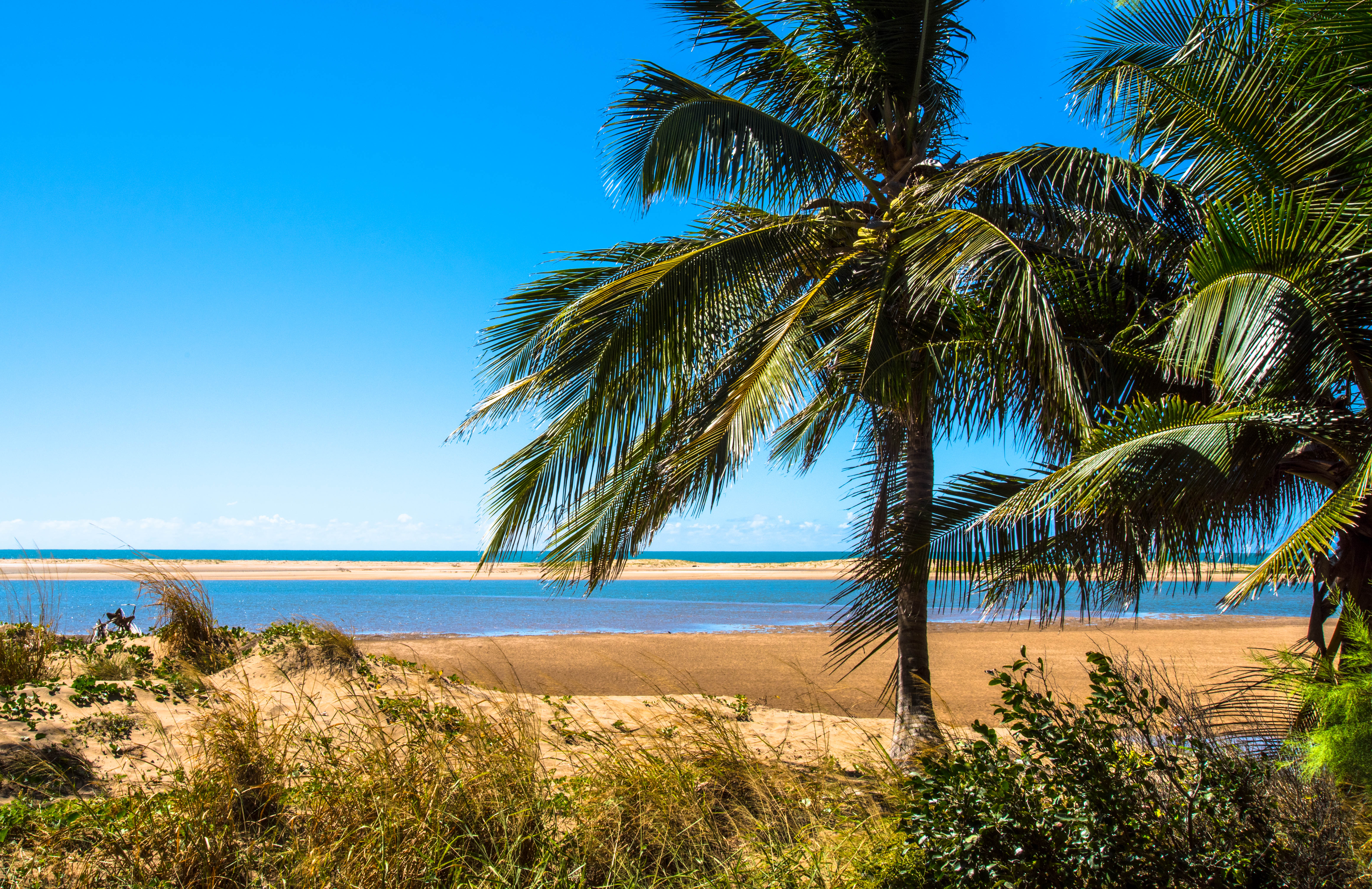
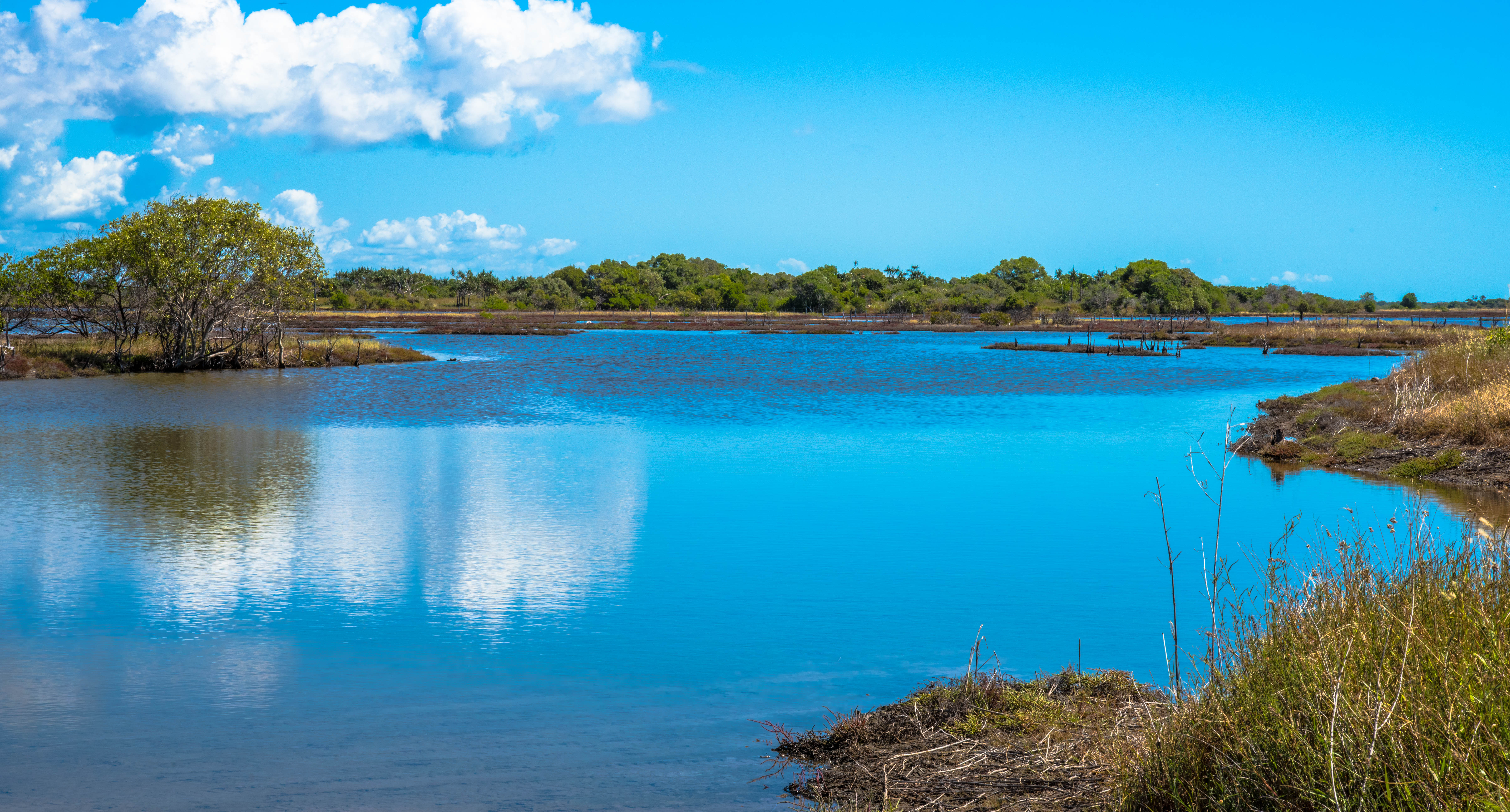
The Burdekin region includes the main towns of Ayr and Home Hill linked together by the Silverlink bridge that straddles the mighty Burdekin River. There are over a dozen other smaller centres making the region the sugar capital of Australia. A fishing and boating mecca, bird watching paradise and traditional homeland of the Gudjuda Aboriginal people.

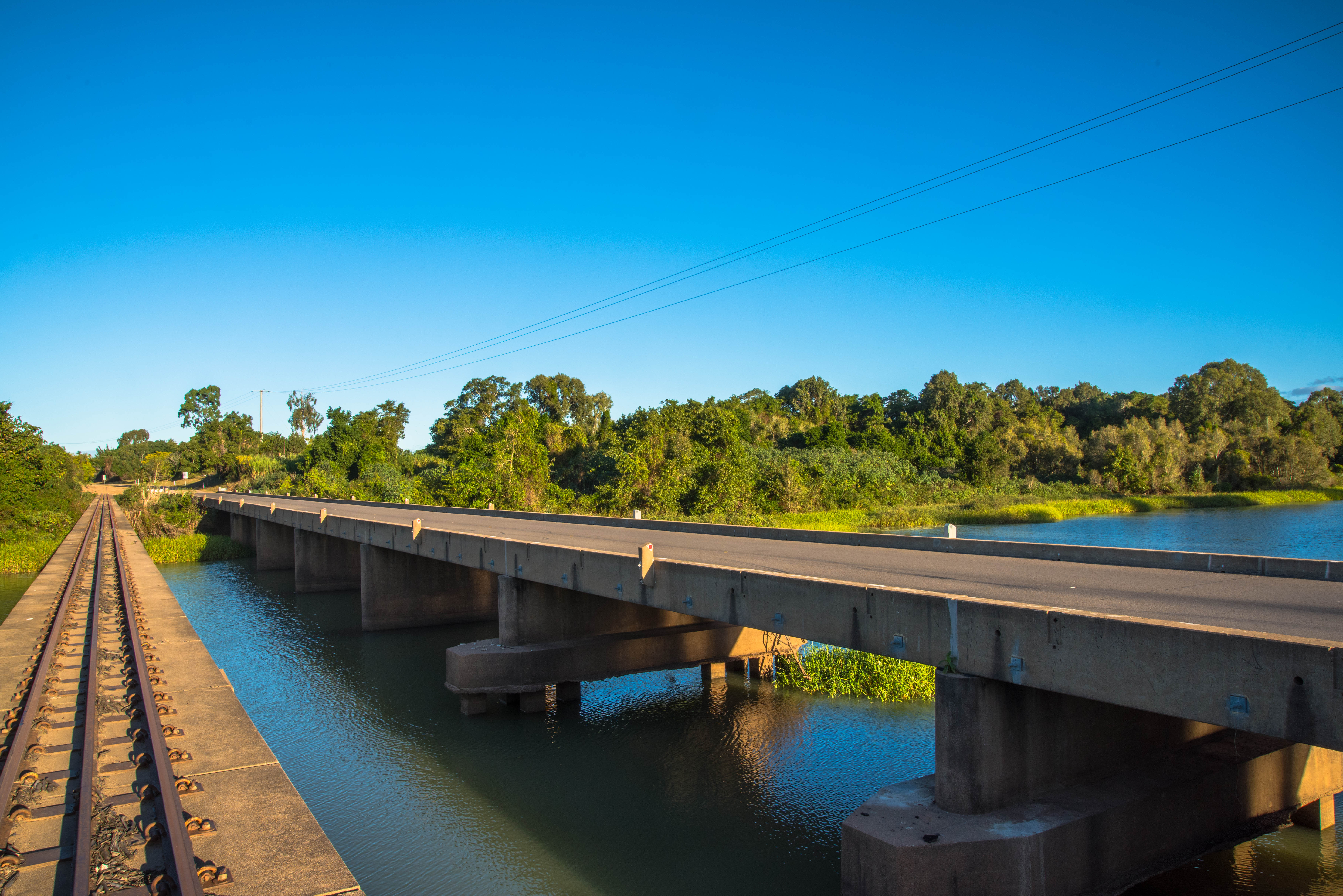
Burdekin River Bridge known as the Silver Link
The Burdekin River Bridge
This bridge links Ayr and Home Hill, and links north and south Queensland, is the districts best known landmark, also known as the Silver Link. Home Hill is located on the southern side of the bridge.
It was completed in 1957, after taking 10 years to construct due to issues acquiring steel after the war. At 1103 metre in length it is the only bridge in Australia without a solid footing, it is one of the longest multi-span bridges in Australia, longer than Brisbane’s Story Bridge or New South Wales’s Hawkesbury River Railway Bridge. It is 46 metres shorter than Sydney’s Harbour Bridge.
It spans across the Burdekin River dwarfing the old original bridge which is set just off the river bed and was regularly covered and washed away by flood waters. Evidence of the old bridge can be seen by the old footings still situated in the river bed. The new bridge also has the railway line and walking/bike path.
For those who like their stats, the bridge rests on 11 hollow concrete caissons support the bridge. Each Caisson is:
- sunk at 30m in depth, varying in width of 5.5 to 7.6m
- 20mabove the river bed
- weigh 4000t each
- fitted with cutting edges, each one weighing 238t
It is often called a ‘floating bridge’ as it is entirely supported by sand.

Weather
Each day we rise to sunshine, no wind but wonderfully calm balmy fresh mornings with the promise of another glorious spring day…………..hang on it’s not actually spring, it is still the dry season here in North Queensland.
The season is definitely changing though. You can feel the changes in the air, the environment, the landscape, the people, the flora and fauna. Just what are those changes you might ask?
The nights are still cool, but they are not cold. Balmy one might say, 13C to 15C sometimes it doesn’t get much cooler than 19C, then the daytime temperature ranges from 23C to 28C. The humidity hasn’t arrived yet, but we have been told, once the Mango winds drop, the temp rises rapidly and the humidity sets in. Thats around November.
For those experiencing the real winter down south there are distinct differences to your seasons. One of them is the sudden warmer days, one here, one there then becoming more frequent with fresh new shoots and blossoms gradually appearing on the shrubs and trees. You then know you are in for a change, and that change is beautiful, who doesn’t like a good florally spring?
Flora and Fauna
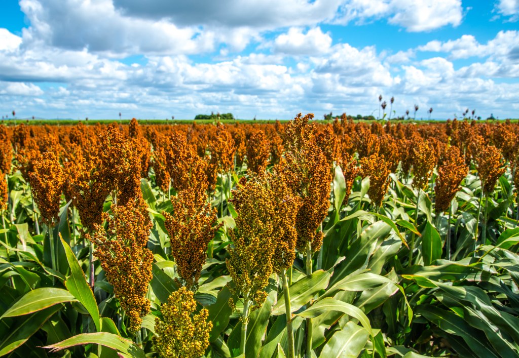

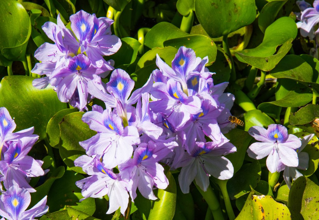


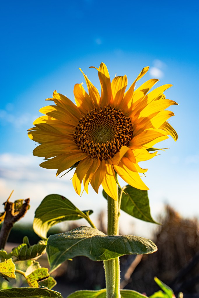
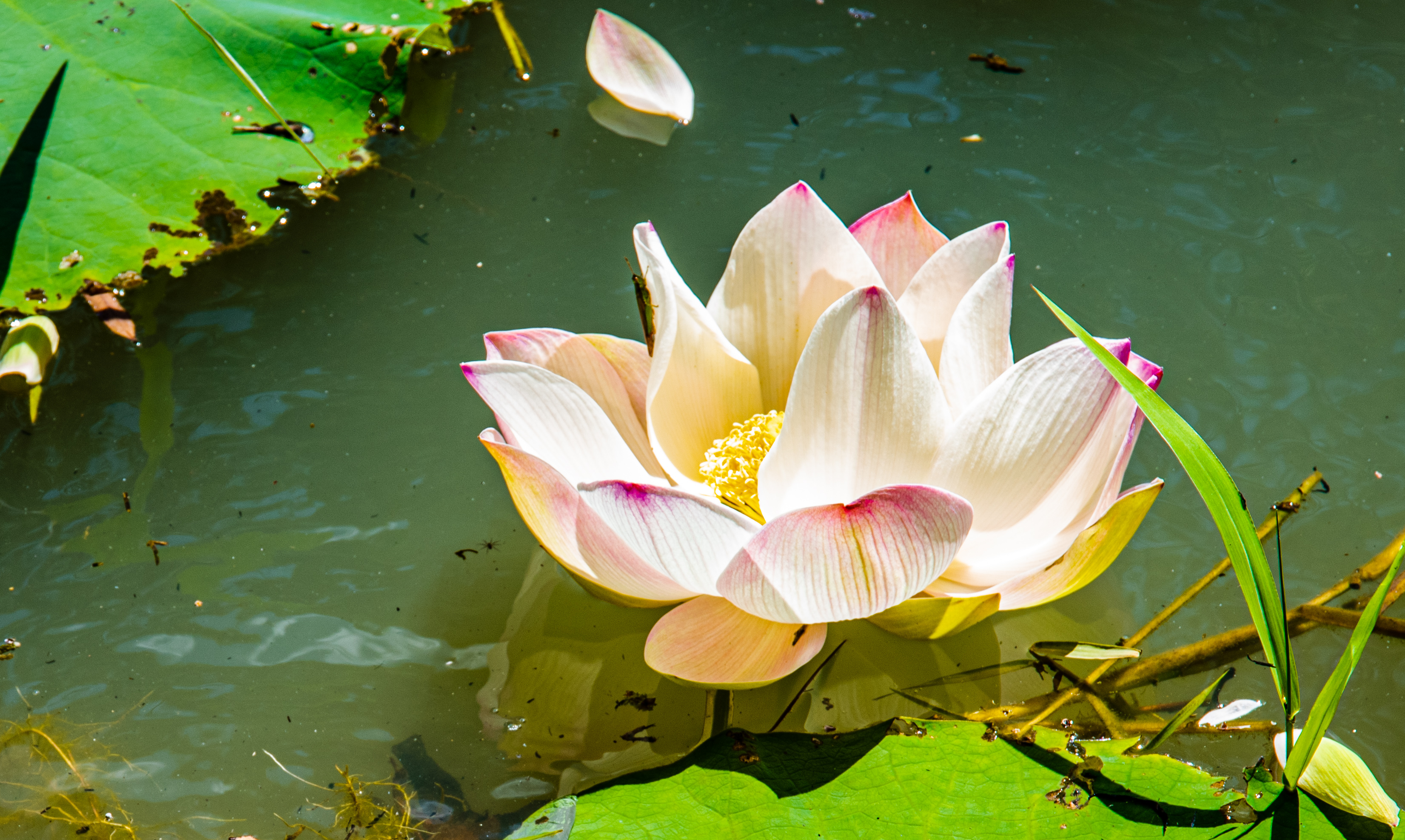
L-R (top): Sorgham, Pawpaw, Lilly flowers; (bottom) Flame tree flower, mango flowers and baby mangos, sunflowers.
There are blossoms here, but they are mainly the mango flowers. The huge mango trees that stand majestic and green with their shiny leaves in the fields since the summer ended. All located around homes and in orchards are now covered in masses of flower bunches. When the trees were green, the varieties are almost undetectable to the novice, but as soon as they flower, it is obvious, very obvious by the different colours of the flowers. The trees turn from the green of the leaves to red, orange-yellow or golden tones with the blossoms of the mango flowers. Green ants scurry in and around the flowers collecting the nectar, pollinating as they go about their work. As one looks at the masses of blossoms, you cannot but wonder, how do the mangos become so large if every one of these flowers becomes a mango.
Aha!! Mother Nature at her very best…….
In come the Mango winds. Around late August, early September. Yes, called that because they are required to blow at least half the flowers off the trees to prevent overloading the branches to snapping point with the weight of the mangos. In an effort to be strong enough to blow the flowers off, these winds are horrid, daily gusts of up to 40kph and strong winds of 20-30kph starting around 8am to 9am, then dropping off around 4pm. They are so strong it can blow the wax out of your ears!!
The fauna has also changed. When we arrived at the farm, we had a large variety of bugs, frogs, beetles and birds. We still have the infamous cane toads, but the tree frogs are in short supply now.
Small flocks of tiny red finches, who live in the tops of the mature cane, will suddenly fly out on mass. The red breasted parrot, in groups of up to six, fly up from the mature cane and screech as they fly overhead. The whistling kites and pheasants are always in plentiful supply due to the cane harvest, that leaves behind their food source. The curlews are still here, always here, but migrating to the remnants of bushland for safety as each cane field is harvested.
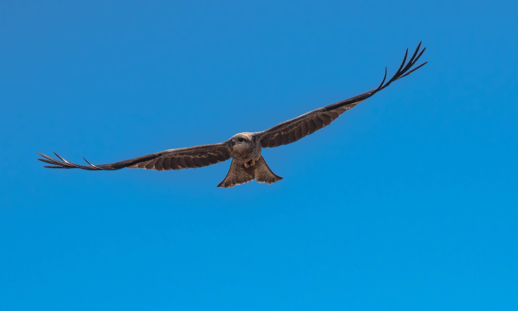


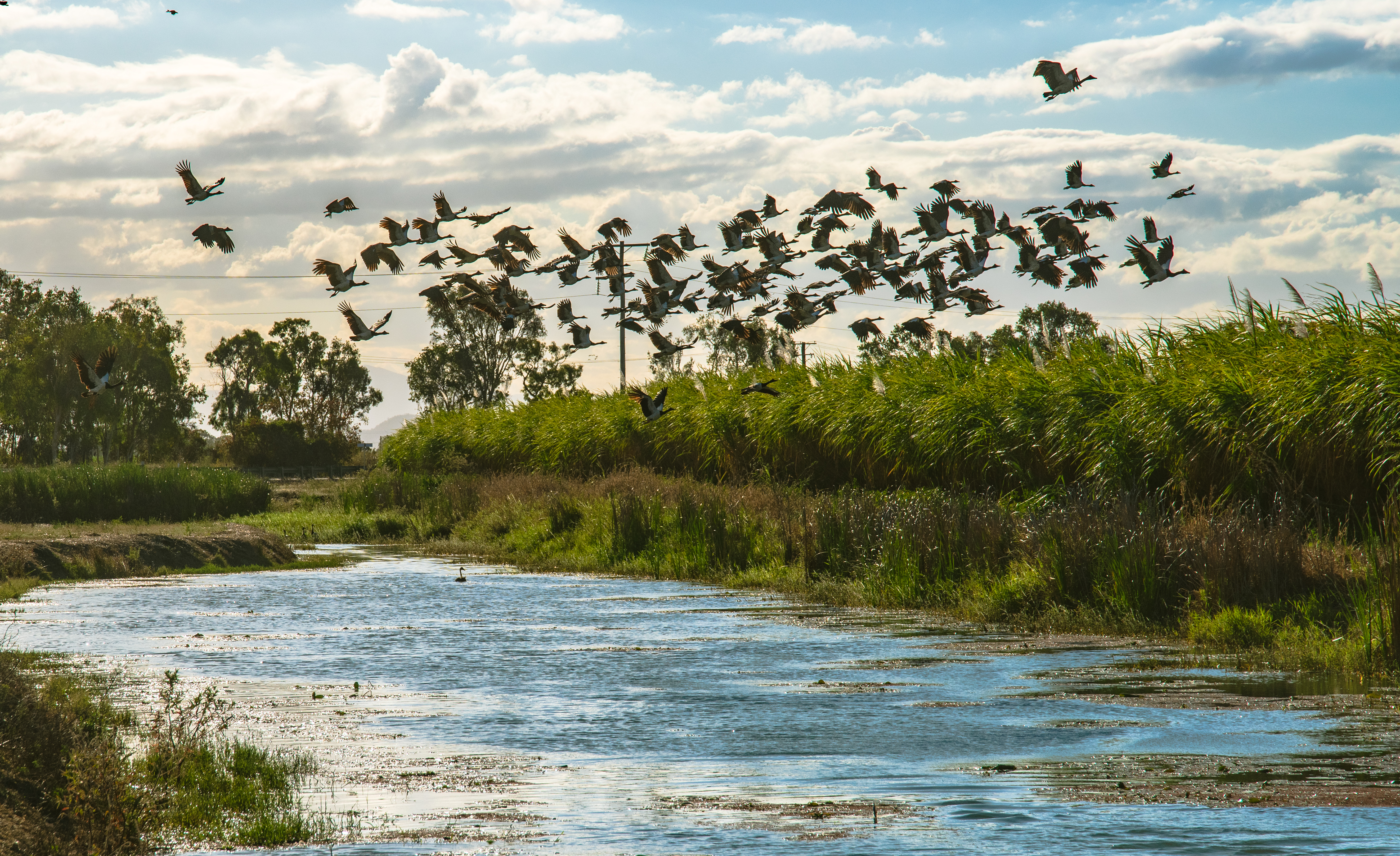
Whistling kites, Bustard, Magpie Geese
Bird life is becoming more prolific and varied, and there are new migratory birds moving in. Driving along the backroads recently, a huge flock of Magpie Geese on their migratory journey, sitting on the irrigation channel bank with a family of swans on the water in the channel. Walking along to check them out, camera in hand only stopping to capture a closer look through the lens and to get a closer photo. When woosh, up went the first mob, a few more steps and woosh, up went the next lot. Five different flocks took off and we were a good hundred meters away. We watched as they soared above us creating their ‘V’ formations as they flew about above the cane fields, then disappeared. We gave up on them returning and headed back towards home, when we came across one of the flocks, located in a new cane field.
Driving along the edge of the field steadily we get close enough for another photo or three, then the geese lift off a few meters above the ground, rising and hovering, then relocate on the other side of the field. We leave them in peace not wanting to disturb them any further.
There is one thing we have learnt on our journey so far, and that is to take nothing for granted, linger longer in places absorbing the community, environment, our surroundings and all it has to offer. Sadly, when we travel, we are either in a hurry to tour to take in as much as we can in too short a time, or we have commitments elsewhere or if we have the time, we try to get through some places too quickly. Our journey has taught us to appreciate the surrounding landscape and culture and to be grateful for the opportunity we have been given.
I hope that through our journey blogs, you too can experience, through our words and photos, what we have had the opportunity to explore and experience.
We certainly feel blessed.


Burdekin Festival that wasn’t

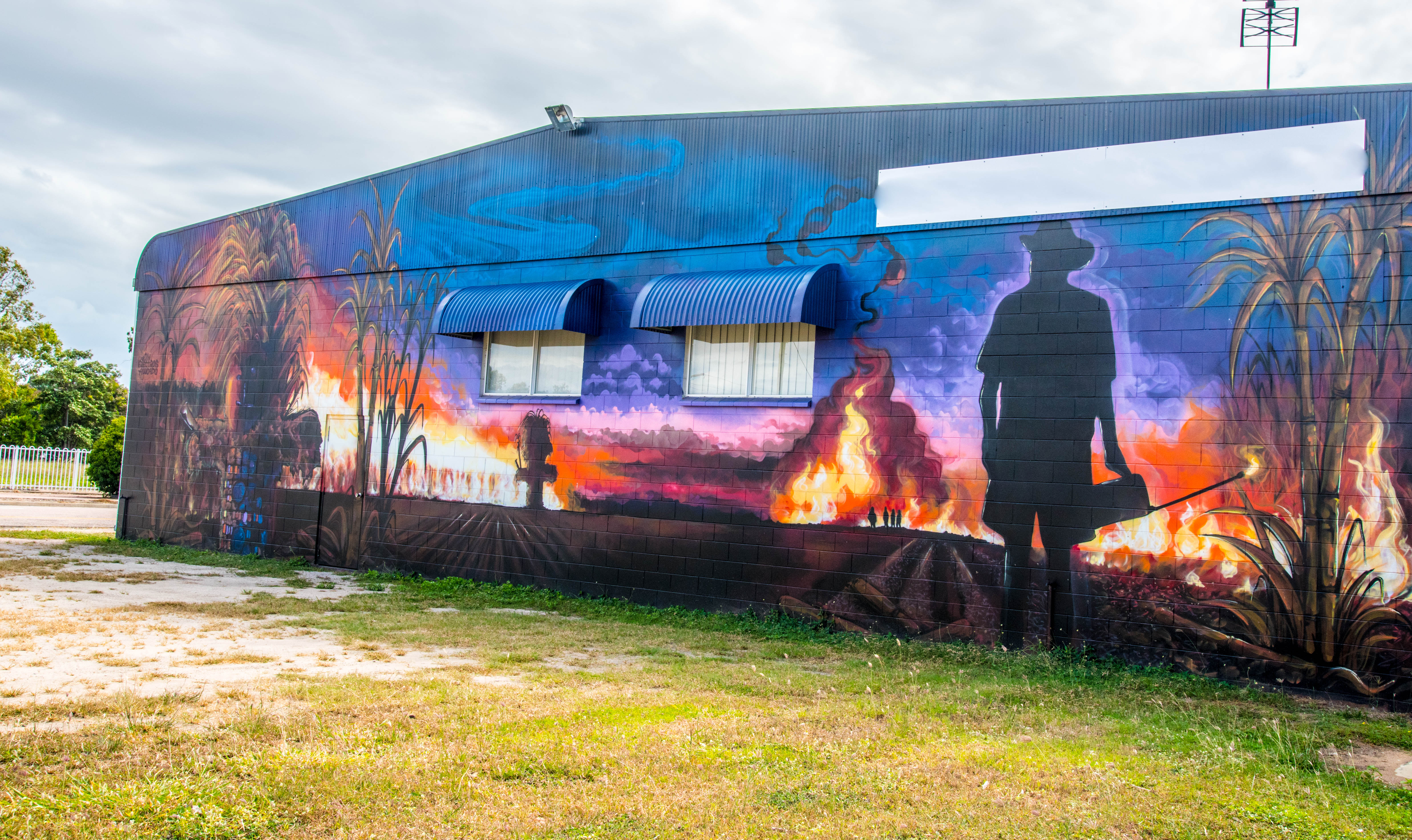
The Sweet Days, Hot Nights Festival is all about showcasing and celebrating what is great about the rich agricultural region and the enviable lifestyle that comes with it here in the Burdekin and is held at the Home Hill Showgrounds annually. Sugar cane is called ‘liquid gold’.
Like so many other places across Australia the festival was cancelled for their May 2020 event due to COVID, so they opted to put it all online. Sadly, the money this festival normally brings to the region through activities such as stalls where local produce and culinary delights are shared and experienced, the music, family-friendly entertainment plus the opportunity to interact with tourists on their way north could not take place due to social distancing laws.
Lucky for us the organisers decided they would burn the field next to the showgrounds and instead of using it for the demonstrations of cane cutting, past and present harvesting techniques, etc., they opted to harvest it with current day machines and use the money from it to cover some of the lost income due to the cancellation.
We sat on top of the seating stands to view the burn from a different angle. Hoping this aspect would provide a more interesting camera angle I started photographing the action when the intensity of the heat hit me. It was very, very hot, so hot I actually had to turn my back to the fire to shield my face and camera from the heat. How hot was it?? Ian was on the ground with his digital infrared temperature gun to test the heat generated at various locations of the fire. At the hottest point it got to 250C!!!
I can assure you all that when we do the cane burns in the field, you don’t get the intensity of the heat like that was, so not really sure why it was different.

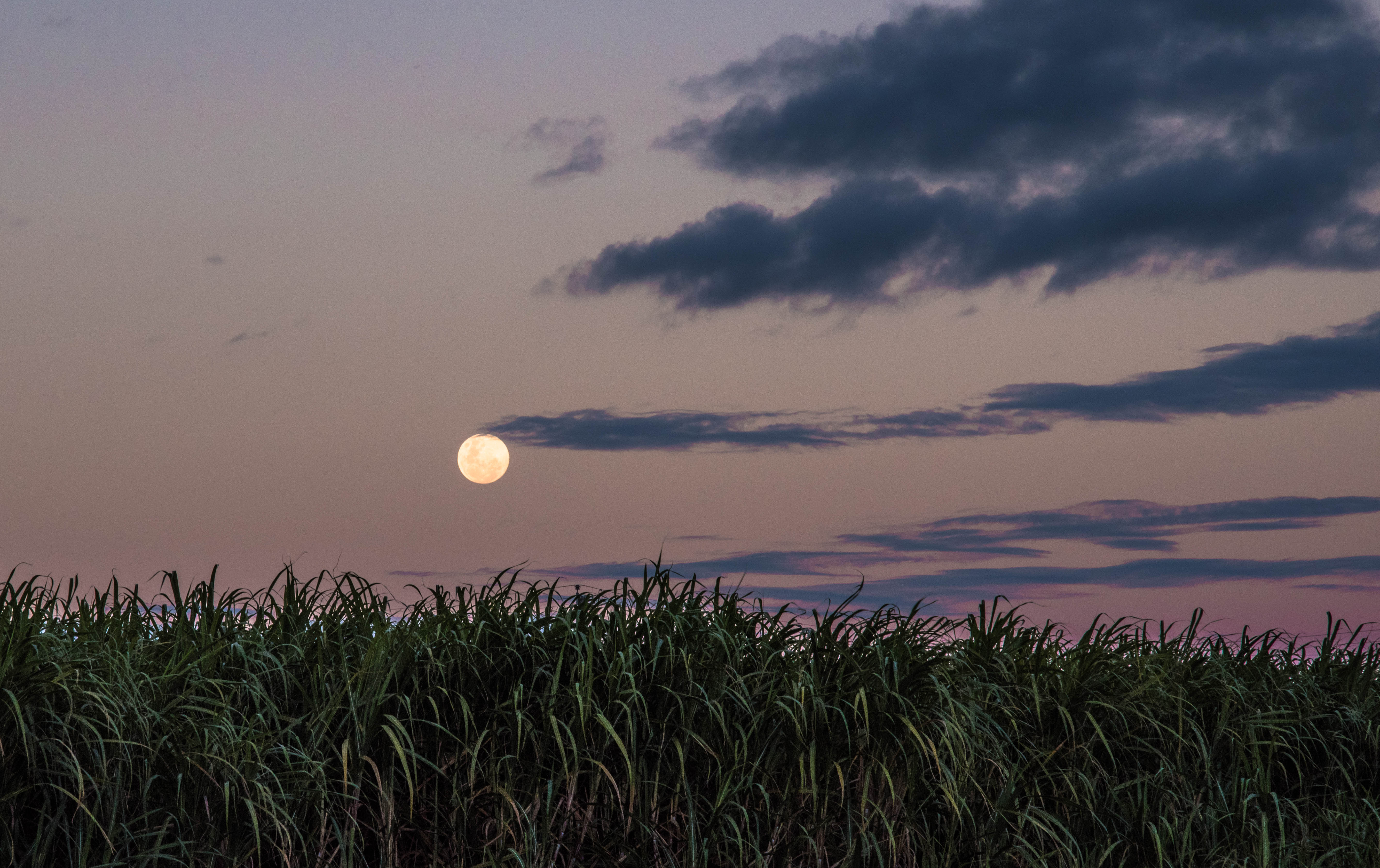
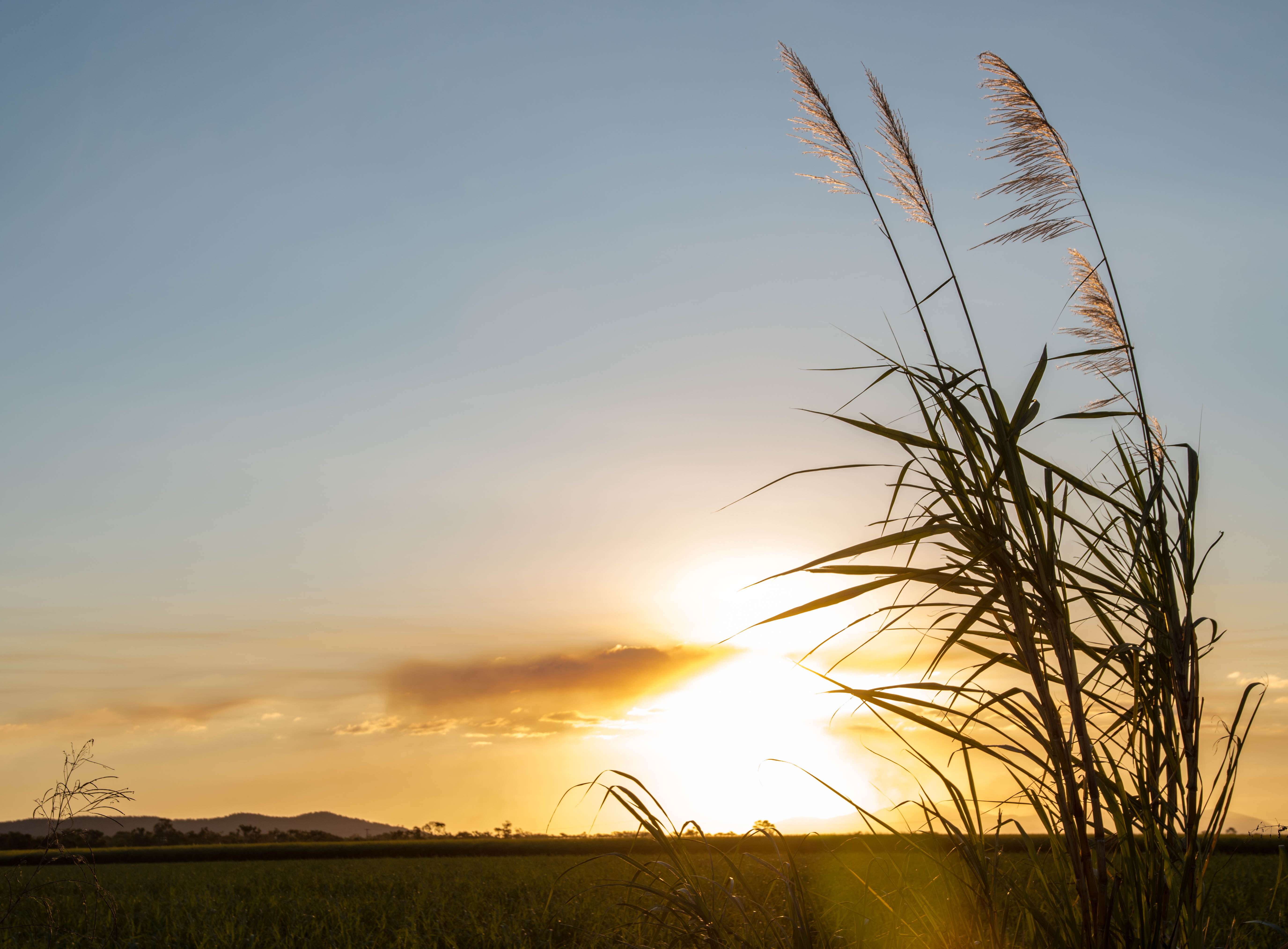
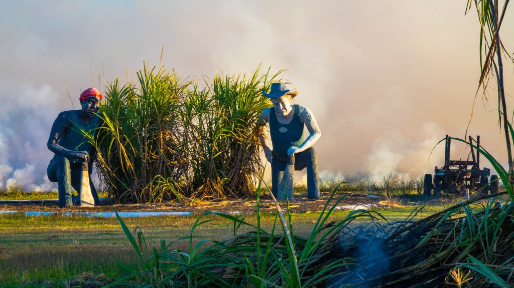
A couple of nights later we took some more visitors to the top of Inkerman Hill to witness some sugar cane burns from that level. We had been wanting to do this for some time. Clearly 5pm wasn’t the best time to burn on that day so we only witnessed a couple from the top, but the golden glow from the setting sun across the cane fields certainly demonstrated that this region produces liquid gold.
We descend the hill and as we head back to the van with our guests, we find another burn just off the road. At least our visitors got to see a burn before they moved on.
As I always say, there is never a dull moment in the Burdekin!!
Sugar Cane Farming, NQld

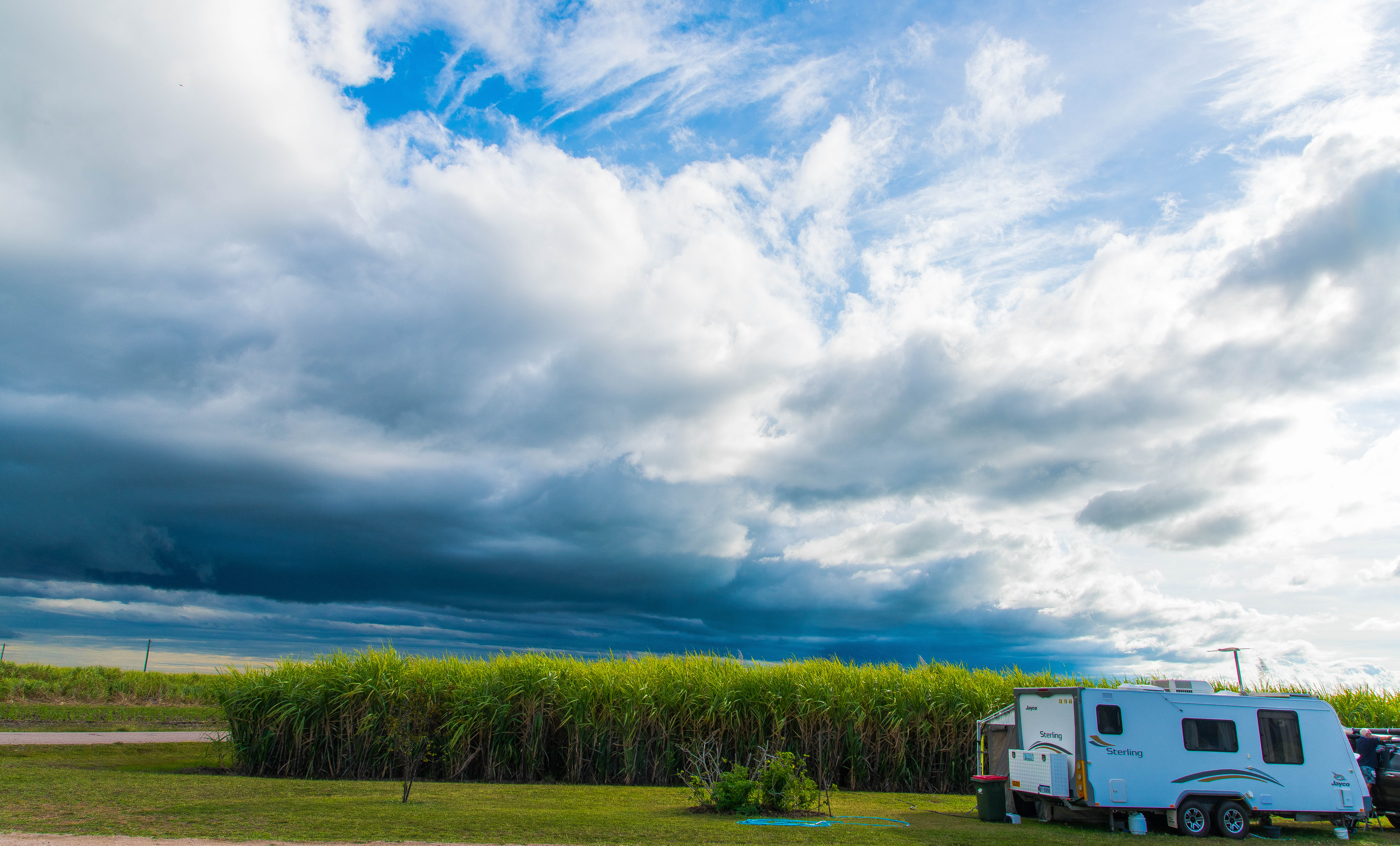
So, as we are in the sugar cane region, one of several in Queensland, the landscape has been changing, dramatically. When we first arrived in June, the cane, standing tall, close to the road edge, created barriers for homes, sheds and properties. Visibility at cross-roads and corners were zero, forcing you to slow right down then edging out to see.
Half-way through the season, the landscape is taking on a dramatic change. As more and more cane is harvested, fields turn back to soil, then within a week or two of being harvested, the new sprouts of cane appear. Cane is harvested strategically, creating a patchwork of mature cane, new cane leaves at various stages of growth through to ‘ploughed’ out paddocks ready for planting.
As one drives down the roads between where mature cane once created a barrier on either side of the road, there are new shoots, cane at 300mm high then some of the first cane harvest is now nearly 1500mm high. Occasionally you come across a very different crop, it is called a fallow crop and is usually legumes, pulses or in some cases corn or maize. It makes for a very refreshing change.
What a fascinating industry this is. It is nothing like what we have experienced before with a terminology and practices specific to this industry. Australia is the second largest exporter of raw sugar globally producing 4m tonnes raw sugar from the 35m tonnes of cane harvested annually resulting in $2.5b value of production. There are 4,000 cane farm businesses servicing 24 sugar mills around Australia.
Approximately 95% of sugar produced in Australia is grown in Queensland, with 5% in northern New South Wales, along 2,100 km of coastline between Mossman in far north Queensland and Grafton in northern New South Wales. A sugar industry was established in Western Australia in the Ord River Irrigation Area in the mid 1990s but ceased operations in 2007. So, it seems a shame this didn’t take off considering the unlimited supply of water in the region from the Ord River System.

The early farmers in the Ayr district found that the supply of water to irrigate their cane crops was inadequate. Several irrigation schemes were proposed, however none eventuated until the Queensland Government approved an irrigation scheme for the district in July 1916. The Inkerman Supply Board was constituted in February 1917 and the Irrigation Plant was opened in May 1922.
Growing the Cane


L-R: Cane billets planted every 4-5 years; New cane growing; spraying for pests and disease.
Sugar cane is a giant tropical grass. Uniquely, and unlike grain crops that store carbohydrates in seeds, sugar cane stores carbohydrate – in the form of a sucrose (sugar) rich liquid – in its stalk. The harvested cane is carted to the mill in cane trains where the liquid is extracted by mechanically crushing the stalk and then crystallising the juice into raw sugar. The raw sugar product is transported from the mill to the storage and loading facility.
Sugar cane farming follows a seasonal rhythm from planting to harvesting dictated by the tropical climate, plant biology, logistics and economic factors.
The seasonal rhythm includes planting, not sowing; they fertilise and spray once at the planting stage only; in this area, the cane is irrigated, further north it is rainfall dependant; the growing season is anywhere from 12 to 16 months; they have three year cycles and it is planted on flat country, not on hills. It is a constant cycle of processes. And to add in a political mix here, the farmer is completely controlled by the mills for their harvest!!
Planting and growing the sugar cane
In order to ‘plant’ the farmer needs to ‘cut’ down some cane to obtain the ‘billets’ for planting. The billets are cut from the farmers best quality cane and stored in bins and the planting is conducting using specialised planting boxes towed behind a tractor. The planting is completed in straight rows, planting every second row, watch the video at the link below.
Sugar cane is propagated from the billets that contain one or more buds. The buds germinate to produce a primary stalk, from which roots and shoots develop. Planted cane, generally done March to May, takes 14-16 months to maturity, cut cane from harvest takes 12-14 months.
Cane is flood irrigated in this region, other areas use rainfall or overhead irrigation practices.
Planting process video https://www.youtube.com/watch?v=rVGizl_r93o
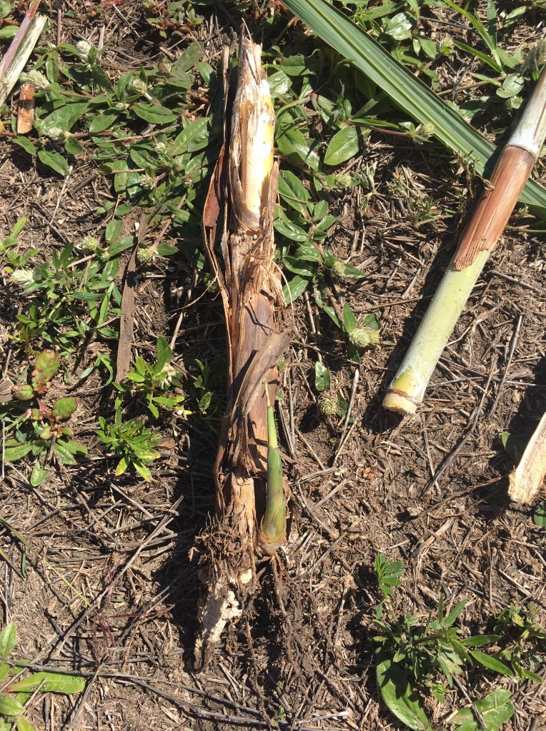
Each subsequent crop, known as a ratoon, is harvested annually. Thereafter the cane is ploughed out after five or six ratoons and the ground fallowed prior to planting again. Ratooning – Once the cane is cut, the plant immediately begins to regrow from the underground root buds known as the stool. Ratooning is triggered by removal of the cane stems and the cane plant is again ready to harvest in the subsequent year. The first crop planted is known as the “plant cane” and each subsequent year’s crop known as “first ratoon”, “second ratoon” etc.
The cane is fertilised at planting and after harvest, spraying of weeds is only done when the cane is young and generally after planting. The cane is then irrigated to ensure growth to maturity.
Cane Harvesting


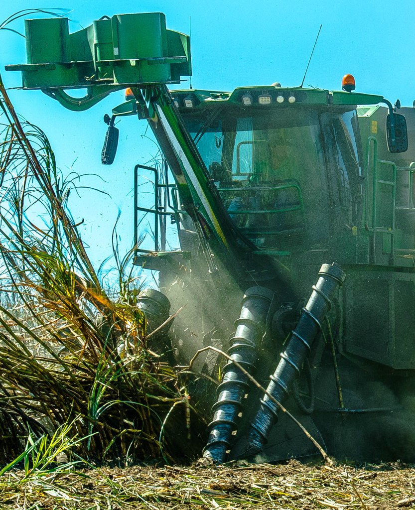
Cane is harvested between June and November annually. Cutting the cane manually by a scythe as was done in the past, specifically built harvesters are now used. To prepare for harvesting the cane, only in the Burdekin region, it is burnt prior to harvesting to remove the leaf matter and reduce the amount of trash on the ground, that impedes the harvest and irrigation process. This practice does not damage the cane or the sugar content in any way and in fact provides valuable carbon back into the soil and also reduces transport and logistics costs by over 40%.
The burning takes place in the evening or early morning generally on a daily basis across the region. However, the average farmer generally burns every 2nd or 3rd day, pending the size of the field. (see my previous post of cane burning practices and photos)
The mill controls which fields to harvest and how much the farmer can harvest in a week. Before purchasing land to set up a new field of cane, the farmer must register his intentions and be accepted into the quota the mills have available. Each ‘farm’ has designated siding/s and carriages for the cane. NB: In other regions, the harvest maybe done differently. E.g., some farmers around here, who don’t have a designated siding, have to cart their billets directly to the mill, but again they cannot just deliver whenever they wish. It is so very different from grain farming.
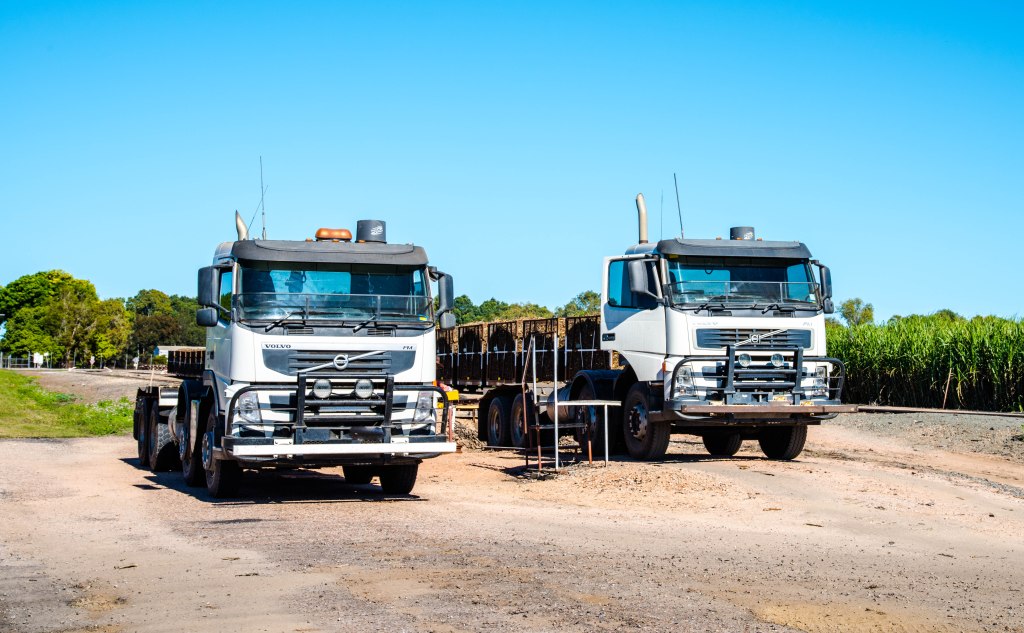
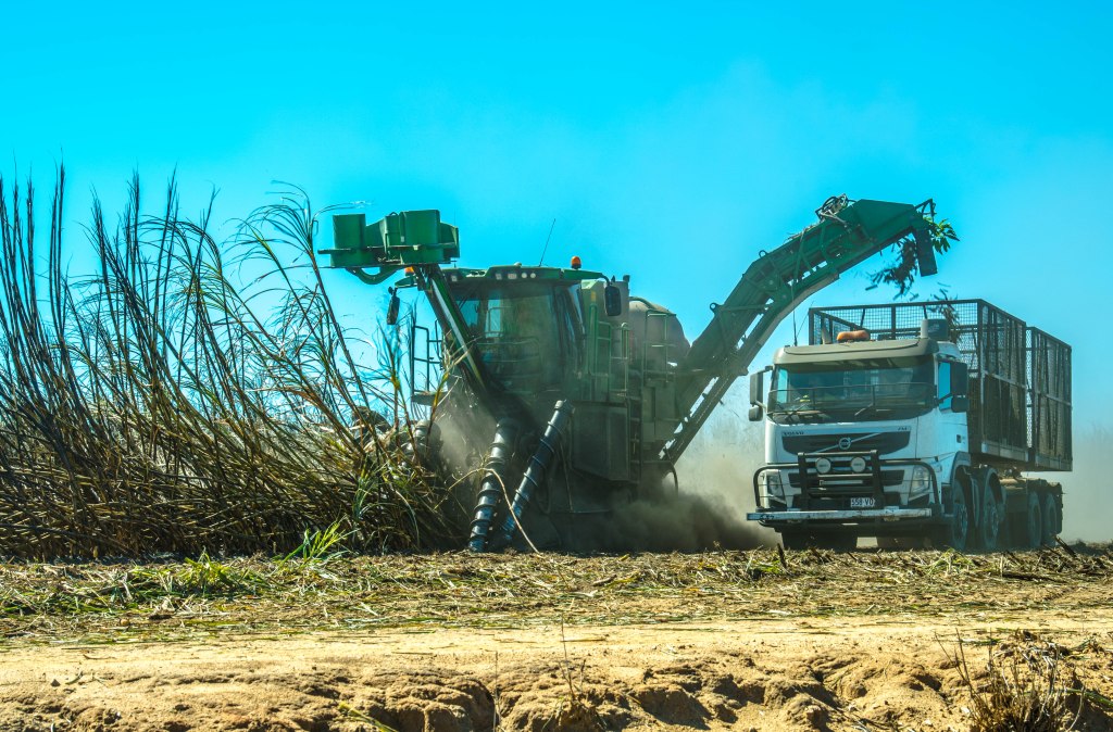
The harvest is completed mechanically using specialised equipment to harvest two rows of cane in the one pass and the billets are loaded into 6 tonne capacity rail wagons transported on trucks or trailers (towed by tractors). The truck/tractor follow the harvester in the same manner as a chaser bin follows a grain harvester.

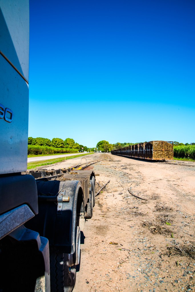
The full bins are then taken to the designated rail siding operated by the mill. The bins are offloaded by the truck/tractor onto one track and empty bins loaded onto the truck/trailer and the process continues. The trucks are an eight-wheeler configuration carrying two bins at once.
Cane harvesting video https://www.youtube.com/watch?v=3jBGTabSVeE
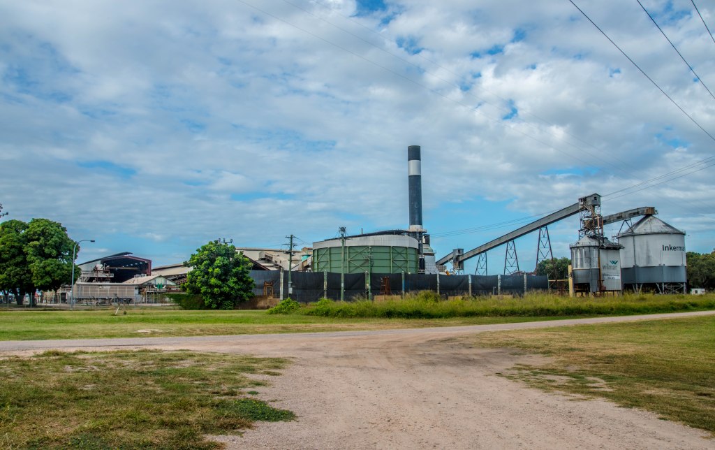
The mill then collect the full bins daily using small narrow gauge loco engines, taking the full bins to the designated mill, in our case it is the Inkerman Mill, one of five mills owned by Wilmar Sugar in the region.
Train locos collecting the rail bins https://www.youtube.com/watch?v=x0RcV4Z3uRE
There are several by-products of the cane processing at the mills, these include bagasse (waste), molasses and mill mud (great soil improver). These are transported by semi-trailers to various locations for other applications.
The selling process is complex and can be reviewed at https://www.australiancanefarms.com.au/gallery
We hope you have all enjoyed the practice of cane harvesting and as the months progress we will share our personal experiences.
Burdekin Sugar Cane Burning

What an incredible opportunity to watch sugar cane burning in Queensland. When we took the position, little did we know that our dream to watch the burning of the sugar cane was only conducted in the Burdekin, the last place in Australia to do so, and that is exactly where we had just successfully obtained our next contract.
We arrived early due to Covid, then the crushing season has been held up due to rain, but finally we got the nod, the wait had seemed forever. Woohoo!!
Cane burning takes place either early morning or late evening. Sunday night’s weather was ideal and we got the nod, Ian was to come prepared, but basically to watch in readiness to learn for the next burn. And you guessed it, I got to go along to watch. Burns are conducted every two or three days, but more on that later.
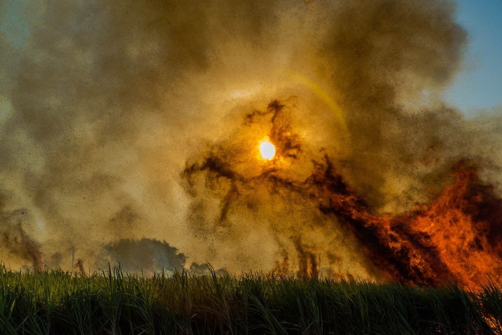
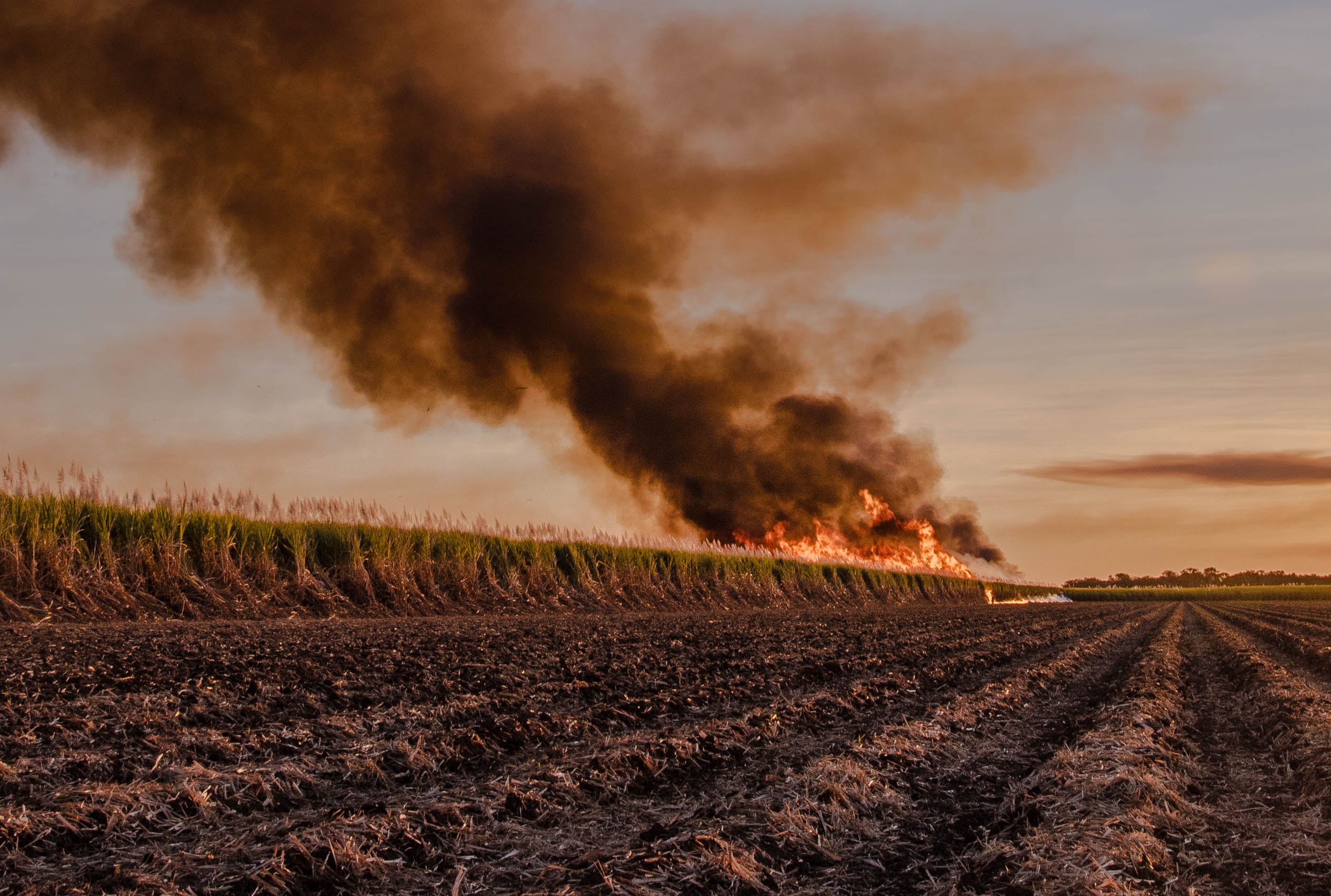
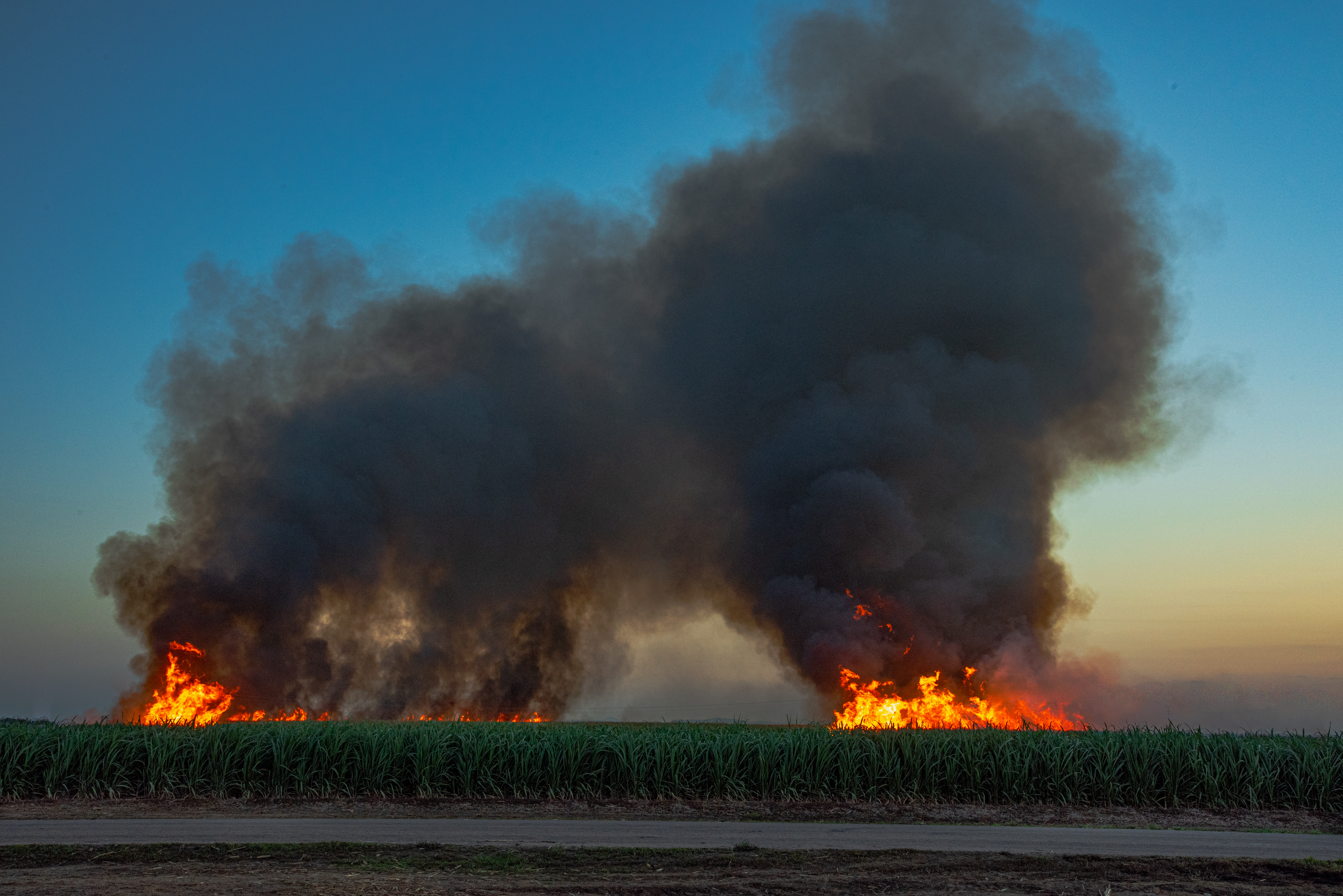
As we arrived at the cane field, other burns had taken place in the area evident by the incredible cloud masses, called Pyrocumulus clouds, created by the fires and atmospheric conditions. To add to the spectacle the setting sun threw light onto the top section of cloud mass, creating a beautiful cloud formation.
The day had been very humid and muggy with a weather system just off the coast, trying to drop some rain on us. I think enough prayers had been said to scare the rain off as we didn’t even get 1mm of rain all weekend.
We park the vehicle in a safe location and setup ready to watch. The tractor with the water cart drives along behind the fire starter who walks the full length of one side of the field. This is called the back burn, necessary to protect other cane that is very nearby. Behind this tractor, is another fire fighting unit with a person to spray the cane not wanting to be burnt.
The fire starter, the moves across the roadside, at right angles to the first burnt side to get the fire to burn inwards. By the time the entire length is burnt, the fire slows down, then suddenly, it is like an explosion of fire as the entire field goes up. The roar of the fire burning the trash (leaves) is unbelievable and at the same time it is moving fast towards the backburn side.
We sit back and watch in awe at the spectacle before us, then as quickly as the fire took hold, it dies down and the cane is ready to harvest! 30-40mins in total is all it takes.
The ash builds up skyward then begins to fall to the ground, this is called ‘black snow’. It is definitely not the day to be washing white sheets, let me tell ya!! We have heard many stories of the black ash covers your car, caravan, etc., leave an awful mess, you won’t be back ‘cause its terrible here in the dry!! We have ignored the stories, as to us it is no different to red dust and dust storms, and boy we have seen plenty of that.
Monday morning is an early start for them all as they venture out at 4am, before the sparrows and hawks are up, only the curlews are awake, the harvest has started.
****************************************
Why burn you ask? In the Burdekin region the cane variety grown for irrigation farming purposes is much leafier than other varieties grown further north or south that are more rainfall reliant. The variety creates more leaf matter, know as trash, that if not burnt, impacts the harvest by slowing down the harvester and reducing productivity by up to 40%.
So, if you want to see and experience a sugar cane burning, you need to be in the Burdekin region between June and November. Head out amongst the cane fields in your vehicle and follow the smoke. Alternatively, the view from Mt Inkerman of the burning is quite spectacular.


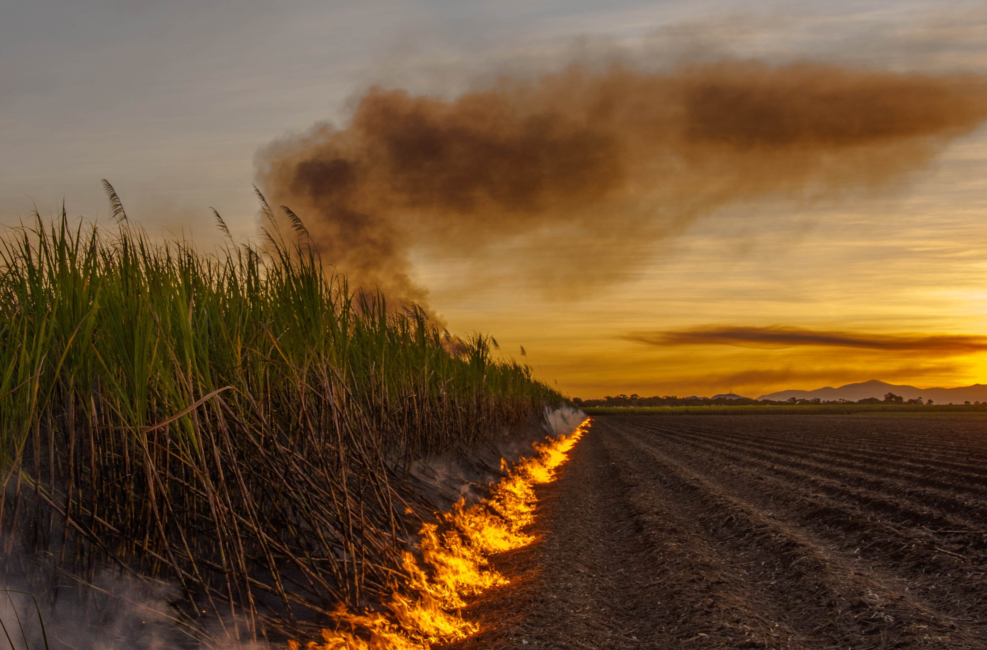
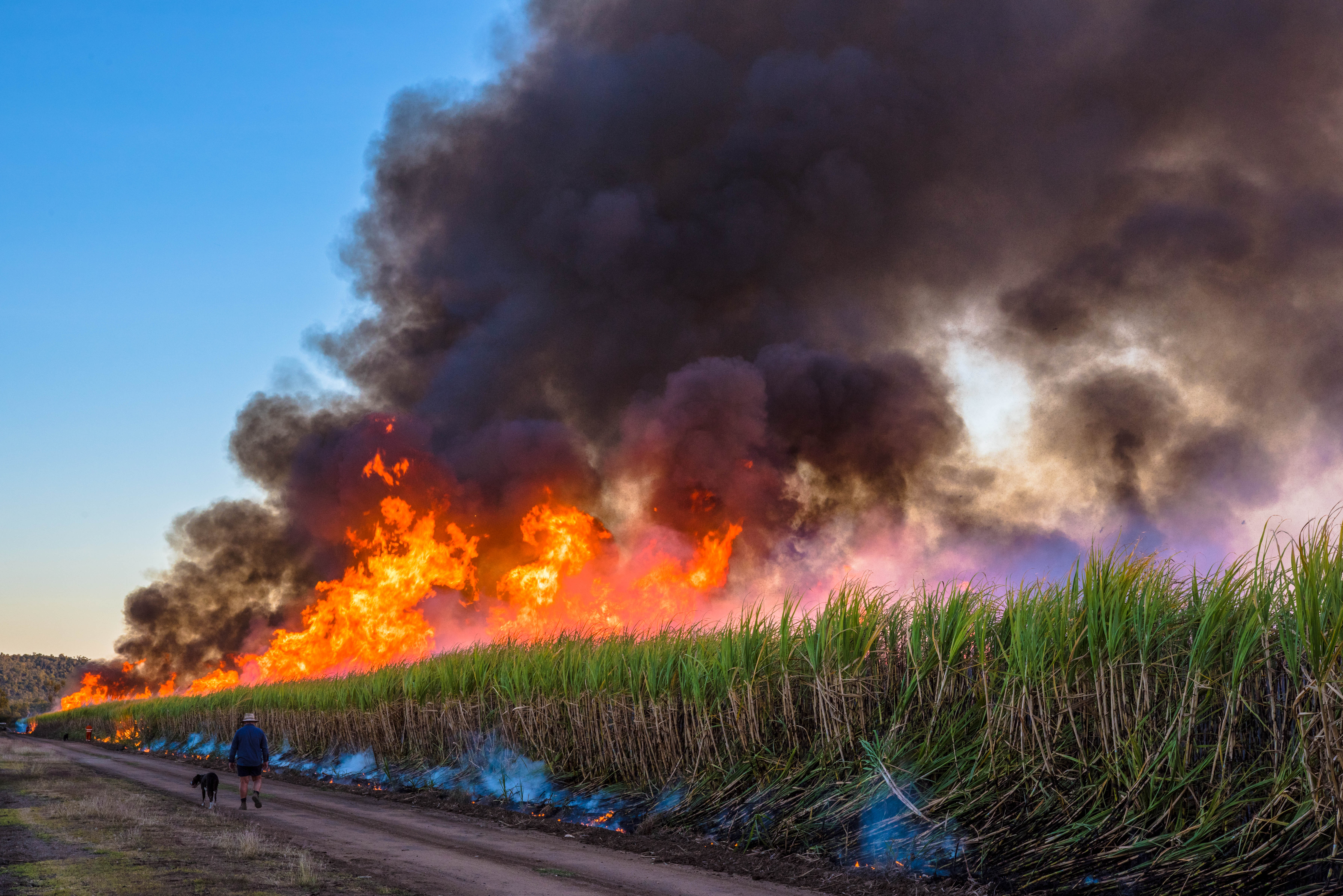
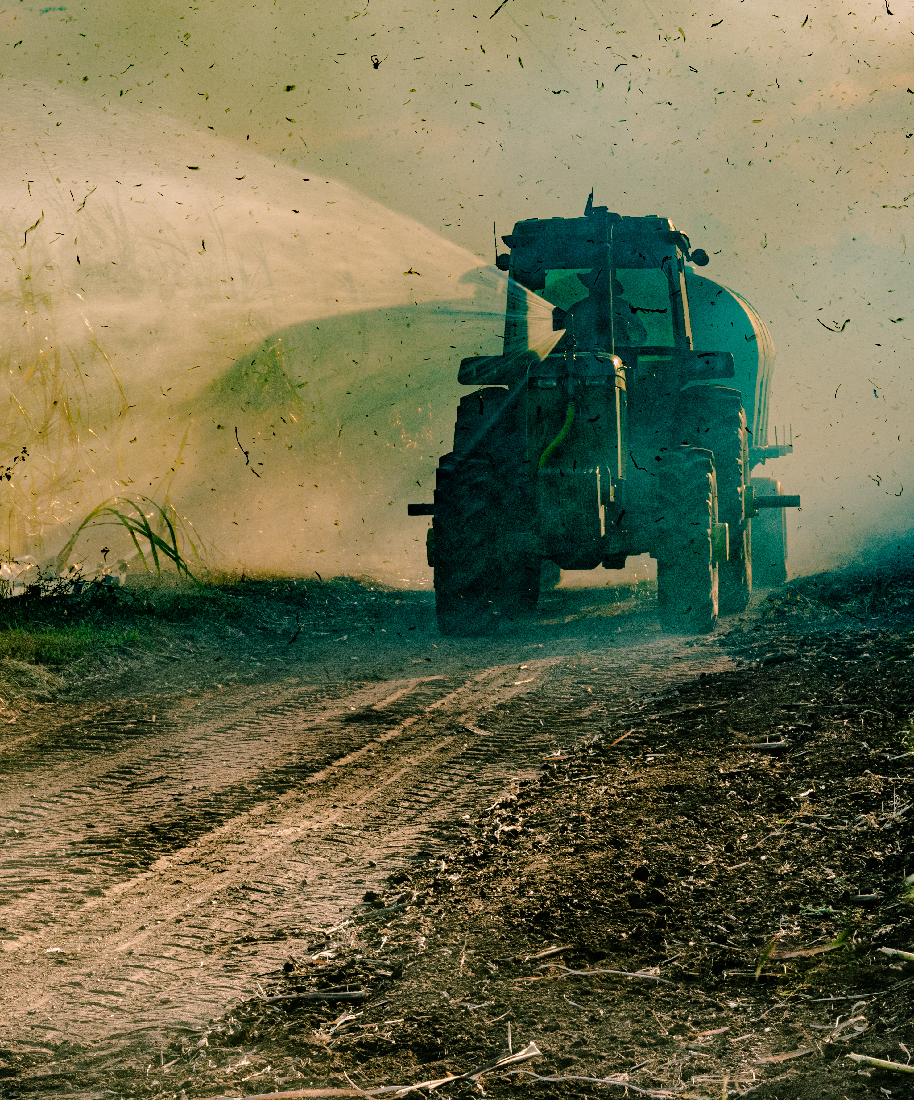
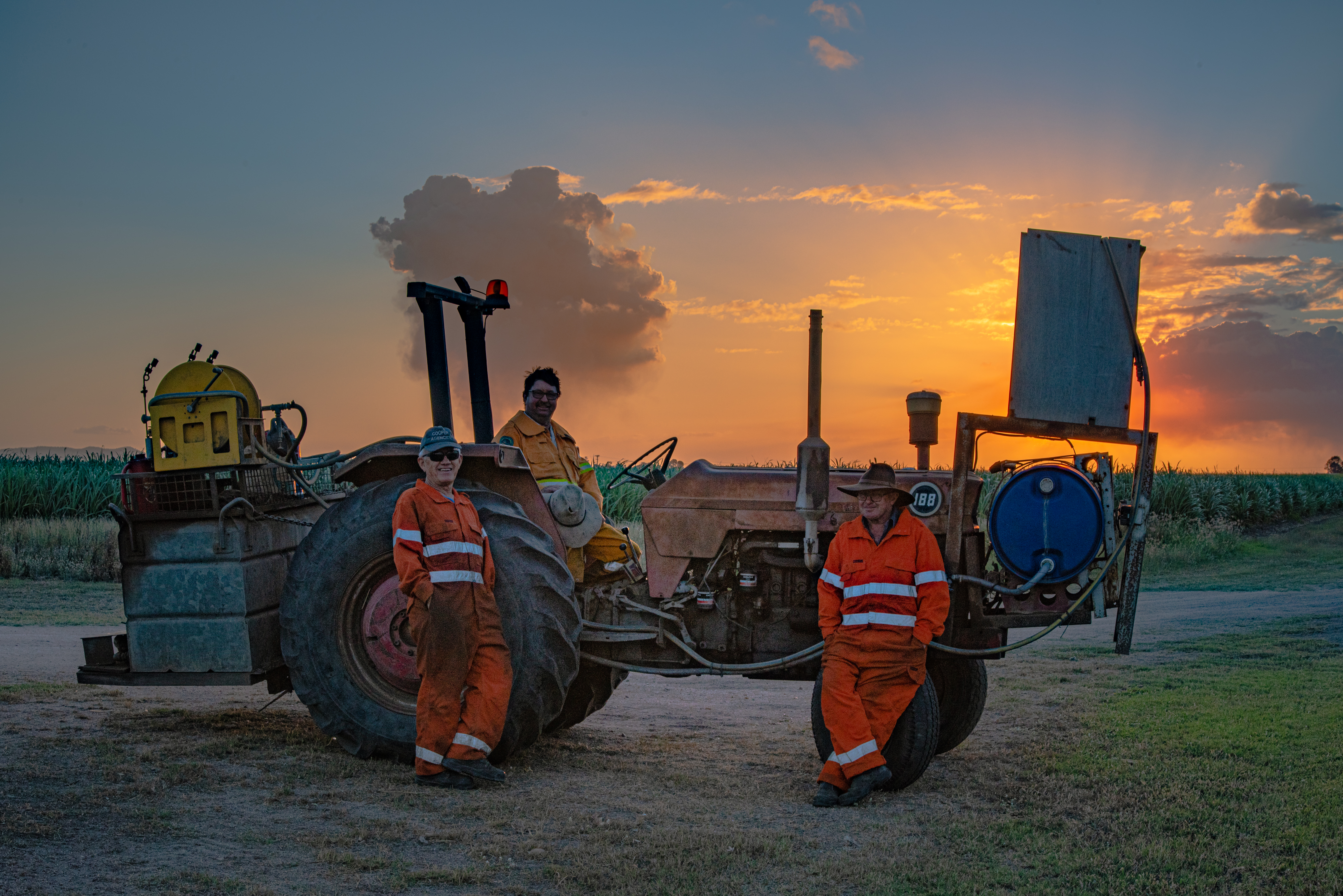

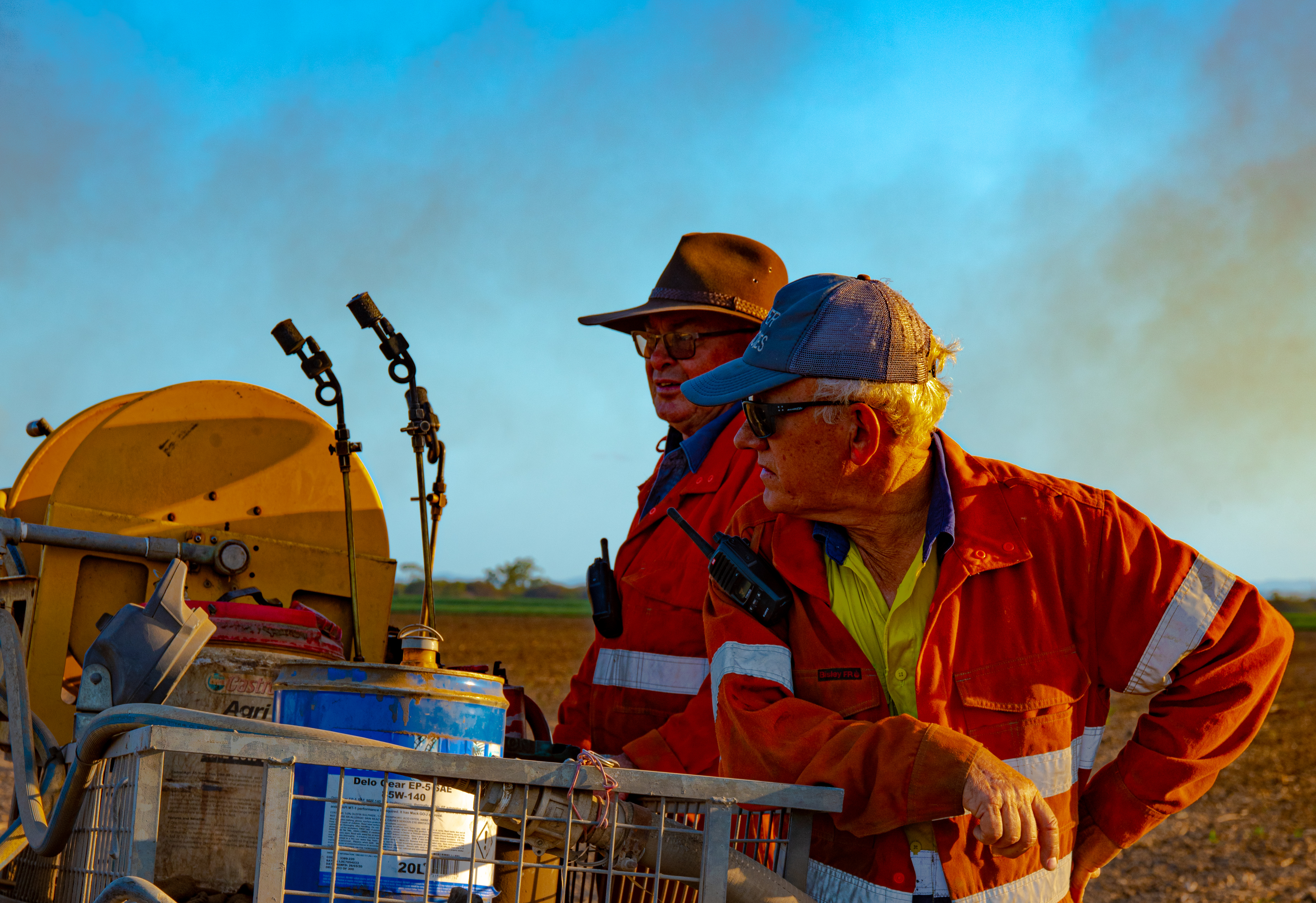
A selection of images demonstrating a sugar cane fire. The overalls the workers are wearing a compliant fire retardant material. The burning process is conducted under strict protocols. Water carts, usually 2-3 are strategically located around the field. The cane is burnt on two sides with the wind coming from the other side, then the windward side, the cane is lit at the base of the cane. Once all four sides have been lit, the workers are picked up by the smaller tractor and they then operate the water sprayers. The plan is designed for the fire to implode on itself burning into the middle of the cane field. Its all over in less than 15 minutes.
