Alice Springs
Our trip to Alice Springs from Kununurra was rather rushed. But we did manage to enjoy some of the places along the way.
Alice Springs – One should never underestimate this incredible place, not just what it has to offer, but its culture, beauty and uniqueness. I always ask, “what makes people stay in their chosen location, where they live?” Well known ABC Sunday morning show host ‘Macca’ had a segment on his program called ‘Why do you live where you live?’ Well, I used to ask myself this at each place where I lived, and my answer was always family or investment (livelihood). As we travel and stay in different towns/communities, I still ask myself that very question, and have found that once you immerse yourself into the community you often find the answer.


So, what has Alice got to offer……Now most of us Uluru (Ayres Rock) comes to mind immediately as the place to visit and never give the town of Alice Springs a second thought. Well, we think differently, to us Alice Springs is pretty close to the centre of Australia, in fact they call this place ‘The Red Centre’ so here are the facts about where the centre of Australia really is…..
Using the centre of gravity, CT Madigan discovered, in the 1930s, by using a plumb bob, the geographical centre of Australia. This was proven later using computer technology in 1988 by the Department of Geographic Information, where the actual centre is positioned.
“A centre pole has been located on the exact calculated geographical centre -25.6091 134.3619, approximately 200km south of Alice Springs between the Finke and Goyder Rivers. The centre is known as the Lambert Centre, the Geographic Centre of Australia.” https://www.atlasobscura.com/places/lambert-centre-of-australia
So why Alice, why do people live here?? Well let’s start with its history. This place is steeped in it.
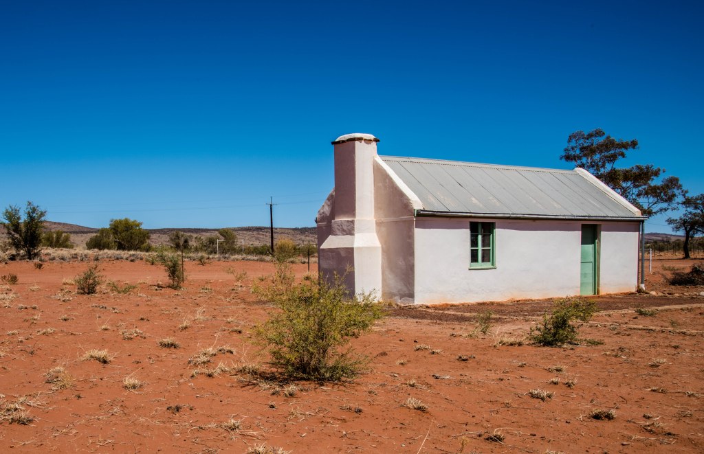
Alice Springs was originally located at the site where the first telegraph station was built, north of the current Alice Springs townsite. When the explorers first arrived, there was water in the river (now the Todd River), and the water remained there for several months, thus the settlers thought it was a natural spring. Sadly, this was not the case, and the water soon dried up in the summer. The water remains after rains due to the rock formation that prevents the water from soaking away. The Alice Springs settlement was named after Mrs Alice Todd, the wife of Charles Todd, who won the government tender to construct the Overland Telegraph line. Alice Todd never lived or visited the place!!
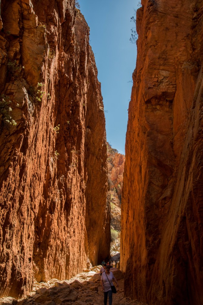
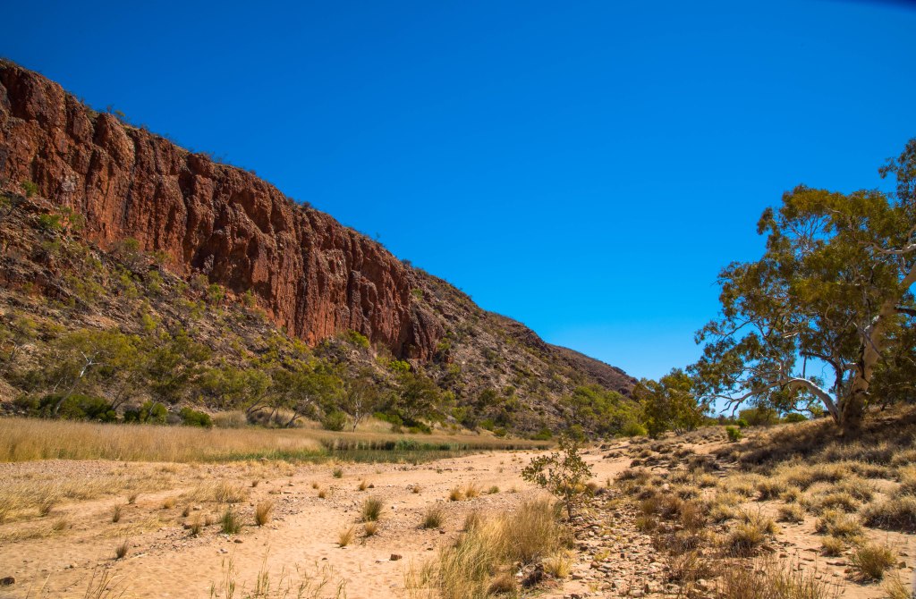
What fascinated us is ‘The Gap’ between the MacDonnell Ranges where the Todd River, the Stuart Highway and the Ghan Railway line all fit nicely between the Gap. There are many more of these ‘gaps’ throughout the ranges and other ranges that run east to west in the region. The most prominent are the gorges along the Larapinta Highway.
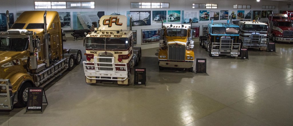

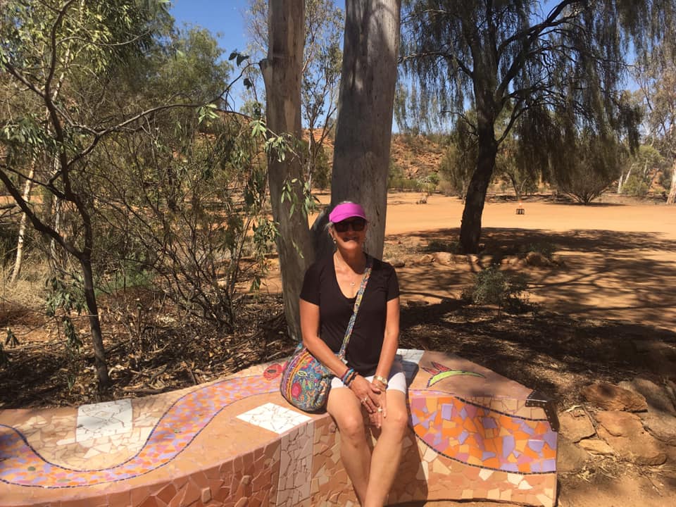
Further more Alice has many other attractions, Transport Hall of Fame, West MacDonnell ranges, Telegraph Station, School of the Air, Desert Park and Olive Pink garden, Araluen Arts Centre, Museums full of amazing history, Old Goal including Women’s Hall of fame, the never ending number of art galleries (selling traditional art works) and much more that we haven’t had time to explore.
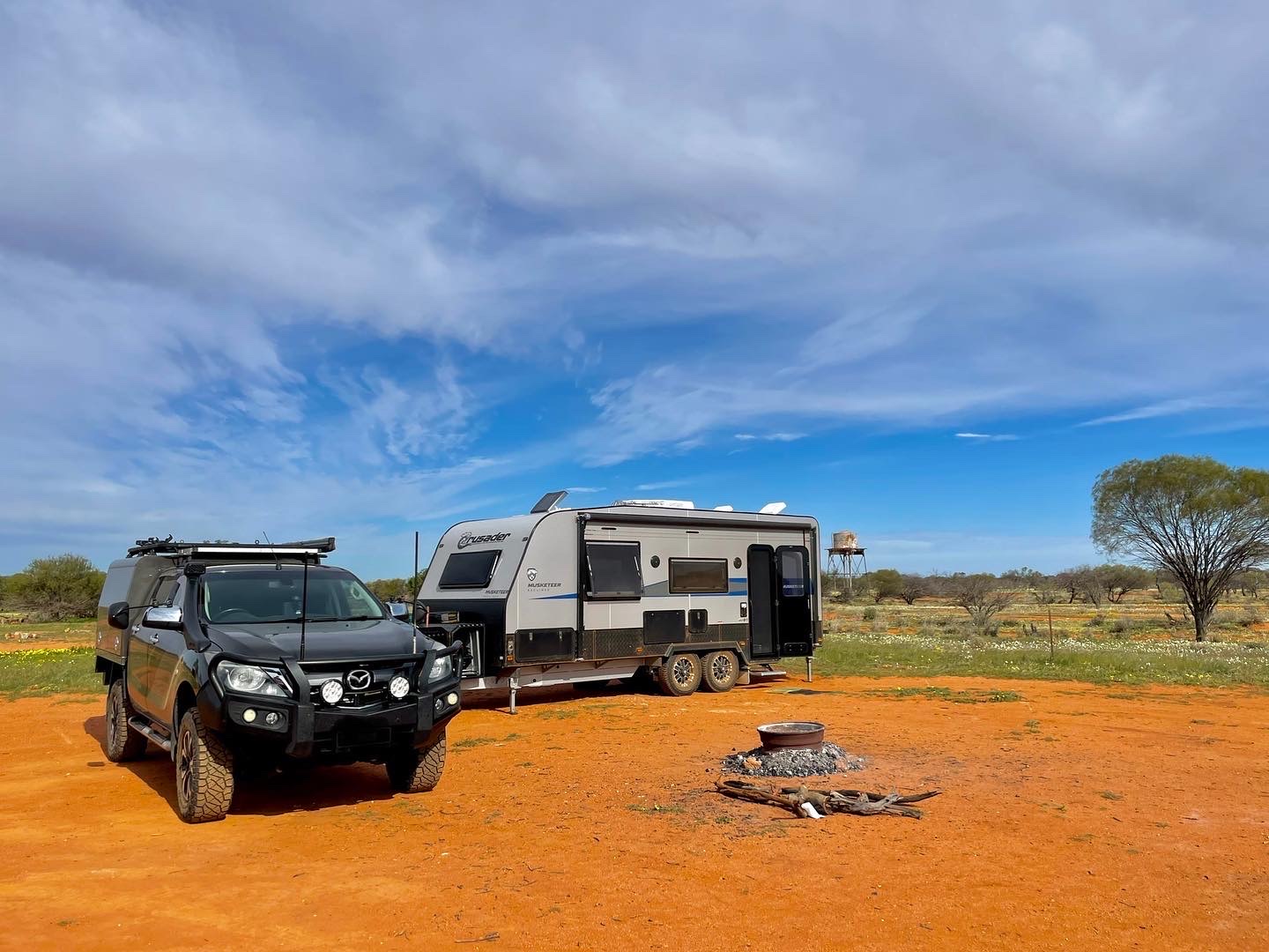
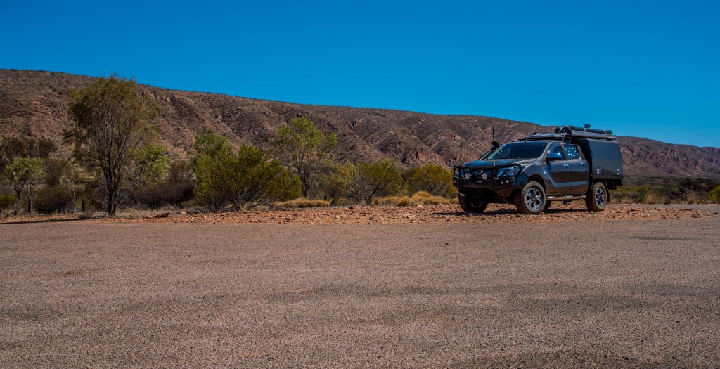
We were fortunate to be able to camp in this amazing place with my dear cousin and their wonderful family. Parked up alongside his new retirement workshop, don’t think he actually knows the meaning of the word retirement, but anyway, we were guests of theirs and enjoying the fun, laughter and the many wonderful stories. It is the most incredible opportunity and we have loved every minute of this stay. We returned to his property on our way home in 2020. It was really hard to leave as we really do love this place so much.
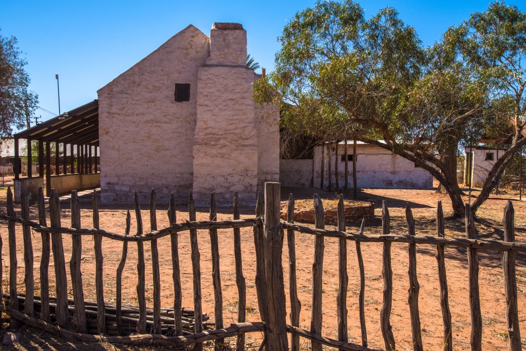
Alice Springs Telegraph Station

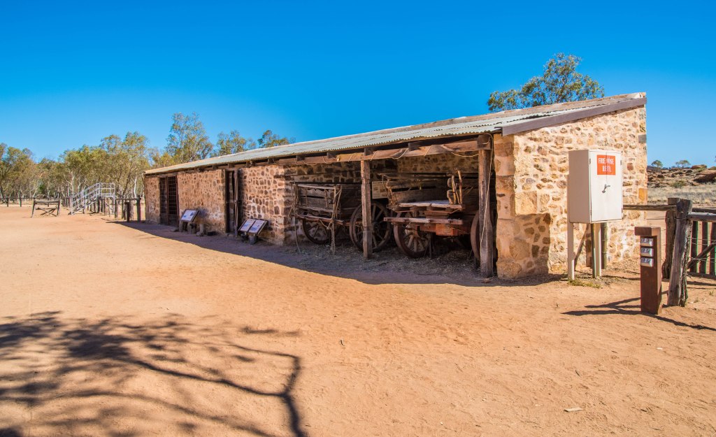

Did you know the Telegraph Station was the original site of the first European settlement in Alice Springs and the now town of Alice was called the Town of Stuart. They later renamed the town of Stuart to Alice Springs.
The Telegraph Station was stablished in 1871 to relay messages between Darwin and Adelaide along Australia’s Overland Telegraph Line. This not only connected Australia’s population centres with the north of the country, but it also connected Australia up with the undersea telegraph network of the British Empire. Prior to 1872, a message back to England would travel by boat and take 3 to 4 months each way. However, after the telegraph line was built, Morse code messages travelling through Alice Springs could reach London in as little as 5 hours – slow by today’s standards, but revolutionary for people of the 19th century!
We took a walk to the telegraph station while our car was being serviced. It wasn’t a long walk along the Todd River to the north of town, once we arrived we took the guided tour and learnt that this place was more than just a telegraph station.
Since ceasing operation as a telegraph station, the site has been an education centre for part aboriginal children (1932-42) known as the Bungalow; a wartime army base during World War 2 (1942-1945); and an aboriginal reserve (1945-1963). In 1963 the aboriginal people moved to Amoonguna, an aboriginal settlement south-east of town that still exists today.
The old Telegraph Station site was then gazetted as an historical reserve. The buildings have been restored and the area is now a popular picnic and meeting location. The café offers food and coffee, and the green lawns with the beautiful gum trees provide a relaxing location. Explore more at https://alicespringstelegraphstation.com.au/
Standley Chasm & Birthday Waterhole

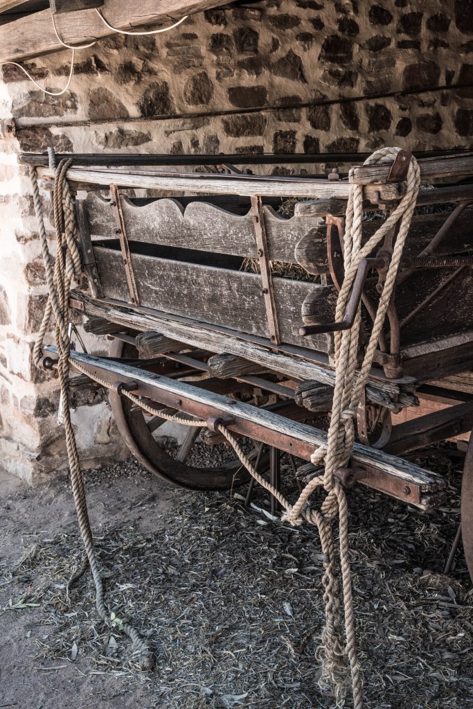
Our first taste of the west MacDonnell Ranges was to view Standley Chasm and have lunch at the cafe. After the MECCA meeting and viewing some of the vehicles, we hopped aboard Russ’ ‘LILTOW’ truck and headed off to the Chasm with some of group members, which included a Buick, Willys jeep, motorcycles and more. Whilst those who had arrived early waited for other members, we headed to the Chasm to catch the sun coming through the gap at midday which is the best time for viewing.
The only disappointment was the walk in through the fire decimated gorge, due to no rain since the terrible summer fires, the vegetation hadn’t been able to recover. The fire had been hot, not even a blade of grass had been left and rocks were blackened by the heat and beautiful ghost gums destroyed. This area will take years to recover.
After lunch we headed to a location called Birthday waterhole along a 4WD only track 14 kms off Namatjira Drive. I have no idea as to why it’s called this, maybe someone celebrated a birthday there or you can only swim in your birthday suit??


As we ventured further into the area and the landscape opened up, the enormity of the aftermath of the fires was becoming apparent to what could only be described as a moon scape. Spinifex landscaped were barren, leaving dry sandy desert like scapes, with blackened tufts, the remains of large spinifex plants. Trees and shrubs no longer bared leaves leaving blackened sticks across the barren plains.

Finally, we reached Birthday waterhole, and no surprise there was no water in the waterhole, but there was a beautiful river-bed and gorge with some of the trees and ghosts gum that had managed to escape the fire.
Back onto the highway, we headed west a little further to a lookout and overnight stop providing a view over part of the ranges. What an amazing view we had at this stop, there were incredible ridges that appeared to emerge from the earth like a sleeping Spinosaurus!!
We returned home back in Alice to a wonderfully cooked BBQ, still taking in the day’s events and what we had seen, realising we had only got a small taste of what was on offer.
Hermannsburg Community

The last time we travelled part of this road was in 1994 during our trip to the red centre via the Great Central Road. Now that was one hell of a trip along a very, very corrugated road average speed was around 50-60kph. There were so many breakdowns we actually called it our ‘breakdown’ holiday!!! But that’s another story!! Now back to 2019…….
It has only taken us 25 years to return, but we are now back in Alice Springs to do the things we didn’t get to do in 1994, but more importantly to catch up with my cousin and the family. After our taste of the west Macs (as the locals call the West MacDonnell ranges), that my cousin took us on in their 4WD truck, we ventured back out to do the entire loop starting along the Larapinta Drive and returning via Namatjira Drive, the northern part of the loop.
Our first stop was Hermannsburg community. This is a growing community that had expanded somewhat since our last visit in 1994. The main reason for our visit this time wasn’t for fuel and repairs (as it was in 1994), but to visit the historic precinct and learn about the history.
Hermannsburg nestles on the edge of the incredible Finke River, a location two young Lutheran missionaries, who had been trained in the Hermannsburg Institute Germany, identified as a suitable location to set up the settlement in 1877. The Mission consisted of 3750km2 leased by the Government to what was known as they Finke River Mission. There were several missionaries sent to run the mission in Hermannsburg.
The first two inexperienced missionaries and their team of lay persons arrived in 1878, and came across many difficulties and hardships included water shortages, illness, loneliness, weather conditions and issues with making contact with the shy and nomadic Aborigines. By 1893, three missionaries had left and were replaced with a new missionary who arrived in 1894, Pastor Carl Strehlow. He also restored ‘faith’ in the mission and turned the entire mission and the community around into a success.
The pastor, with his linguistic ability was able to translate the new testament of the Bible into the local Aboriginal Aranda language, plus many of the hymns, which they sang at their church services. Sadly, his death in 1922 saw the end of an era, but he had left an incredible legacy on the local Aborigines. One of those legacies was demonstrated with the Women’s Central Desert Choir in recent times. Several years ago some of the local women were approached by a new person to town, Morris an experienced choir conductor from Victoria, who had moved to Alice Springs with his wife. He decided to approach the many local women around town, asking them if they could sing, what he discovered was nothing short of remarkable, not only could they sing, but they were all able to sing the hymns in fluent Lutheran. These women had come from the Hermannsburg mission thus why they knew the hymns and had sung before. Anyway, that’s another story which you can read more about on the internet.
Hermannsburg was also the birth place of Albert Namatjira, a landscape artist who was trained by Rex Battarbee to paint in the western ways. His paintings soon became popular and in demand and his works are now known around the world. My parents always had several of his paintings (prints) hanging on the lounge room walls. The purple ranges against the ghost gums in the creek bed were my favourites. Many of his family, children and grand children also paint in the same method and their works can be found at the historic precinct art gallery at Hermannsburg.
I felt a strong connection to the Finke River and Hermannsburg and whilst there tried to imagine what it was like for those stockmen that drove cattle to the Finke River mission where they ran a successful station. My connection is from my Dad (Peter Baker) who at about 19 or 20 years old, took on a job to drove cattle from Kulgera Station (on the border) to Hermannsburg following the Finke River. One of the stops Dad always talked about was Palm Valley to the south of Hermannsburg. It was here that stockmen would often ‘hold’ the cattle overnight, the valley provided a protected location with water and green feed for the stock, before the final drive to the mission a little further north. We visited Palm Valley in 1994, but not this time. (I do hope I got that story right Mick)
After coffee and traditional strudel looking out over the Finke River and Mt Hermannsburg in the distance we took in a walk around the historic village. Several photos later and more knowledgeable for our visit, we left Hermannsburg heading west and following the Finke River.

Now the Finke River in itself is a remarkable river, one of four main rivers of the Lake Eyre Basin and thought to be the oldest riverbed in the world!! It only flows a few days of the year and when it does, the water usually disappears into the sands of the Simpson Desert and rarely reaches Lake Eyre. Now there’s a bit of Trivia for you!!
Not far on along the road where brumbies roam freely, we stopped in on Albert Namatjira’s house restored as it was when he lived there. The house was situated on a rise back from the Finke River.
Larapinta Drive heads out towards Kings Canyon through the Mereenie oil fields, so we turn off the Larapinta drive to the North onto Namatjira drive back to Alice Springs.
Namatjira Drive

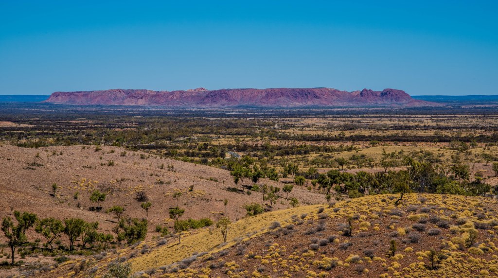
Heading north on Namatjira Drive through some amazing desert oak country the Tnorala Gosse Bluff rises before us. What appears to be a simple range, it is in fact a circular group of ranges that is only visible from the air. We again cross the Finke River flood plain before rising up towards Tyler’s Pass where we take the road to the lookout that provides a 360 degree view of the area including Gosse Bluff and the flood plain of the Finke below.
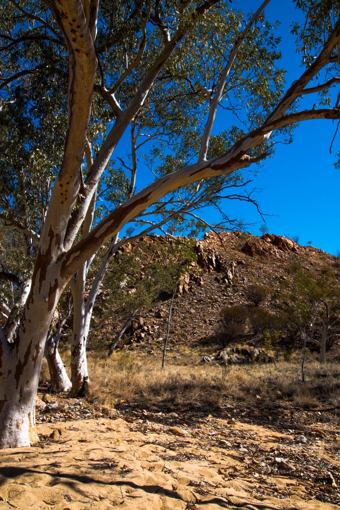
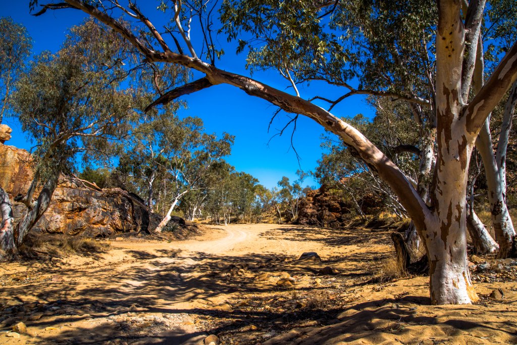
We continue on towards those beautiful ranges providing an amazing view through our windscreen with Mount Sonder dominating the skyline to the north of the road. As the road veers back towards the east, the western Macs become the predominant feature on the horizon with their incredible ridges and spinifex covered rises. How amazing is this country?
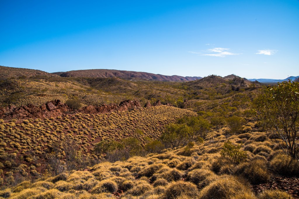
Looking at the ranges, the angle of the ridges denoting how they evolved, pushed up through seismic and volcanic activity millions of years ago then the impact of water and further earth movement presents some incredible scenes we enjoy today. One is in awe of the spectacular feast before us and the ever changing colours.
There are so many gorges, or breaks in the ranges, to discover and explore, time is a limiting factor, so we choose our options and take in Ormiston Gorge, Glen Helen Gorge, then return back onto Larapinta Drive before returning to Alice Springs.

At Glen Helen Gorge we again come across the incredible Finkle River that has forged its way through the gap and created a natural waterhole. Whilst this is great place to swim, we chose not to, the water temperature is way too cold for these two ducks!! As one walks down towards the gorge, along the river bed a high cliff rises vertically above and overshadows an old gnarly ghost gum that has survived many floods and fires. It is hard to believe we are now directly north of Hermannsburg.


Leaving there, we travel only a few kilometres down the road to Ormiston Gorge. Driving in we wind through the ranges following Ormiston Creek that feeds the Finke River, that invites us towards the gap in the ranges. Now what has become evident is the burnt landscape. A short walk we find a wonderful waterhole, smaller than Glen Helen, but natural all the same, nestled in amongst the rocky gorge. The fire came very close to the buildings here including on the ridges of the gorge but the ghost gums in the river were saved.
After leaving there, we take in one further lookout before hitting the road and making the return trip to Alice Springs.
Olive Pink Garden & Alice Springs Desert Park

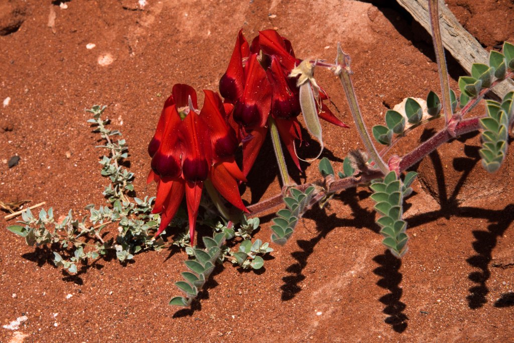
The Alice Springs Desert Park is located on Larapinta drive providing a controlled and protected area where native flora species are grown, managed and monitored and fauna is studied. We spent a short time there simply enjoying lunch with Perth friends Kerry & Dean and the wonderful native garden in the immediate grounds. As we left, it gave us great pleasure to introduce Kerry and Dean to some of our arid nature best, the Sturts Desert Pea and some busy zebra finches in amongst the shrubs.
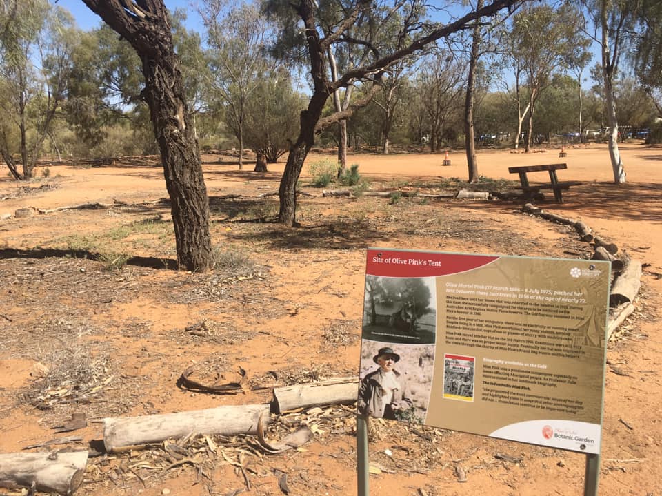
Olive Pink Garden on the other hand is a unique arid zone garden designed by Olive Pink and kept going by the dedication of the Olive Pink Botanic Garden Trustees to maintain the garden in her memory.
Olive Pink, artist, activist and gardener, first came to Alice Springs when she took up an invitation from Daisy Bates in 1926. A visit that captured her heart and imagination of the desert landscape and Aboriginal culture. She returned to Sydney to study Anthropology and finally after many return trips decided to remain the region in 1940 at the age of 56. See life can begin again in your 50’s, I love this woman already!!
There is much more information of this incredible woman on the internet and in many books written. http://opbg.com.au/ Olive Pink settled temporarily where the garden is today. She pitched her tent in 1956, aged 72, living there for 17 months until her ‘home hut’ was relocated there, continuing her work from the location on the edge of the Todd River between two hills.
The garden provides three main walks plus the hill walk. Plants are strategically planted in accordance with Olive Pink’s garden designs. Mature plants grow with the natural rainfall, whilst new plantings are given a head start with a watering system to ensure their survival. Name plates are located at the base of plants and the booklet available provides information on each walk and the plants within them.
A fascinating woman, with an incredible history.
NT to SA
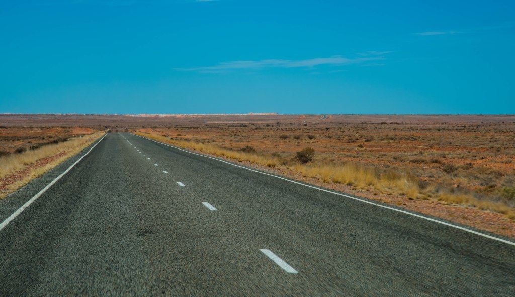
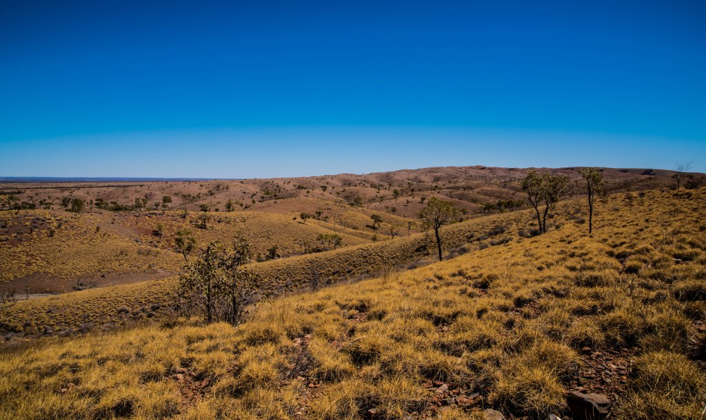
The journey south from the NT to SA is a smorgasbord of landscapes that any artist would be appreciative of. Leaving the town of Alice Springs, after crossing over the Ghan railway, the ranges continue for a couple of hundred kilometres. In between are low flat rangelands with scattered spinifex, mulga interspersed with groups of desert oaks. Every now and then, pockets of acacia flowering a muted yellow, adds colour to the dry earth.
The roads are still no better, the bitumen feels like dirt road corrugations and occasionally the road varies with a wave effect, making you feel like you are on a boat! We certainly appreciate our WA roads.


As we drive down the road we are alerted to a monument on the side of the road, it is from the Cannonball run where four people were killed in a tragic accident. Two officials and two drivers. This occurred 25 years ago, the same year we did our trip to the NT and remember the story very well. Read the story here http://monumentaustralia.org.au/themes/culture/social/display/80242-cannonball-run-monument
The Waterhouse Ranges ran out to the west providing a beautiful purple hue as they stretch further out east, like the Namatjira purple hills he always painted. The landscape then flattened out for a short distance before the road meandered through Mt Hitchins and Mt Grevillea, part of the James Ranges. The road at this point appears to be a continuous curve, one wonders if one might come back to where one started, then slowly the road straightens up as it comes out the other side of the ranges where the Stuart’s Well Roadhouse provides a nice stop for morning smoko.
Back on the road and we found ourselves crossing the Finke River again and further south the Palmer Valley Cattle Station. From here the landscape opens up to flat rangelands, some mulga patches but a lot of desolate and barren areas, blown from the recent dust storm. Lunch stop was at the Kulgera Roadhouse which has the southern most pub in the NT. In 1994 we stopped here and was able to view the homestead and cattle yards, this time there is a pub, roadhouse, camp ground, police station and other out buildings, but no homestead. The pub was again a very interesting bar with several items of interest creating another quirky Aussie watering hole.
As we enjoyed our lunch, dust could be seen coming from the east rising above the mulga shrub eventually turning out in front of the roadhouse to make its way to the main highway. The double deck, road train appeared to be loaded with young cattle as they could barely be seen above the railings.
Twenty kilometres down the road we crossed the border into SA, farewelling NT until next time…..and yes we will be back. Alice and her beautiful ranges and the landscape that stretches out from this central point has left her magic within us.
